Category:Vischpoortstraat 24, Elburg
Jump to navigation
Jump to search
| Object location | | View all coordinates using: OpenStreetMap |
|---|
 | |||||
| Upload media | |||||
| Instance of |
| ||||
|---|---|---|---|---|---|
| Location | Elburg, Gelderland, Netherlands | ||||
| Street address |
| ||||
| Located on street |
| ||||
| Heritage designation |
| ||||
 | |||||
|
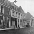
This is a category about rijksmonument number 14874
|
| Address |
|
Media in category "Vischpoortstraat 24, Elburg"
The following 5 files are in this category, out of 5 total.
-
 Elburg - Ellestraat - View NE.jpg 2,592 × 3,915; 11.79 MB
-
 Elburg - Vischpoortstraat 24 RM14874.JPG 2,892 × 4,236; 2.28 MB
-
 Elburg Vischpoort - panoramio.jpg 5,335 × 2,277; 3.36 MB
-
 Elburg, Netherlands - panoramio (51).jpg 4,896 × 3,264; 2.51 MB
-
 Overzicht - Elburg - 20069264 - RCE.jpg 1,200 × 1,190; 286 KB


.jpg)
