Category:Vigántpetend
Jump to navigation
Jump to search
| Object location | | View all coordinates using: OpenStreetMap |
|---|
village in Hungary    | |||||
| Upload media | |||||
| Instance of |
| ||||
|---|---|---|---|---|---|
| Location | Tapolca District, Veszprém County, Hungary | ||||
| Population |
| ||||
| Area |
| ||||
 | |||||
Subcategories
This category has only the following subcategory.
Media in category "Vigántpetend"
The following 7 files are in this category, out of 7 total.
-
 Coa Hungary Town Vigántpetend.svg 260 × 300; 46 KB
-
 Flag of Vigántpetend.svg 1,200 × 600; 61 KB
-
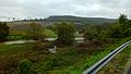 High water on the Eger Stream in Balaton-felvidék 2014 - Vigántpetend 01.jpg 2,304 × 1,296; 2.39 MB
-
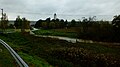 High water on the Eger Stream in Balaton-felvidék 2014 - Vigántpetend.jpg 2,304 × 1,296; 2.14 MB
-
 Vigantpetend rovastabla.png 159 × 40; 8 KB
-
 Vigántpetend címere.jpg 2,000 × 2,236; 206 KB
-
 Vigántpetend légifotó.jpg 480 × 342; 27 KB


