Category:Views of villages in Vorarlberg
Jump to navigation
Jump to search
States of Austria:  Burgenland ·
  Carinthia ·
  Lower Austria ·
  Salzburg ·
  Styria ·
  Tyrol ·
  Upper Austria ·
  Vorarlberg
Wikimedia category | |||||
| Upload media | |||||
| Instance of | |||||
|---|---|---|---|---|---|
| Category combines topics | |||||
| Villages in Vorarlberg | |||||
Wikimedia list article | |||||
| Instance of | |||||
| |||||
Subcategories
This category has the following 3 subcategories, out of 3 total.
Media in category "Views of villages in Vorarlberg"
The following 35 files are in this category, out of 35 total.
-
 002 2013 09 18 Dorf.jpg 3,779 × 2,638; 3.9 MB
-
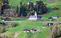
 Andelsbuch Kapelle Heiliger Antonius Umgebung.jpg 5,000 × 3,012; 8.42 MB
-
 Andelsbuch Pfarrkirche Luftbild.jpg 5,000 × 3,267; 7.99 MB
-
 Au Rehmen Vogelperspektive.jpg 4,500 × 3,000; 11.02 MB
-
 Bartholomäberg Innerberg Kirche Luftbild.jpg 5,000 × 3,183; 12.33 MB
-
 Bartholomäberg Pfarrkirche Luftbild 2.jpg 5,000 × 3,119; 9.56 MB
-
 Bartholomäberg Pfarrkirche Luftbild.jpg 5,000 × 3,200; 9.97 MB
-
 Bezau Pfarrkirche Kloster Luftbild.jpg 5,000 × 2,801; 6.8 MB
-
 Damüls 2.JPG 3,008 × 2,000; 2.59 MB
-
 Damüls, Uga-Lift, Mittagsspitze - panoramio.jpg 2,816 × 2,112; 3.02 MB
-
 Fontanella Gemeindezentrum Luftbild.jpg 5,000 × 3,229; 10.94 MB
-
 Gaißau Pfarrkirche Luftbild.jpg 5,000 × 2,931; 8.14 MB
-
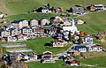
 Gurtis.jpg 4,032 × 3,024; 11.1 MB
-
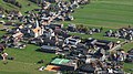
 Göfis Pfarrkirche Gemeindehaus Luftbild.jpg 5,000 × 2,856; 8.98 MB
-
 Hauptstraße, Sibratsgfäll 01.jpg 5,184 × 3,456; 5.79 MB
-
 Lech Zürs Übersicht.jpg 6,000 × 3,808; 23.07 MB
-
 Lech Zürs.jpg 6,000 × 4,002; 29.89 MB
-
 Mellau 02.JPG 3,008 × 2,000; 3.41 MB
-
 Mellau heading ENE (42952240265).jpg 4,032 × 3,024; 3.92 MB
-
 PanoramaDamüls.JPG 2,929 × 1,693; 671 KB
-
 Raggal.jpg 6,000 × 3,691; 16.63 MB
-
 Roens center of town 2014.jpg 6,016 × 4,016; 2.92 MB
-
 Sankt Anton im Montafon 1.JPG 4,272 × 2,848; 2.28 MB
-
 Schnepfau Gemeindezentrum Schrägluftbild.jpg 5,000 × 3,233; 17.89 MB
-
 Schnepfau Hirschau Vogelperspektive.jpg 4,000 × 2,667; 13.41 MB
-
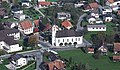
 Schnifis Gemeindezentrum Schrägluftbild.jpg 5,000 × 2,893; 15.1 MB
-
 Schnifis Übersicht Schrägluftbild.jpg 5,000 × 3,333; 19.05 MB
-
 Schoppernau Hochalpe Winter Vogelperspektive.jpg 4,500 × 3,000; 13.77 MB
-
 Schruns Dorfzentrum Schrägluftbild NO.jpg 5,000 × 3,401; 17.31 MB
-
 Schruns Dorfzentrum Schrägluftbild S.jpg 5,000 × 3,266; 17.61 MB
-
 Schröcken Dorfzentrum2 Schrägluftbild.jpg 4,000 × 2,242; 8.27 MB
-
 Sibratsgfäll Dorfansicht Schrägluftbild O.jpg 6,000 × 4,002; 17.62 MB
-
 Thüringen Vorarlberg 1.JPG 4,272 × 2,848; 7.4 MB
-
 Uebersaxen-Winter.jpg 2,025 × 1,553; 1 MB
-
 Übersaxen 01.JPG 2,688 × 1,861; 676 KB


.jpg)


