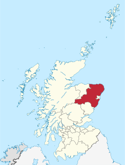
Category:Views of Aberdeenshire
Appearance
Wikimedia category | |||||
| Upload media | |||||
| Instance of | |||||
|---|---|---|---|---|---|
| Category combines topics | |||||
| Aberdeenshire | |||||
council area of Scotland | |||||
| Instance of | |||||
| Part of |
| ||||
| Location | Scotland | ||||
| Capital | |||||
| Population |
| ||||
| Area |
| ||||
| Different from | |||||
| official website | |||||
 | |||||
Media in category "Views of Aberdeenshire"
The following 63 files are in this category, out of 63 total.
-
A coloratura copse - geograph.org.uk - 1619667.jpg 640 × 480; 53 KB
-
A River Valley - geograph.org.uk - 90287.jpg 640 × 475; 59 KB
-
Aberdeen Harbour Panorama.jpg 24,885 × 3,392; 8.84 MB
-
Aberdeenshire from Benachie.jpg 3,200 × 2,127; 1.71 MB
-
Aberdeenshire with cloud.jpg 4,272 × 2,848; 7.77 MB
-
Aberdeenshire wood - panoramio.jpg 1,936 × 1,288; 1.21 MB
-
Aberdeenshire, UK - panoramio (1).jpg 1,600 × 1,200; 497 KB
-
Aberdeenshire, UK - panoramio (2).jpg 1,600 × 1,200; 546 KB
-
Aberdeenshire, UK - panoramio (4).jpg 1,600 × 1,200; 597 KB
-
Aberdeenshire, UK - panoramio - Gyula Péter.jpg 1,200 × 1,600; 861 KB
-
Aberdeenshire-calendar01.jpg 400 × 210; 37 KB
-
Arch through cliffs - geograph.org.uk - 857598.jpg 640 × 480; 103 KB
-
Autumn - panoramio - Alexander Reuss.jpg 2,048 × 1,536; 1.88 MB
-
Ben Macdui from Breariach walk - panoramio.jpg 1,280 × 960; 638 KB
-
Birch, berries and stile - geograph.org.uk - 1062121.jpg 640 × 480; 90 KB
-
Braeriach from Macdhui - panoramio.jpg 1,704 × 1,122; 336 KB
-
Braidon Bay - panoramio.jpg 5,760 × 3,840; 19.32 MB
-
Burn of Gouls - geograph.org.uk - 1198605.jpg 640 × 480; 94 KB
-
Cac Carn Mor from Cac Carn Beag(1155m MSL) - panoramio.jpg 2,048 × 1,536; 1.86 MB
-
Carn an Leth-allt - geograph.org.uk - 1246465.jpg 640 × 480; 83 KB
-
Carn Cruinn - geograph.org.uk - 1300370.jpg 640 × 480; 102 KB
-
Carn Dearg, above the Dee - geograph.org.uk - 862828.jpg 640 × 359; 40 KB
-
Carn na Cuimbne - geograph.org.uk - 1067339.jpg 640 × 423; 156 KB
-
Castle Hill - geograph.org.uk - 800936.jpg 640 × 427; 260 KB
-
Clifftop Ruins - geograph.org.uk - 800500.jpg 640 × 427; 238 KB
-
Coastal Path from Whitehills - geograph.org.uk - 1078392.jpg 640 × 480; 84 KB
-
Coulins burn - geograph.org.uk - 1752592.jpg 800 × 533; 262 KB
-
Country Junction - geograph.org.uk - 1775740.jpg 1,600 × 1,064; 333 KB
-
Cove near Kinneff - geograph.org.uk - 800511.jpg 640 × 427; 271 KB
-
Cow path up Quarry Hill - geograph.org.uk - 1522221.jpg 640 × 480; 53 KB
-
Creag an Dubh Loch and the Dubh Loch - geograph.org.uk - 556263.jpg 640 × 480; 99 KB
-
Culture Clash^ - geograph.org.uk - 1541030.jpg 640 × 426; 63 KB
-
Daugh of Davidston - geograph.org.uk - 687716.jpg 640 × 324; 163 KB
-
Dee Gorge - panoramio.jpg 2,816 × 2,112; 1.47 MB
-
Descending Carn Liath - geograph.org.uk - 1246439.jpg 640 × 480; 91 KB
-
Doonie Point viewed from cliff edge - geograph.org.uk - 897449.jpg 640 × 480; 122 KB
-
Downstream River Bogie - geograph.org.uk - 1326226.jpg 640 × 480; 122 KB
-
East side of Clashanruich from Lary Hill - geograph.org.uk - 849917.jpg 640 × 429; 124 KB
-
Easter Aulton - geograph.org.uk - 370895.jpg 640 × 304; 180 KB
-
Easter Bodylair - geograph.org.uk - 379847.jpg 640 × 480; 68 KB
-
Eroded Footpath - geograph.org.uk - 1397687.jpg 480 × 640; 102 KB
-
Feb 2013 - Trip North (8465578385).jpg 3,264 × 4,928; 5.07 MB
-
Fields by the River Dee - geograph.org.uk - 1372305.jpg 640 × 428; 193 KB
-
Fingask moss - geograph.org.uk - 981571.jpg 640 × 427; 52 KB
-
Foot of The Cairnwell - geograph.org.uk - 1502793.jpg 640 × 480; 94 KB
-
Footpath near Corrour - geograph.org.uk - 1397682.jpg 640 × 480; 86 KB
-
Glas allt Shiel - geograph.org.uk - 916420.jpg 480 × 640; 89 KB
-
Glen Ey from An Socach summit - geograph.org.uk - 1303906.jpg 640 × 481; 239 KB
-
Glengarden - geograph.org.uk - 442305.jpg 640 × 480; 114 KB
-
Glens of Foundland - panoramio.jpg 1,936 × 1,288; 1.18 MB
-
Gorehead Wood and Hill of Marcus - geograph.org.uk - 975323.jpg 640 × 427; 89 KB
-
Hill of Annahar - geograph.org.uk - 119552.jpg 640 × 419; 67 KB
-
Hill of Craigour - geograph.org.uk - 1132212.jpg 640 × 480; 66 KB
-
Inverenzie - geograph.org.uk - 873328.jpg 640 × 426; 105 KB
-
Landscape near Loch Muick - panoramio.jpg 2,816 × 2,112; 1.4 MB
-
Looking north on Creagan nan Gabhar - geograph.org.uk - 1533873.jpg 640 × 429; 91 KB
-
Looking south at Ardallie - geograph.org.uk - 773312.jpg 640 × 480; 73 KB
-
Looking southwards to Torry Farm. - geograph.org.uk - 266821.jpg 640 × 426; 74 KB


