Category:Views from automobiles in Decatur County, Georgia
Jump to navigation
Jump to search
Counties of Georgia: Appling · Atkinson · Bacon · Baker · Banks · Barrow · Bartow · Ben Hill · Berrien · Brooks · Bryan · Butts · Calhoun · Camden · Carroll · Charlton · Chatham · Chattooga · Clayton · Clinch · Cobb · Coffee · Colquitt · Cook · Coweta · Crawford · Crisp · Dade · Dawson · Decatur · DeKalb · Dodge · Dooly · Dougherty · Douglas · Early · Effingham · Evans · Floyd · Forsyth · Franklin · Fulton · Glynn · Gordon · Grady · Gwinnett · Habersham · Hall · Haralson · Harris · Hart · Henry · Houston · Irwin · Jasper · Jeff Davis · Jefferson · Lamar · Lanier · Laurens · Liberty · Long · Lowndes · Lumpkin · Macon · Marion · McIntosh · Mitchell · Monroe · Montgomery · Murray · Newton · Peach · Pulaski · Putnam · Randolph · Rockdale · Schley · Seminole · Spalding · Stephens · Stewart · Sumter · Talbot · Tattnall · Telfair · Terrell · Thomas · Tift · Toombs · Troup · Turner · Upson · Walker · Ware · Wayne · Wheeler · White · Whitfield · Wilcox · Worth
City-counties: Columbus–Muscogee · Georgetown–Quitman · Macon–Bibb · Statenville–Echols
City-counties: Columbus–Muscogee · Georgetown–Quitman · Macon–Bibb · Statenville–Echols
Media in category "Views from automobiles in Decatur County, Georgia"
The following 42 files are in this category, out of 42 total.
-
 Bainbridge Bypass and Spring Creek Road WB offramp.jpg 2,617 × 1,909; 934 KB
-
 Bainbridge Bypass offramp from US-84 eastbound to US-27 southbound.jpg 3,264 × 1,074; 713 KB
-
 Brinson City Limit, US84 WB.jpg 5,184 × 3,456; 4.43 MB
-
 Brinson, US84 EB.jpg 5,184 × 3,456; 4.58 MB
-
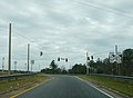
 GA253 at GA38 offramp, Bainbridge.jpg 5,184 × 3,456; 5.42 MB
-
 GA262nSign-FromUS27s (29205551325).jpg 2,400 × 1,600; 2.57 MB
-
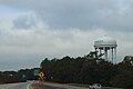 Georgia SR84EB Bainbridge water tower.jpg 5,184 × 3,456; 4.24 MB
-
 Georgia SR84EB Donalsonville Exit.jpg 5,184 × 3,456; 4.33 MB
-
 Georgia SR84EB GA97 .5 mile.jpg 5,184 × 3,456; 4.48 MB
-
 Georgia SR84EB Lake Douglas Rd Overpass.jpg 5,184 × 3,456; 4.3 MB
-
 Georgia SR84EB US27 exit 1 mile.jpg 5,184 × 3,456; 4.6 MB
-
 Georgia SR84WB GA97 309 end of exit ramp.jpg 5,184 × 3,456; 5.73 MB
-
 Georgia US84EB Faceville Hwy Exit .5 mile.jpg 5,184 × 3,456; 4.4 MB
-
 Georgia US84EB Faceville Hwy Exit.jpg 5,184 × 3,456; 5.4 MB
-
 Georgia US84EB GA253 exit.jpg 5,184 × 3,456; 4.12 MB
-
 Georgia US84EB GA253 Overpass.jpg 5,184 × 3,456; 4.36 MB
-
 Georgia US84EB Lake Douglas Rd Overpass.jpg 5,184 × 3,456; 4.38 MB
-
 Georgia US84EB S West St Overpass.jpg 5,184 × 3,456; 4.63 MB
-
 Georgia US84EB Shotwell St Exit .5 mile.jpg 5,184 × 3,456; 5.13 MB
-
 Georgia US84EB Shotwell St Exit next right.jpg 5,184 × 3,456; 4.81 MB
-
 Georgia US84EB Shotwell St Exit.jpg 5,184 × 3,456; 4.9 MB
-
 Georgia US84EB US27 Exit .75 mile.jpg 5,184 × 3,456; 4.87 MB
-
 Georgia US84EB US27 Exit ahead.jpg 5,184 × 3,456; 5.13 MB
-
 Georgia US84EB US27 Exit ramp.jpg 5,184 × 3,456; 4.76 MB
-
 Georgia US84EB US84B turn left.jpg 5,184 × 3,456; 4.21 MB
-
 Georgia US84WB GA253 .5 mile.jpg 5,184 × 3,456; 4.62 MB
-
 Georgia US84WB GA253 Overpass.jpg 5,184 × 3,456; 4.7 MB
-
 Georgia US84WB GA253.jpg 5,184 × 3,456; 4.55 MB
-
 Georgia US84WB Lake Douglas Road Overpass 2021.jpg 5,184 × 3,456; 4.96 MB
-
 Georgia US84WB Lake Douglas Road Overpass.jpg 5,184 × 3,456; 4.36 MB
-
 Georgia US84WB S West St Overpass.jpg 5,184 × 3,456; 5.03 MB
-
 Georgia US84WB Shotwell St .25 mile.jpg 5,184 × 3,456; 4.61 MB
-
 Georgia US84WB Shotwell St.jpg 5,184 × 3,456; 4.38 MB
-
 Georgia US84WB SR309 Overpass.jpg 5,184 × 3,456; 4.6 MB
-
 Georgia US84WB SR97 Overpass.jpg 5,184 × 3,456; 4.72 MB
-
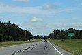
 Georgia US84WB US27 1 mile.jpg 5,184 × 3,456; 4.22 MB
-
 Georgia US84WB US27 exit.jpg 5,184 × 3,456; 4.45 MB
-
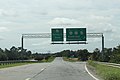
 Georgia US84WB US84 .25 mile.jpg 5,184 × 3,456; 4.83 MB
-
 Georgia US84WB US84 exit.jpg 5,184 × 3,456; 4.78 MB
-
 Seminole County limit, US84 WB.jpg 5,184 × 3,456; 5.09 MB
-
 South Georgia Peanut Field and dirt road - panoramio.jpg 4,128 × 3,096; 3.45 MB
-
 Spring Creek, Decatur County, US84 EB.jpg 5,184 × 3,456; 4.61 MB


.jpg)


