Category:Viele map of New York City published in 1874
Jump to navigation
Jump to search
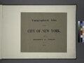
Viele, Egbert L. Topographical Atlas of the City of New York including the annexed territory [in the Bronx], showing original water courses and made land. (New York: 1874), comprising a single map plus a title page; NYPL includes a 1913 retrospective statement by the surveyor, Eugene Quackenbush.
Online at The New York Public Library Digital Collections website, Topographical atlas of the city of New York….
Media in category "Viele map of New York City published in 1874"
The following 7 files are in this category, out of 7 total.
-
 Viele map of lower Manhattan, 1874 -a.jpg 400 × 450; 94 KB
-
 Statement of the surveyor Eugene Quackenbush. NYPL1527361.tiff 7,230 × 5,428; 112.31 MB
-
 Tonawanda (Village); Tonawanda Business Directory NYPL1576161.tiff 7,230 × 5,428; 112.31 MB
-
 Topographical atlas of the city of New York (cropped).jpg 638 × 608; 150 KB
-

-

-
 Topographical atlas of the city of New York.jpg 22,539 × 6,341; 40.03 MB

.jpg)