Category:Viduklė in topographic maps
Jump to navigation
Jump to search
Media in category "Viduklė in topographic maps"
The following 6 files are in this category, out of 6 total.
-
 Shubert map - R11L02.jpg 7,975 × 5,891; 18.31 MB
-
 Ltopo X-13.jpg 9,920 × 9,751; 9.15 MB
-
 KdwR M20 1915.jpg 6,454 × 5,593; 7.11 MB
-
 KAM map 1403.jpg 4,272 × 3,512; 3.19 MB
-
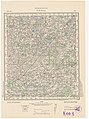
 P27 S36 Raseiniai 1935.jpg 10,296 × 8,782; 14.7 MB
-
 R100 n-34-022.jpg 4,769 × 6,394; 8.91 MB


