Category:Victoria Island, Ottawa
Jump to navigation
Jump to search
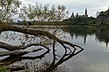
English: Victoria Island is located in Ontario between Ottawa and Gatineau on the Ottawa River, where it narrows near the Canadian War Museum at LeBreton Flats. The island is accessible via the Chaudière Bridge, which connects Ottawa's Booth Street to Rue Eddy in Gatineau; the Portage Bridge connecting the two cities passes over.
| Object location | | View all coordinates using: OpenStreetMap |
|---|
island in Ottawa, Ontario, Canada  | |||||
| Upload media | |||||
| Instance of | |||||
|---|---|---|---|---|---|
| Location | Ottawa, Southern Ontario, Ontario, Canada | ||||
| Located in or next to body of water | |||||
 | |||||
Subcategories
This category has the following 6 subcategories, out of 6 total.
B
- Bronson Pulp Mill (25 F)
W
- Willson Carbide Mill (38 F)
Media in category "Victoria Island, Ottawa"
The following 7 files are in this category, out of 7 total.
-
 Ottawa, seen from Victoria Island 1.jpg 4,320 × 2,880; 3.49 MB
-
 Ottawa, seen from Victoria Island 2.jpg 4,320 × 2,880; 2.82 MB
-
 Pont du Portage - 03.jpg 3,648 × 2,736; 2.08 MB
-
 Seagulls Victoria Island Ottawa (40195999464).jpg 3,504 × 2,336; 7.88 MB
-
 Sentier de la Riviere-des-Outaouais - 10.jpg 4,608 × 3,456; 3.05 MB
-
 Totem Victoria Island (40010507055).jpg 2,336 × 3,504; 5.89 MB
-
 Victoria Island - l'île Victoria - panoramio.jpg 3,000 × 4,000; 1.92 MB


.jpg)

.jpg)
