Category:Victoria Bridge, County Tyrone
Jump to navigation
Jump to search
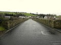
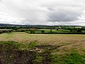
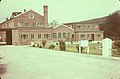
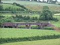
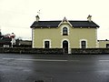
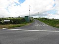
English: Victoria Bridge (Droichead Victoria in Irish) is a small village in County Tyrone, Northern Ireland. In the 2001 Census it had a population of 318 people. It lies within the Strabane District Council area.
village in County Tyrone, Northern Ireland  | |||||
| Upload media | |||||
| Instance of | |||||
|---|---|---|---|---|---|
| Location | Strabane District Council, Northern Ireland | ||||
| Population |
| ||||
| Different from | |||||
 | |||||
Subcategories
This category has only the following subcategory.
V
Media in category "Victoria Bridge, County Tyrone"
The following 57 files are in this category, out of 57 total.
-

-

-

-
 Arches Café - geograph.org.uk - 1313786.jpg 640 × 479; 45 KB
-
 Ballought, Victoria Bridge - geograph.org.uk - 193022.jpg 640 × 318; 36 KB
-
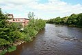
 Bridge across the River Mourne - geograph.org.uk - 4351017.jpg 640 × 480; 150 KB
-
 Bridge along Fyfin Road, Victoria Bridge - geograph.org.uk - 4351021.jpg 640 × 480; 137 KB
-
 Burial Chamber at Victoria Bridge - geograph.org.uk - 135200.jpg 640 × 479; 220 KB
-
 Burn, Victoria Bridge - geograph.org.uk - 4351071.jpg 640 × 480; 172 KB
-
 Bus shelter at Stonewalls - geograph.org.uk - 135293.jpg 640 × 479; 117 KB
-

-
 Clady Johnston - geograph.org.uk - 4011766.jpg 640 × 480; 155 KB
-
 Concrete lane, Clady Johnston - geograph.org.uk - 4011758.jpg 640 × 480; 168 KB
-

-
 Crop under wraps, Victoria Bridge - geograph.org.uk - 1313797.jpg 640 × 479; 63 KB
-
 DayToday Shop, Victoria Bridge - geograph.org.uk - 4351066.jpg 640 × 480; 141 KB
-
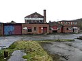 Derelict factory, Victoria Bridge - geograph.org.uk - 4351010.jpg 640 × 480; 146 KB
-

-

-
 Fyfin Road, Breen - geograph.org.uk - 4351033.jpg 640 × 480; 147 KB
-

-
 Fyfin Road, Victoria Bridge - geograph.org.uk - 4351023.jpg 640 × 480; 150 KB
-
 Fyfin Road, Victoria Bridge - geograph.org.uk - 4351047.jpg 640 × 480; 144 KB
-
 Fyfin Road, Victoria Bridge - geograph.org.uk - 4351052.jpg 640 × 480; 154 KB
-
 Heading to Victoria Bridge - geograph.org.uk - 135297.jpg 640 × 479; 110 KB
-
-
 Melmount Road, Victoria Bridge - geograph.org.uk - 1313790.jpg 640 × 479; 61 KB
-
 Mulvin Townland - geograph.org.uk - 3700442.jpg 640 × 481; 72 KB
-
 Mulvin Townland - geograph.org.uk - 3700444.jpg 640 × 480; 58 KB
-
 Myrtle Road, Victoria Bridge - geograph.org.uk - 141551.jpg 640 × 479; 105 KB
-
 Myrtle Road, Victoria Bridge - geograph.org.uk - 141552.jpg 640 × 479; 92 KB
-
 Near Victoria Bridge - geograph.org.uk - 1303944.jpg 640 × 271; 31 KB
-
 Near Victoria Bridge - geograph.org.uk - 1313793.jpg 640 × 479; 60 KB
-
-
 Old railway bridge at Victoria Bridge - geograph.org.uk - 193020.jpg 640 × 479; 70 KB
-
 Old Station House, Victoria Bridge - geograph.org.uk - 1313785.jpg 640 × 479; 42 KB
-
 Old Station House, Victoria Bridge - geograph.org.uk - 4350992.jpg 640 × 480; 134 KB
-
 Railway signal, Victoria Bridge - geograph.org.uk - 4350997.jpg 640 × 480; 167 KB
-

-
 Roadside, Victoria Bridge - geograph.org.uk - 1313796.jpg 640 × 479; 57 KB
-
 Stone Road, Clady Johnston - geograph.org.uk - 4011763.jpg 640 × 480; 158 KB
-
 Stone Road, Clady Johnston - geograph.org.uk - 4011765.jpg 640 × 480; 152 KB
-
 The Arches Bar, Victoria Bridge - geograph.org.uk - 4351000.jpg 640 × 480; 144 KB
-

-

-

-

-
 Three Mile Hill, Victoria Bridge - geograph.org.uk - 141557.jpg 640 × 479; 95 KB
-
 Urbalreagh Road, Clady Johnston - geograph.org.uk - 4011769.jpg 640 × 480; 173 KB
-
 Victoria Bridge - geograph.org.uk - 193018.jpg 640 × 479; 65 KB
-
 Victoria Bridge - geograph.org.uk - 994479.jpg 640 × 480; 70 KB
-
 Victoria Bridge - geograph.org.uk - 994480.jpg 640 × 296; 31 KB
-
 Victoria Bridge, County Tyrone - geograph.org.uk - 4351041.jpg 640 × 480; 145 KB
-
 Victoria Bridge, County Tyrone - geograph.org.uk - 83233.jpg 640 × 479; 111 KB
-
 Victoria Bridge, County Tyrone - geograph.org.uk - 83236.jpg 640 × 479; 103 KB
-
 Victoria Bridge, County Tyrone - geograph.org.uk - 994477.jpg 640 × 480; 50 KB
-
 Victoria Bridge, County Tyrone - geograph.org.uk - 994478.jpg 640 × 480; 70 KB


