Category:Viborg Maps
Jump to navigation
Jump to search
Media in category "Viborg Maps"
The following 8 files are in this category, out of 8 total.
-
 -Viborg 1900.jpg 1,430 × 1,167; 1.1 MB
-
 Danmark - Viborg1.jpg 482 × 599; 73 KB
-
 Praefecturae Viburgensis Tabulam Geographicam Viborg Map 1767 BNF Gallica.jpg 5,748 × 4,352; 16.34 MB
-
 Resen Viborg 1677.JPG 2,059 × 1,696; 2 MB
-
 Viborg 1726.JPG 1,725 × 2,179; 2.47 MB
-
 Viborg 1795 by du Plat.jpg 5,000 × 5,762; 1.68 MB
-
 Viborg 1900.jpg 1,789 × 1,296; 455 KB
-
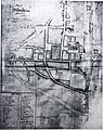
 Viborg map 1700s.JPG 3,056 × 2,168; 3.1 MB


