Category:Verwood
Jump to navigation
Jump to search
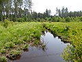
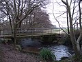
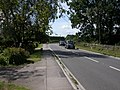
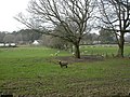
English: Verwood is a small town on the River Crane north of Bournemouth in East Dorset, England close to the New Forest.
Polski: Verwood - miasto w Wielkiej Brytanii, w Anglii, w hrabstiwe Dorset. W 2005 liczyło 13 680 mieszkańców.
Română: Verwood este un oraş în comitatul Dorset, regiunea South West, Anglia. Oraşul se află în districtul East Dorset.
town in Dorset, UK  | |||||
| Upload media | |||||
| Instance of | |||||
|---|---|---|---|---|---|
| Location | Dorset, South West England, England | ||||
| Population |
| ||||
 | |||||
Subcategories
This category has the following 6 subcategories, out of 6 total.
B
- Boveridge Heath (11 F)
M
- Moors Valley Railway (16 F)
T
- The Hub (Verwood, Dorset) (3 F)
V
- Verwood Memorial Hall (3 F)
- Verwood War Memorial (1 F)
Media in category "Verwood"
The following 200 files are in this category, out of 263 total.
(previous page) (next page)-
 2 CR at Flameburst 2005.JPG 1,280 × 960; 260 KB
-

-
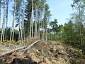
 Area cleared of trees near Mount Ararat - geograph.org.uk - 6628916.jpg 1,024 × 683; 249 KB
-
 Ashley Heath, car boot sale - geograph.org.uk - 1283433.jpg 640 × 480; 90 KB
-
 Ashley Heath, footbridge - geograph.org.uk - 2964863.jpg 1,024 × 768; 189 KB
-
 Birches Copse, Verwood, Dorset - geograph.org.uk - 87718.jpg 640 × 481; 161 KB
-
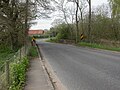
 Black Moor Road, Verwood - geograph.org.uk - 2682233.jpg 1,588 × 1,472; 697 KB
-
 Boveridge Heath, crossroads - geograph.org.uk - 3564645.jpg 1,024 × 768; 162 KB
-
 Boveridge Heath, ditch - geograph.org.uk - 3564627.jpg 1,024 × 768; 239 KB
-
 Boveridge Heath, power lines - geograph.org.uk - 3564655.jpg 1,024 × 768; 204 KB
-
 Boveridge Heath, saplings - geograph.org.uk - 3564635.jpg 1,024 × 768; 267 KB
-
-
 Bridleway In Potterne Park - geograph.org.uk - 2801639.jpg 1,600 × 1,200; 940 KB
-
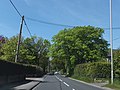
 Brock Way, Verwood - geograph.org.uk - 3088677.jpg 640 × 420; 44 KB
-
 Burrows Lane Verwood Dorset - geograph.org.uk - 2786347.jpg 640 × 426; 94 KB
-
 Businesses in the centre of Verwood - geograph.org.uk - 3992695.jpg 1,536 × 1,152; 999 KB
-
 Crab Orchard - geograph.org.uk - 2750764.jpg 3,086 × 2,438; 2.42 MB
-
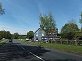
 Crab Orchard, roadside produce - geograph.org.uk - 1441967.jpg 640 × 480; 123 KB
-
 Crab Orchard, Verwood Road - geograph.org.uk - 1441960.jpg 640 × 480; 108 KB
-
 Dewlands Common, footpath - geograph.org.uk - 1320562.jpg 640 × 480; 101 KB
-
 Dewlands Road, Verwood - geograph.org.uk - 1449265.jpg 640 × 480; 213 KB
-
 Eastworth Farm, Verwood - geograph.org.uk - 5812939.jpg 1,908 × 1,332; 1.33 MB
-
 Eastworth Farmhouse - geograph.org.uk - 1258215.jpg 640 × 480; 60 KB
-
 Eastworth Play Area - geograph.org.uk - 1258176.jpg 640 × 480; 85 KB
-
 Eastworth, Burrows Farm - geograph.org.uk - 2292415.jpg 1,024 × 768; 128 KB
-
 Eastworth, Burrows Lane - geograph.org.uk - 2292404.jpg 1,024 × 768; 331 KB
-
 Eastworth, dismantled bridge - geograph.org.uk - 1258267.jpg 480 × 640; 122 KB
-
 Eastworth, fingerpost - geograph.org.uk - 1258193.jpg 480 × 640; 114 KB
-
 Eastworth, footpath - geograph.org.uk - 1258223.jpg 640 × 480; 74 KB
-
 Eastworth, former railway line - geograph.org.uk - 1258293.jpg 640 × 480; 64 KB
-
 Eastworth, road bridge - geograph.org.uk - 1258252.jpg 640 × 480; 76 KB
-
 Entrance to Verwood - geograph.org.uk - 3088658.jpg 640 × 480; 106 KB
-
 Fern Bank - geograph.org.uk - 3022958.jpg 640 × 480; 57 KB
-
 Field Fencing on West Moors. - geograph.org.uk - 3396519.jpg 640 × 480; 133 KB
-
 Flameburst 2012 Main Display Across the Lake.jpg 479 × 720; 152 KB
-
 Flameburst stage crowd.JPG 1,280 × 960; 600 KB
-
 Footpath and cycleway, Verwood, Dorset - geograph.org.uk - 1174923.jpg 640 × 426; 103 KB
-
 Footpath going towards Barrow farm - geograph.org.uk - 2787585.jpg 640 × 426; 82 KB
-
 Forest path - geograph.org.uk - 6628953.jpg 1,024 × 683; 255 KB
-

-
 Forest Track, Boveridge Heath - geograph.org.uk - 2364700.jpg 800 × 600; 211 KB
-
 Forest view near Wild Church Bottom - geograph.org.uk - 6628900.jpg 1,024 × 683; 334 KB
-
 Gate to Stevens Castle - geograph.org.uk - 2787644.jpg 426 × 640; 90 KB
-
 Gordon+Haskell (headshot).jpg 110 × 114; 27 KB
-
 Gordon+Haskell.jpg 276 × 415; 45 KB
-
 Gotham, by-way - geograph.org.uk - 2292424.jpg 768 × 1,024; 286 KB
-
 Gotham, sheep grazing - geograph.org.uk - 2292432.jpg 1,024 × 768; 300 KB
-
 Heathland colours, Ringwood Forest - geograph.org.uk - 6628919.jpg 1,024 × 683; 357 KB
-
 High Street, Verwood - geograph.org.uk - 2176359.jpg 1,600 × 1,200; 403 KB
-
 House on West Moors Rd - geograph.org.uk - 3022954.jpg 640 × 480; 84 KB
-
 Houses in Old Sawmill Close - geograph.org.uk - 6629838.jpg 1,024 × 683; 189 KB
-
 Information board Stevens Castle - geograph.org.uk - 2787642.jpg 426 × 640; 122 KB
-
 Italian restaurant, Verwood - geograph.org.uk - 3992679.jpg 1,536 × 1,153; 1 MB
-
 Late Kenny Ball at Flameburst.gif 200 × 148; 20 KB
-
 Late sunlight on recreation ground at Verwood - geograph.org.uk - 6071507.jpg 1,024 × 683; 329 KB
-
 Lilies by Eastworth Farm, Verwood - geograph.org.uk - 5812942.jpg 2,014 × 1,490; 1.65 MB
-
 Lloyds verwood.png 1,362 × 592; 1.93 MB
-
 Manor Road, Verwood - geograph.org.uk - 2461155.jpg 640 × 480; 56 KB
-
 Margards Lane, Verwood - geograph.org.uk - 1449877.jpg 640 × 480; 216 KB
-

-
 Moors Lake, bay 16 - geograph.org.uk - 2964824.jpg 1,024 × 768; 285 KB
-
 Morrisons, Verwood, Dorset - geograph.org.uk - 94228.jpg 640 × 481; 108 KB
-
 Noon Hill, bridleway - geograph.org.uk - 3550430.jpg 768 × 1,024; 305 KB
-
 Noon Hill, Ringwood Forest - geograph.org.uk - 94231.jpg 481 × 640; 86 KB
-
 Oaklands Close, Verwood - geograph.org.uk - 3123783.jpg 640 × 480; 77 KB
-
-
 On the path to Moors Valley Country Park - geograph.org.uk - 6750365.jpg 1,600 × 1,064; 380 KB
-
 Path across Dewlands Common - geograph.org.uk - 6629858.jpg 1,024 × 683; 272 KB
-
 Path crossing drainage ditch near Ebblake Bridge - geograph.org.uk - 6538564.jpg 1,024 × 683; 313 KB
-
 Path north from Ebblake Bridge - geograph.org.uk - 6538563.jpg 1,024 × 683; 340 KB
-
 Path on Dewlands Common - geograph.org.uk - 6629841.jpg 1,024 × 683; 281 KB
-
 Pistle Down, bridleway junction - geograph.org.uk - 2292559.jpg 1,024 × 768; 198 KB
-
 Pollard Oaks. Moors Valley Country Park - geograph.org.uk - 6750370.jpg 1,600 × 1,064; 840 KB
-
 Pond On Lower Common - geograph.org.uk - 2801695.jpg 1,024 × 768; 316 KB
-
 Pond, North Of Lower Common - geograph.org.uk - 2801834.jpg 1,600 × 1,200; 771 KB
-
 Pottern Farm, Verwood Dorset - geograph.org.uk - 1174900.jpg 640 × 369; 94 KB
-
 Pylon at Potterne Farm - geograph.org.uk - 5039741.jpg 427 × 640; 404 KB
-
 Ringwood Forest, crossroads - geograph.org.uk - 3564622.jpg 1,024 × 768; 135 KB
-
 Ringwood Forest, Fallen Trees - geograph.org.uk - 2364543.jpg 800 × 600; 219 KB
-
 Ringwood Forest, plantation - geograph.org.uk - 3550421.jpg 768 × 1,024; 367 KB
-
 Ringwood Forest, timber - geograph.org.uk - 3550405.jpg 1,024 × 768; 306 KB
-
 Ringwood Road, Verwood - geograph.org.uk - 6628909.jpg 1,024 × 683; 188 KB
-
 Road name sign, Margards Lane, Verwood - geograph.org.uk - 1450270.jpg 640 × 479; 233 KB
-
 Romford Bridge - geograph.org.uk - 1258358.jpg 640 × 480; 100 KB
-
 Romford Bridge over River Crane - geograph.org.uk - 3992746.jpg 1,536 × 1,154; 1.19 MB
-
 Romford, old railway - geograph.org.uk - 1258307.jpg 640 × 480; 158 KB
-
 Romford, old road bridge - geograph.org.uk - 1258321.jpg 640 × 480; 140 KB
-
 Roundabout on Champtoceaux Avenue, Verwood - geograph.org.uk - 5812547.jpg 2,048 × 1,536; 1.43 MB
-

-
 Sign for the Monmouth Ash, Verwood - geograph.org.uk - 1099972.jpg 497 × 640; 124 KB
-
 Sign for the Three Legged Cross - geograph.org.uk - 2220383.jpg 480 × 640; 84 KB
-
 Skate Park, Three Legged Cross - geograph.org.uk - 2801680.jpg 1,024 × 768; 215 KB
-
 Sleepbrook Close - geograph.org.uk - 6629839.jpg 1,024 × 683; 247 KB
-

-
 St Michael, Verwood, churchyard - geograph.org.uk - 3592672.jpg 480 × 640; 99 KB
-
 St Michael, Verwood, May 2013 - geograph.org.uk - 3592687.jpg 640 × 480; 102 KB
-
 Station Road, B3081, west of Verwood - geograph.org.uk - 3992700.jpg 1,536 × 1,151; 1.2 MB
-
 Station Road, Verwood - geograph.org.uk - 5812925.jpg 1,960 × 1,412; 1.2 MB
-
 Stephen's Castle Nature Reserve - geograph.org.uk - 1354255.jpg 640 × 480; 104 KB
-

-
 Stephen's Castle, heathland - geograph.org.uk - 1354204.jpg 640 × 480; 79 KB
-
 Stephen's Castle, pond - geograph.org.uk - 1354299.jpg 640 × 480; 97 KB
-
 Stephen's Castle, tumulus - geograph.org.uk - 1354279.jpg 640 × 480; 108 KB
-
 Steps up to Stevens Castle - geograph.org.uk - 2787618.jpg 426 × 640; 114 KB
-
 Stile Onto Open Access Land, Lower Common - geograph.org.uk - 2801651.jpg 1,024 × 768; 301 KB
-
 The Albion Inn, Verwood - geograph.org.uk - 3992722.jpg 1,536 × 1,152; 1.02 MB
-
 The centre of Verwood - geograph.org.uk - 3992690.jpg 1,536 × 1,152; 1.01 MB
-
 The lake at Moors Valley Country Park - geograph.org.uk - 376725.jpg 640 × 480; 66 KB
-
 The Monmouth Ash, Verwood - geograph.org.uk - 1099981.jpg 640 × 480; 111 KB
-

-
 Track over bridge, near Bridge Farm - geograph.org.uk - 6629861.jpg 1,024 × 683; 255 KB
-
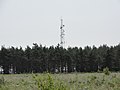 Transmitter mast - geograph.org.uk - 3551655.jpg 3,648 × 2,736; 3.55 MB
-
 Verwood Cemetery - geograph.org.uk - 1412104.jpg 640 × 480; 80 KB
-
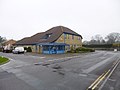
 Verwood centre - geograph.org.uk - 8907.jpg 640 × 481; 124 KB
-
 Verwood centre - geograph.org.uk - 8908.jpg 640 × 481; 108 KB
-
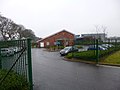 Verwood Day Centre - geograph.org.uk - 3360928.jpg 1,024 × 766; 127 KB
-
 Verwood Fire Station - geograph.org.uk - 251174.jpg 640 × 427; 171 KB
-
 Verwood Industrial Estate - geograph.org.uk - 1362960.jpg 640 × 480; 69 KB
-
 Verwood Leisure Centre - geograph.org.uk - 1216772.jpg 640 × 480; 54 KB
-
 Verwood Manor Farm - geograph.org.uk - 1441947.jpg 640 × 480; 98 KB
-
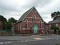
 Verwood Methodist Church, May 2013 - geograph.org.uk - 3592549.jpg 640 × 461; 60 KB
-
 Verwood Police Station - geograph.org.uk - 3360941.jpg 1,024 × 768; 105 KB
-
 Verwood Post Office - geograph.org.uk - 3360963.jpg 1,024 × 768; 156 KB
-
 Verwood Railway Station.jpg 640 × 481; 163 KB
-
 Verwood residential area - geograph.org.uk - 94229.jpg 640 × 481; 100 KB
-
 Verwood Road, Crab Orchard - geograph.org.uk - 2750679.jpg 640 × 476; 87 KB
-
 Verwood Surgery - geograph.org.uk - 3360949.jpg 1,024 × 762; 141 KB
-
 Verwood town 2010.JPG 2,592 × 1,936; 2.74 MB
-
 Verwood town centre.jpg 720 × 540; 145 KB
-
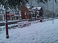 Verwood winter 2010.jpg 720 × 540; 117 KB
-
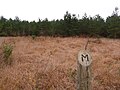 Verwood, 'M' is for ... mystery - geograph.org.uk - 1573120.jpg 640 × 480; 86 KB
-

-
 Verwood, aerial on Pistle Down - geograph.org.uk - 1575232.jpg 480 × 640; 53 KB
-
 Verwood, Albion Way - geograph.org.uk - 1225806.jpg 640 × 480; 51 KB
-
 Verwood, angling platform - geograph.org.uk - 1441921.jpg 640 × 480; 141 KB
-
 Verwood, Apple Tree Cottage - geograph.org.uk - 531184.jpg 640 × 458; 109 KB
-
 Verwood, boardwalk - geograph.org.uk - 1320534.jpg 480 × 640; 155 KB
-
 Verwood, boundary - geograph.org.uk - 1412127.jpg 640 × 480; 100 KB
-
 Verwood, bridleway - geograph.org.uk - 1441951.jpg 640 × 480; 106 KB
-
 Verwood, bridleway over Mount Ararat - geograph.org.uk - 1573110.jpg 640 × 480; 74 KB
-

-
 Verwood, Bugden's Copse - geograph.org.uk - 1363122.jpg 640 × 480; 139 KB
-
 Verwood, builders' merchant - geograph.org.uk - 1362958.jpg 640 × 480; 56 KB
-
 Verwood, Burrows Lane - geograph.org.uk - 1575270.jpg 640 × 480; 71 KB
-
 Verwood, clinic and vets - geograph.org.uk - 953601.jpg 640 × 480; 58 KB
-
 Verwood, Crane Bridge - geograph.org.uk - 1216726.jpg 640 × 480; 103 KB
-

-

-
 Verwood, Dewlands Common - geograph.org.uk - 1320557.jpg 640 × 480; 89 KB
-
 Verwood, Dewlands Common - geograph.org.uk - 8904.jpg 640 × 481; 154 KB
-

-
 Verwood, Doe's Lane - geograph.org.uk - 1320574.jpg 640 × 480; 128 KB
-
 Verwood, Dorset - geograph.org.uk - 184383.jpg 640 × 481; 77 KB
-
 Verwood, Eastworth finger-post - geograph.org.uk - 1741221.jpg 480 × 640; 132 KB
-
 Verwood, Eastworth Road - geograph.org.uk - 1258119.jpg 640 × 480; 107 KB
-
 Verwood, Ebblake Industrial Estate - geograph.org.uk - 1412138.jpg 640 × 480; 72 KB
-
 Verwood, fishing lake - geograph.org.uk - 1441916.jpg 640 × 480; 115 KB
-
 Verwood, forest fungus - geograph.org.uk - 1573136.jpg 640 × 480; 106 KB
-

-
 Verwood, former main crossroads - geograph.org.uk - 953590.jpg 640 × 480; 58 KB
-
 Verwood, Hainault Drive - geograph.org.uk - 1362951.jpg 640 × 480; 56 KB
-
 Verwood, lane junction - geograph.org.uk - 1441878.jpg 640 × 480; 78 KB
-
 Verwood, library - geograph.org.uk - 953580.jpg 640 × 480; 67 KB
-

-
 Verwood, maize field - geograph.org.uk - 1442002.jpg 640 × 480; 109 KB
-
 Verwood, maize fields - geograph.org.uk - 1442008.jpg 640 × 480; 91 KB
-
 Verwood, molehills - geograph.org.uk - 1216694.jpg 640 × 480; 121 KB
-
 Verwood, Noon Hill Drive - geograph.org.uk - 1362964.jpg 640 × 480; 59 KB
-
 Verwood, old course of Station Road - geograph.org.uk - 1225813.jpg 640 × 480; 102 KB
-
 Verwood, paddocks - geograph.org.uk - 1441892.jpg 640 × 480; 103 KB
-
 Verwood, painter painted^ - geograph.org.uk - 2441217.jpg 1,017 × 768; 308 KB
-

-
 Verwood, plantation - geograph.org.uk - 1412116.jpg 480 × 640; 120 KB
-
 Verwood, police station - geograph.org.uk - 953602.jpg 640 × 480; 49 KB
-

-
 Verwood, postbox - geograph.org.uk - 1216796.jpg 480 × 640; 85 KB
-

-

-

-

-

-

-

-

-

-

-

-

-

-

-

-
 Verwood, River Crane downstream - geograph.org.uk - 1216753.jpg 480 × 640; 137 KB
-
 Verwood, River Crane upstream - geograph.org.uk - 1216744.jpg 640 × 480; 142 KB
-
 Verwood, sluice - geograph.org.uk - 1441908.jpg 640 × 480; 117 KB
-
 Verwood, Southernhay Road - geograph.org.uk - 1362944.jpg 640 × 480; 86 KB
-
 Verwood, Spar - geograph.org.uk - 953570.jpg 640 × 480; 117 KB
-
 Verwood, St. Michael's Road - geograph.org.uk - 1441870.jpg 640 × 480; 96 KB
-
-
 Verwood, start of Ringwood Road - geograph.org.uk - 953599.jpg 640 × 480; 80 KB
-
 Verwood, Stephen's Castle - geograph.org.uk - 1354174.jpg 640 × 480; 104 KB


.jpg)


