Category:Vermessungssäule Kasseler Kuppe
Jump to navigation
Jump to search
| Object location | | View all coordinates using: OpenStreetMap |
|---|
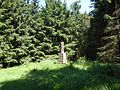
This is the category of the Hessian Kulturdenkmal (cultural monument) with the ID 39313 (Wikidata)
|
| Upload media | |||||
| Instance of | |||||
|---|---|---|---|---|---|
| Location | Berkatal, Werra-Meißner-Kreis, Kassel Government Region, Hesse, Germany | ||||
| Street address |
| ||||
| Heritage designation | |||||
 | |||||
Media in category "Vermessungssäule Kasseler Kuppe"
The following 5 files are in this category, out of 5 total.
-
 Kasseler Kuppe.JPG 4,000 × 3,000; 3.66 MB
-
 Vermessungssäule Kasseler Kuppe-Hinweistafel.jpg 3,648 × 2,736; 6.42 MB
-
 Vermessungssäule Kasseler Kuppe-Inschrift 1878.jpg 3,648 × 2,736; 5.89 MB
-
 Vermessungssäule Kasseler Kuppe-Inschrift 1880.jpg 3,598 × 2,698; 6.23 MB
-
 Vermessungssäule Kasseler Kuppe.jpg 2,055 × 2,736; 5.8 MB


