Category:Vegetation index maps
Jump to navigation
Jump to search
Wikimedia category | |||||
| Upload media | |||||
| Instance of | |||||
|---|---|---|---|---|---|
| Category combines topics | |||||
| Vegetation Index | |||||
| |||||
Media in category "Vegetation index maps"
The following 22 files are in this category, out of 22 total.
-
Australian Vegetation.png 2,000 × 2,000; 229 KB
-
Biomes vegetation Russia.jpg 2,169 × 1,219; 2.41 MB
-
DroneMapper Processed NDVI 4cm GSD.png 854 × 450; 762 KB
-
ECDM 20211013 Horn-of-Africa Food-Insecurity.pdf 1,754 × 1,239; 724 KB
-
EVI.png 2,725 × 1,511; 1.66 MB
-
Global Vegetation.jpg 1,024 × 768; 78 KB
-
Globalndvi tmo 200711 lrg.jpg 3,600 × 1,800; 2.17 MB
-
Greening Sahel 1982-1999.jpg 949 × 365; 64 KB
-
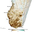
Madagascar tmo 2021205 lrg.jpg 2,581 × 2,480; 2.99 MB
-
Madagascar tmo 2021205.jpg 720 × 640; 307 KB
-
NDVI 062003.png 2,052 × 1,364; 480 KB
-
NDVI 102003.png 2,052 × 1,364; 504 KB
-
NDVI 1998.gif 360 × 286; 485 KB
-
NDVI 2017-09-10.png 816 × 1,056; 747 KB
-
NDVI Chichigalpa Time Lapse.gif 1,018 × 720; 2.19 MB
-
NDVI of irrigated fields.jpg 9,930 × 5,580; 3.86 MB
-
NDVI.jpg 454 × 334; 72 KB
-
Reflectancia de vegetación.svg 1,838 × 612; 43 KB
-
Southernafrica amo 2019059 NDVI anomaly.png 720 × 545; 431 KB
-
Vegetation Index (NESDIS 2017-09-14).png 4,096 × 2,048; 4.73 MB
-
Woody plant cover dynamics.webp 1,989 × 790; 325 KB


