Category:Veerhuis (Opheusden)
Jump to navigation
Jump to search
| Object location | | View all coordinates using: OpenStreetMap |
|---|
farmhouse in Neder-Betuwe, Netherlands  | |||||
| Upload media | |||||
| Instance of | |||||
|---|---|---|---|---|---|
| Location | Opheusden, Neder-Betuwe, Gelderland, Netherlands | ||||
| Street address |
| ||||
| Located on street |
| ||||
| Heritage designation |
| ||||
 | |||||
|
This is a category about rijksmonument number 522904
|
| Address |
|
Media in category "Veerhuis (Opheusden)"
The following 8 files are in this category, out of 8 total.
-
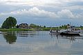 20170512 Veer tussen Opheusden en de Blauwe Kamer.jpg 5,184 × 3,456; 2.47 MB
-
 20170512 Veerhuis Opheusden.jpg 4,941 × 3,286; 2.84 MB
-
 Exterieur OVERZICHT - Opheusden - 20313792 - RCE.jpg 1,192 × 1,200; 230 KB
-
 Exterieur OVERZICHT VOORGEVEL - Opheusden - 20313791 - RCE.jpg 1,185 × 1,200; 317 KB
-
 Opheusden Veerweg 1 1.jpg 3,264 × 2,448; 3.11 MB
-
 Opheusden Veerweg 1 2.jpg 3,264 × 2,448; 2.45 MB
-
 Opheusden Veerweg 1 3.jpg 3,264 × 2,448; 3.06 MB
-
 Opheusden Veerweg 1 4.jpg 2,448 × 3,264; 2.38 MB


