Category:Veerhuis 't Vaantje (Sint Michielsgestel)
Jump to navigation
Jump to search
| Object location | | View all coordinates using: OpenStreetMap |
|---|
building in Sint-Michielsgestel, Netherlands  | |||||
| Upload media | |||||
| Instance of | |||||
|---|---|---|---|---|---|
| Location | Sint-Michielsgestel, North Brabant, Netherlands | ||||
| Street address |
| ||||
| Heritage designation |
| ||||
 | |||||
Nederlands: Veerhuis 't Vaantje
|
This is a category about rijksmonument number 33629
|
| Address |
|
Media in category "Veerhuis 't Vaantje (Sint Michielsgestel)"
The following 8 files are in this category, out of 8 total.
-
 "'t Vaantje", exterieur overzicht - Sint Michielsgestel - 20153950 - RCE.jpg 1,200 × 954; 252 KB
-
 "'t Vaantje", exterieur overzicht - Sint Michielsgestel - 20153951 - RCE.jpg 1,200 × 953; 192 KB
-
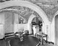
 "'t Vaantje", keuken - Sint Michielsgestel - 20153948 - RCE.jpg 1,200 × 953; 209 KB
-
 "'t Vaantje", keuken - Sint Michielsgestel - 20153949 - RCE.jpg 1,200 × 953; 203 KB
-
 "'t Vaantje", woonkamer - Sint Michielsgestel - 20153946 - RCE.jpg 1,200 × 960; 177 KB
-
 "'t Vaantje", woonkamer - Sint Michielsgestel - 20153947 - RCE.jpg 1,200 × 965; 185 KB
-
 Vaantje-voor.jpg 816 × 1,000; 240 KB
-
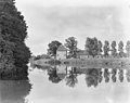
 Vaantje.jpg 1,000 × 665; 164 KB


