Category:Veemarktstraat 68, Breda
Jump to navigation
Jump to search
| Object location | | View all coordinates using: OpenStreetMap |
|---|
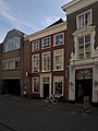
house in Breda, Netherlands  | |||||
| Upload media | |||||
| Instance of | |||||
|---|---|---|---|---|---|
| Location | Breda, North Brabant, Netherlands | ||||
| Street address |
| ||||
| Heritage designation |
| ||||
 | |||||
|
This is a category about rijksmonument number 10335
|
| Address |
|
Media in category "Veemarktstraat 68, Breda"
The following 8 files are in this category, out of 8 total.
-
 Aanzicht - Breda - 20041640 - RCE.jpg 2,320 × 2,880; 1.41 MB
-
 Aanzicht - Breda - 20041641 - RCE.jpg 2,314 × 2,874; 1.47 MB
-
 Breda Veemarktstraat68.jpg 2,736 × 3,648; 4.77 MB
-
 Gevels - Breda - 20041643 - RCE.jpg 1,200 × 960; 245 KB
-
 Gevels - Breda - 20041645 - RCE.jpg 831 × 1,200; 187 KB
-
 Overzicht - Breda - 20041580 - RCE.jpg 1,200 × 965; 246 KB
-
 Overzicht - Breda - 20041581 - RCE.jpg 1,200 × 957; 179 KB
-
 Voorgevel - Breda - 20041642 - RCE.jpg 825 × 1,200; 197 KB


