Category:Veemarktstraat 15, Breda
Jump to navigation
Jump to search
| Object location | | View all coordinates using: OpenStreetMap |
|---|
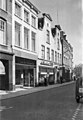
house in Breda, Netherlands  | |||||
| Upload media | |||||
| Instance of | |||||
|---|---|---|---|---|---|
| Location | Breda, North Brabant, Netherlands | ||||
| Street address |
| ||||
| Heritage designation |
| ||||
 | |||||
|
This is a category about rijksmonument number 10310
|
| Address |
|
Media in category "Veemarktstraat 15, Breda"
The following 3 files are in this category, out of 3 total.
-
 Breda Veemarktstraat15.jpg 2,736 × 3,648; 4.71 MB
-
 Enz., overzicht - Breda - 20041600 - RCE.jpg 832 × 1,200; 206 KB
-
 Voorgevel - Breda - 20041599 - RCE.jpg 819 × 1,200; 194 KB

