Category:Vange
Jump to navigation
Jump to search
human settlement in United Kingdom  | |||||
| Upload media | |||||
| Instance of |
| ||||
|---|---|---|---|---|---|
| Location | Basildon, Essex, East of England, England | ||||
 | |||||
English: Vange is a village in the Basildon District of Essex and a suburb of the town of Basildon. As it is much smaller than Basildon, Laindon and Pitsea, it does not have its own town centre or railway station. The London Road (B1464) is the main road through Vange and used to be part of the A13 till it was bypassed in the 1970s.

Subcategories
This category has the following 3 subcategories, out of 3 total.
A
V
- Vange Hill (9 F)
- Vange War Memorial (2 F)
Media in category "Vange"
The following 38 files are in this category, out of 38 total.
-
 A13, eastbound - geograph.org.uk - 5729220.jpg 640 × 426; 60 KB
-
 A13, Stanford-Le-Hope bypass - geograph.org.uk - 2921168.jpg 640 × 430; 32 KB
-
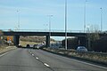 A176 overbridge, A13 - geograph.org.uk - 5738731.jpg 640 × 426; 47 KB
-

-
 Bridleway, One Tree Hill - geograph.org.uk - 5363328.jpg 640 × 480; 162 KB
-
 Cabin, Hovels Farm - geograph.org.uk - 5362312.jpg 640 × 480; 121 KB
-
 Entering Essex, A13 - geograph.org.uk - 5729223.jpg 640 × 426; 45 KB
-
 Hawkesbury Bush - geograph.org.uk - 5363684.jpg 640 × 480; 109 KB
-
 High Rd - geograph.org.uk - 5288132.jpg 640 × 426; 67 KB
-
 High Rd - geograph.org.uk - 5297627.jpg 640 × 426; 55 KB
-
 Hovels Farm - geograph.org.uk - 5363308.jpg 640 × 428; 93 KB
-
 Hovels Farm Livery Yard ^ Stables - geograph.org.uk - 3424617.jpg 2,284 × 1,713; 1.14 MB
-
 Level crossing, High Rd - geograph.org.uk - 3215334.jpg 640 × 430; 44 KB
-
 Level crossing, High Rd - geograph.org.uk - 3925059.jpg 640 × 430; 49 KB
-
 Level Crossing, Vange - geograph.org.uk - 3776635.jpg 640 × 480; 105 KB
-
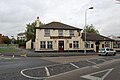 The Barge Public House, Vange - geograph.org.uk - 995977.jpg 640 × 425; 60 KB
-
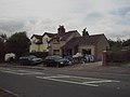
 The Five Bells, Vange - geograph.org.uk - 1066951.jpg 640 × 425; 47 KB
-
 Vange Turn-off - geograph.org.uk - 4452318.jpg 1,109 × 1,600; 504 KB
-
 View from Langdon Hills Country Park - geograph.org.uk - 5363737.jpg 640 × 480; 126 KB
-
 View of Thames Estuary from Langdon Hills Country Park - geograph.org.uk - 3424829.jpg 3,648 × 1,552; 1.46 MB
-

-
 Beeleigh East - geograph.org.uk - 451426.jpg 640 × 448; 41 KB
-
 Craylands School - geograph.org.uk - 461272.jpg 615 × 480; 82 KB
-
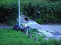
 Footpath to Clay Hill Rd - geograph.org.uk - 62168.jpg 482 × 640; 155 KB
-
 Fryerns School - geograph.org.uk - 460057.jpg 640 × 427; 53 KB
-
 Fryerns School - geograph.org.uk - 461270.jpg 640 × 427; 80 KB
-
 Goldhanger Cross - geograph.org.uk - 451422.jpg 640 × 480; 62 KB
-
 Goldhanger Cross, Fryerns - geograph.org.uk - 457215.jpg 640 × 395; 49 KB
-
 Langdon Hills Country Park, Essex - geograph.org.uk - 56704.jpg 640 × 480; 89 KB
-
 Mill Lane - geograph.org.uk - 60321.jpg 640 × 482; 103 KB
-
 Mixed Metaphors^ - geograph.org.uk - 60041.jpg 640 × 482; 64 KB
-
 Mopsies Park - geograph.org.uk - 463360.jpg 640 × 427; 79 KB
-
 Open land under threat - geograph.org.uk - 205592.jpg 640 × 480; 155 KB
-
 Pattiswick Square - geograph.org.uk - 451428.jpg 640 × 426; 63 KB
-
 Stile On One Tree Hill - geograph.org.uk - 51772.jpg 482 × 640; 67 KB
-
 The old school - geograph.org.uk - 153446.jpg 640 × 480; 116 KB
-
 Vange Water Works - geograph.org.uk - 60352.jpg 640 × 482; 84 KB
-
 WRVS Vans at Vange - geograph.org.uk - 60013.jpg 640 × 482; 81 KB


