Category:Valnontey (valley)
Jump to navigation
Jump to search
| Object location | | View all coordinates using: OpenStreetMap |
|---|
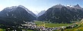
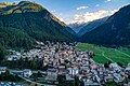
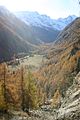
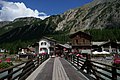
Français : Le Valnontey est une vallée latérale du val de Cogne, ainsi que le nom d'un hameau, dans la région autonome Vallée d'Aoste.
valley  | |||||
| Upload media | |||||
| Instance of | |||||
|---|---|---|---|---|---|
| Located in protected area | |||||
| Location | Cogne, Aosta Valley, Italy | ||||
| Mountain range | |||||
| Elevation above sea level |
| ||||
 | |||||
Subcategories
This category has the following 5 subcategories, out of 5 total.
B
- Bivacco del Money (2 F)
G
- Giardino alpino Paradisia (37 F)
H
R
- Rifugio Vittorio Sella (24 F)
V
- Valmiana (13 F)
Media in category "Valnontey (valley)"
The following 71 files are in this category, out of 71 total.
-
 Andiamo và.jpg 1,200 × 627; 426 KB
-
 Aosta 1983 03.jpg 5,370 × 1,998; 6.23 MB
-
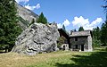
 Baita a Vermiana in Valnontey.jpg 3,918 × 2,204; 5.16 MB
-
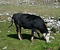
 Cattle in Valnontey.jpg 4,270 × 3,124; 4.85 MB
-
 Cogne - Nella luce.jpg 1,200 × 450; 318 KB
-
 CogneAugust072023 01.jpg 4,000 × 2,668; 13.23 MB
-
 CogneAugust072023 02.jpg 4,000 × 2,668; 12.77 MB
-
 CogneAugust072023 03.jpg 4,000 × 2,668; 12.87 MB
-
 CogneAugust072023 06.jpg 4,000 × 2,668; 11.54 MB
-
 CogneAugust072023 07.jpg 3,840 × 2,558; 9.61 MB
-
 Colonnato centrale - Valnontey (Cogne), Italy.jpg 467 × 700; 56 KB
-
 E-bike charging stations - Cogne.jpg 3,120 × 4,160; 5.43 MB
-
 Fountain in Gran Paradiso National Park.jpg 5,472 × 3,648; 7.35 MB
-
 Gabinio.Valnontey, Panorama Della Valle Col Borgo 128B73.jpg 1,024 × 749; 123 KB
-
 Gran Paradiso visto da Valnontey.JPG 2,288 × 1,712; 2.21 MB
-
 Gran Paradiso visto dal Giardino alpino Paradisia.JPG 2,288 × 1,712; 2.44 MB
-
 Hike signs in Valnontey.jpg 3,648 × 5,108; 4.96 MB
-
 Hotel Ristorante Paradisia.jpg 5,256 × 3,420; 4.64 MB
-
 La Via è libera.jpg 1,024 × 718; 466 KB
-
 Mucche e camosci Valnontey.jpg 2,288 × 1,712; 1.38 MB
-
 Torrent de Grand Loson - bridge.jpg 5,256 × 3,416; 8.38 MB
-
 Torrent de Grand Loson.jpg 3,648 × 5,472; 7.54 MB
-
 Torrent Valnontey 2.jpg 5,472 × 3,648; 9.4 MB
-
 Toules 2022.jpg 5,104 × 3,058; 4.87 MB
-
 Valee 12.jpg 1,067 × 1,600; 329 KB
-
 Valee 21.jpg 1,600 × 1,067; 451 KB
-
 Valle de Cogne, Aosta (1983) 05.jpg 712 × 1,052; 670 KB
-
 Valnontey - bridge 2.jpg 5,472 × 3,648; 8.57 MB
-
 Valnontey - bridge.jpg 3,648 × 5,472; 7.13 MB
-
 Valnontey - cattle.jpg 3,604 × 3,012; 3.86 MB
-
 Valnontey - cow.jpg 3,970 × 2,970; 3.18 MB
-
 Valnontey - river.jpg 11,748 × 5,224; 14.56 MB
-
 Valnontey - trail 2.jpg 5,801 × 5,694; 7.99 MB
-
 Valnontey - trail 4.jpg 5,472 × 3,648; 5.74 MB
-
 Valnontey - trail 5.jpg 5,472 × 3,648; 4.46 MB
-
 Valnontey - trail 6.jpg 5,984 × 3,376; 6.88 MB
-
 Valnontey - trail.jpg 5,472 × 3,648; 7.38 MB
-
 Valnontey - tree.jpg 2,606 × 4,609; 3.81 MB
-
 Valnontey 2.jpg 5,472 × 3,434; 5.7 MB
-
 Valnontey 2013 abc10.jpg 2,816 × 2,112; 2.9 MB
-
 Valnontey 2013 abc11.jpg 2,112 × 2,816; 1.99 MB
-
 Valnontey 2013 abc12 camoscio.jpg 2,816 × 2,112; 2.07 MB
-
 Valnontey 2013 abc2 impronte di lepre.jpg 2,288 × 1,712; 1.33 MB
-
 Valnontey 2013 abc3 pista sci fondo.jpg 1,712 × 2,288; 1.29 MB
-
 Valnontey 2013 abc4 pista sci di fondo.jpg 1,712 × 2,288; 1.21 MB
-
 Valnontey 2013 abc5 sentiero ciaspole.jpg 2,288 × 1,712; 1.28 MB
-
 Valnontey 2013 abc6 impronte lepre.jpg 2,112 × 2,816; 1.37 MB
-
 Valnontey 2013 abc7 sentiero ciaspole.jpg 2,816 × 2,112; 2.86 MB
-
 Valnontey 2013 abc8 scalata cascata di ghiaccio.jpg 2,816 × 2,112; 2.91 MB
-
 Valnontey 2013 abc9 scalata cascata di ghiaccio.jpg 2,816 × 2,112; 2.9 MB
-
 Valnontey 2022.jpg 12,856 × 3,026; 9.51 MB
-
 Valnontey 3.jpg 5,454 × 2,224; 3.66 MB
-
 Valnontey chamois (8062110896).jpg 3,888 × 2,951; 8.42 MB
-
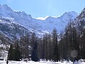
 Valnontey inv 1.jpg 1,712 × 2,288; 1.29 MB
-
 Valnontey inv 2.jpg 2,288 × 1,712; 1.34 MB
-
 Valnontey inv 3.jpg 1,712 × 2,288; 1.35 MB
-
 Valnontey inv 4.jpg 2,288 × 1,712; 1.29 MB
-
 Valnontey inv 5.jpg 2,288 × 1,712; 1.28 MB
-
 Valnontey panorama.jpg 3,872 × 2,592; 5.77 MB
-
 Valnontey river 2.jpg 5,472 × 3,648; 6.02 MB
-
 Valnontey river.jpg 5,472 × 3,648; 5.65 MB
-
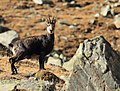
 Valnontey rock goat (8062074395).jpg 3,456 × 5,184; 12.29 MB
-
 Valnontey, winter mode on (10266261254).jpg 5,184 × 3,456; 15.14 MB
-
 Valnontey.jpg 4,694 × 3,377; 3.65 MB
-
 ValnonteyAugust212023 01.jpg 4,000 × 3,000; 13.31 MB
-
 ValnonteyAugust212023 02.jpg 4,000 × 2,668; 12.65 MB
-
 ValnonteyAugust212023 03.jpg 4,000 × 2,668; 11.98 MB
-
 ValnonteyAugust212023 04.jpg 4,655 × 3,103; 17.21 MB
-
 ValnonteyAugust212023 05.jpg 4,612 × 3,076; 16.2 MB
-
 ValnonteyAugust212023 06.jpg 4,627 × 3,082; 17.92 MB
-
 Villaggio di Valnontey.jpg 2,288 × 1,712; 1.28 MB


,_Italy.jpg)


_05.jpg)


.jpg)


.jpg)
.jpg)


