Category:Valid SVG created with Text Editor:Maps
Jump to navigation
Jump to search
Subcategories
This category has the following 4 subcategories, out of 4 total.
Media in category "Valid SVG created with Text Editor:Maps"
The following 200 files are in this category, out of 638 total.
(previous page) (next page)-
 115th United States Congress Senators.svg 959 × 593; 33 KB
-
 116th United States Congress Senators.svg 959 × 593; 33 KB
-
 117th United States Congress Senators.svg 959 × 593; 38 KB
-
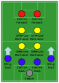
 2-3-2-3 formation.svg 416 × 582; 2 KB
-
 2017 US Electoral College objections map.svg 1,020 × 593; 28 KB
-
 2018 teacher education strikes by state.svg 959 × 593; 28 KB
-
 2023 Crimean–Congo hemorrhagic fever outbreak By Country.svg 2,754 × 1,398; 1.05 MB
-
 3-5-2 formation.svg 416 × 582; 2 KB
-
 3-6-1 formation.svg 416 × 582; 2 KB
-
 4-2-2-2 formation (magic square).svg 416 × 582; 2 KB
-
 4-2-4 formation.svg 416 × 582; 2 KB
-
 4-3-2-1 formation.svg 416 × 582; 2 KB
-
 Accession of the United Kingdom to the CPTPP.svg 2,754 × 1,398; 1.05 MB
-
 Adultery Laws in the United States.svg 959 × 593; 63 KB
-
 Aeroparque Jorge Newbery.svg 2,608 × 700; 205 KB
-
 Aeropuerto.svg 200 × 200; 531 bytes
-
 Afrotropic-Arabian Peninsula.svg 2,487 × 2,770; 387 KB
-
 Afrotropic-East Tropical Africa.svg 752 × 762; 225 KB
-
 Afrotropic-Ecozone-Arabian Peninsula.svg 773 × 555; 36 KB
-
 Afrotropic-Ecozone-Biocountries-IM.svg 500 × 507; 390 KB
-
 Afrotropic-Ecozone-East Tropical Africa.svg 427 × 543; 30 KB
-
 Afrotropic-Ecozone-Northeast Tropical Africa.svg 739 × 540; 72 KB
-
 Afrotropic-Ecozone-South Tropical Africa.svg 898 × 762; 51 KB
-
 Afrotropic-Ecozone-Southern Africa.svg 689 × 757; 29 KB
-
 Afrotropic-Ecozone-West Central Tropical Africa.svg 695 × 849; 64 KB
-
 Afrotropic-Ecozone-West Tropical Africa.svg 500 × 340; 74 KB
-
 Afrotropic-Ecozone-Western Indian Ocean.svg 556 × 629; 22 KB
-
 Afrotropic-Northeast Tropical Africa.svg 2,487 × 2,770; 390 KB
-
 Afrotropic-South Tropical Africa.svg 2,487 × 2,770; 387 KB
-
 Afrotropic-Southern Africa.svg 2,487 × 2,770; 387 KB
-
 Afrotropic-West Central Tropical Africa.svg 2,487 × 2,770; 387 KB
-
 Afrotropic-West Tropical Africa.svg 2,487 × 2,770; 339 KB
-
 Afrotropic-Western Indian Ocean.svg 2,487 × 2,770; 387 KB
-
 Altimetria Sicilia.svg 700 × 700; 32 KB
-
 American attack on Quebec.svg 883 × 1,077; 752 KB
-
 Association football 4-2-3-1 formation.svg 416 × 582; 2 KB
-
 Association football 4-3-3 formation.svg 416 × 582; 5 KB
-
 Association football 4-4-2 diamond formation.svg 416 × 582; 2 KB
-
 Association football 4-4-2 formation.svg 416 × 582; 2 KB
-
 Association football 4-5-1 formation.svg 416 × 582; 2 KB
-
 Association football 5-3-2 formation.svg 416 × 582; 2 KB
-
 Association football 5-3-2 sweeper formation.svg 416 × 582; 2 KB
-
 Association football 5-4-1 formation.svg 416 × 582; 2 KB
-
 Avenida Juan B Justo Mapa.svg 2,400 × 2,400; 5 KB
-
 AzureMaps.svg 105 × 106; 1 KB
-
 Balaeniceps rex distribution.svg 1,000 × 1,000; 406 KB
-
 Balkan floods May 2014.svg 850 × 600; 239 KB
-
 Ballot access of Paul T. Farrell.svg 959 × 593; 80 KB
-
 Bassaricyon gabbii distribution.svg 300 × 300; 161 KB
-
 Bdrates of Japan since 1950 de.svg 512 × 320; 25 KB
-
 Belasica i Ogrаžden.svg 4,228 × 2,500; 10.06 MB
-
 Bermuda.svg 625 × 463; 8 KB
-
 Bezirke Salzburg mit Namen.svg 290 × 244; 7 KB
-
 Bezirke Salzburg.svg 290 × 244; 7 KB
-
 Blank Map-Alboran.svg 1,052 × 744; 11 KB
-
 Blank Taiwan map.svg 1,440 × 2,055; 1.61 MB
-
 Blank US Map (states only).svg 959 × 593; 57 KB
-
 Blank US Map (white on gray and black).svg 959 × 593; 150 KB
-
 Blank USA, w territories.svg 959 × 593; 63 KB
-
 BlankMap-USA-states-Canada-provinces, HI closer.svg 512 × 512; 104 KB
-
 Brazil Coffee production regions.svg 703 × 687; 1.35 MB
-
 British Isles Ireland higlighted.svg 675 × 1,180; 53 KB
-
 Bulgaria Alfatar Municipality geographic map bg.svg 1,000 × 1,258; 991 KB
-
 Bulgaria Apriltsi Municipality geographic map bg.svg 1,000 × 1,137; 2.18 MB
-
 Bulgaria Ardino Municipality geographic map bg.svg 1,000 × 1,216; 4.16 MB
-
 Bulgaria Asenovgrad Municipality geographic map bg.svg 1,158 × 1,000; 5.94 MB
-
 Bulgaria Avren Municipality geographic map bg.svg 1,697 × 1,000; 1.48 MB
-
 Bulgaria Aytos Municipality geographic map bg.svg 1,581 × 1,000; 1.59 MB
-
 Bulgaria Balchik Municipality geographic map bg.svg 1,000 × 1,278; 1,016 KB
-
 Bulgaria Banite Municipality geographic map bg.svg 1,200 × 1,814; 2.03 MB
-
 Bulgaria Bansko Municipality geographic map bg.svg 1,896 × 1,000; 4.27 MB
-
 Bulgaria Batak Municipality geographic map bg.svg 1,023 × 1,000; 6.33 MB
-
 Bulgaria Belene Municipality geographic map bg.svg 1,141 × 1,000; 1.01 MB
-
 Bulgaria Belitsa Municipality geographic map bg.svg 1,000 × 1,080; 3.64 MB
-
 Bulgaria Belogradchik Municipality geographic map bg.svg 1,000 × 1,147; 3.64 MB
-
 Bulgaria Beloslav Municipality geographic map bg.svg 1,573 × 1,000; 556 KB
-
 Bulgaria Belovo Municipality geographic map bg.svg 1,138 × 1,000; 2.79 MB
-
 Bulgaria Berkovitsa Municipality geographic map bg.svg 1,000 × 1,163; 3.17 MB
-
 Bulgaria Blagoevgrad Municipality geographic map bg.svg 1,665 × 1,000; 6.16 MB
-
 Bulgaria Boboshevo Municipality geographic map bg.svg 1,609 × 1,000; 1.52 MB
-
 Bulgaria Bobovdol Municipality geographic map bg.svg 1,000 × 1,307; 1.95 MB
-
 Bulgaria Bolyarovo Municipality geographic map bg.svg 1,000 × 1,160; 2.03 MB
-
 Bulgaria Borino Municipality geographic map bg.svg 1,200 × 2,428; 1.54 MB
-
 Bulgaria Borovan Municipality geographic map bg.svg 1,000 × 1,155; 636 KB
-
 Bulgaria Borovo Municipality geographic map bg.svg 1,000 × 1,339; 1.29 MB
-
 Bulgaria Botevgrad Municipality geographic map bg.svg 1,000 × 1,210; 3.48 MB
-
 Bulgaria Boychinovtsi Municipality geographic map bg.svg 1,569 × 1,000; 1.08 MB
-
 Bulgaria Boynitsa Municipality geographic map bg.svg 1,167 × 1,000; 1.03 MB
-
 Bulgaria Bozhurishte Municipality geographic map bg.svg 1,663 × 1,200; 1,016 KB
-
 Bulgaria Bratsigovo Municipality geographic map bg.svg 1,000 × 1,781; 1.63 MB
-
 Bulgaria BratyaDaskalovi Municipality geographic map bg.svg 1,000 × 1,683; 1.97 MB
-
 Bulgaria Bregovo Municipality geographic map bg.svg 1,000 × 1,062; 881 KB
-
 Bulgaria Breznik Municipality geographic map bg.svg 1,152 × 1,000; 3.34 MB
-
 Bulgaria Brezovo Municipality geographic map bg.svg 1,000 × 1,187; 2.55 MB
-
 Bulgaria Brusartsi Municipality geographic map bg.svg 1,000 × 1,100; 677 KB
-
 Bulgaria Burgas Municipality geographic map bg.svg 1,000 × 1,453; 2.74 MB
-
 Bulgaria Byala (Ruse) Municipality geographic map bg.svg 1,671 × 1,000; 2.38 MB
-
 Bulgaria Byala (Varna) Municipality geographic map bg.svg 1,238 × 1,000; 731 KB
-
 Bulgaria ByalaSlatina Municipality geographic map bg.svg 1,000 × 1,577; 1.6 MB
-
 Bulgaria Chavdar Municipality geographic map bg.svg 1,000 × 1,338; 637 KB
-
 Bulgaria Chelopech Municipality geographic map bg.svg 1,000 × 1,257; 338 KB
-
 Bulgaria Chepelare Municipality geographic map bg.svg 1,200 × 1,734; 2.31 MB
-
 Bulgaria Chernoochene Municipality geographic map bg.svg 1,309 × 1,000; 3.41 MB
-
 Bulgaria Chervenbryag Municipality geographic map bg.svg 1,213 × 1,000; 1.38 MB
-
 Bulgaria Chiprovtsi Municipality geographic map bg.svg 1,200 × 1,000; 2.07 MB
-
 Bulgaria Chirpan Municipality geographic map bg.svg 1,000 × 1,141; 1.38 MB
-
 Bulgaria Chuprene Municipality geographic map bg.svg 1,000 × 1,137; 2.23 MB
-
 Bulgaria Dalgopol Municipality geographic map bg.svg 1,911 × 1,000; 3.08 MB
-
 Bulgaria Devin Municipality geographic map bg.svg 1,200 × 2,656; 4 MB
-
 Bulgaria Devnya Municipality geographic map bg.svg 1,030 × 1,000; 745 KB
-
 Bulgaria Dimitrovgrad Municipality geographic map bg.svg 1,572 × 1,000; 1.51 MB
-
 Bulgaria Dimovo Municipality geographic map bg.svg 1,259 × 1,000; 2.1 MB
-
 Bulgaria Dobrich Municipality geographic map bg.svg 1,299 × 1,000; 459 KB
-
 Bulgaria Dobrich-selska Municipality geographic map bg.svg 1,000 × 1,064; 3.82 MB
-
 Bulgaria Dolnabanya Municipality geographic map bg.svg 1,000 × 1,441; 737 KB
-
 Bulgaria DolnaMitropoliya Municipality geographic map bg.svg 1,328 × 1,000; 1.88 MB
-
 Bulgaria Dolnichiflik Municipality geographic map bg.svg 1,814 × 1,000; 2.28 MB
-
 Bulgaria DolniDabnik Municipality geographic map bg.svg 1,000 × 1,029; 884 KB
-
 Bulgaria Dospat Municipality geographic map bg.svg 1,200 × 1,575; 2.31 MB
-
 Bulgaria Dragoman Municipality geographic map bg.svg 1,444 × 1,000; 2.28 MB
-
 Bulgaria Dryanovo Municipality geographic map bg.svg 1,419 × 1,000; 2.22 MB
-
 Bulgaria Dulovo Municipality geographic map bg.svg 1,035 × 1,000; 1.62 MB
-
 Bulgaria Dupnitsa Municipality geographic map bg.svg 1,000 × 1,009; 2.99 MB
-
 Bulgaria Dvemogili Municipality geographic map bg.svg 1,000 × 1,088; 1.75 MB
-
 Bulgaria Dzhebel Municipality geographic map bg.svg 1,000 × 1,046; 2.21 MB
-
 Bulgaria Elena Municipality geographic map bg.svg 1,456 × 1,000; 5.39 MB
-
 Bulgaria Elhovo Municipality geographic map bg.svg 1,000 × 1,237; 2.98 MB
-
 Bulgaria ElinPelin Municipality geographic map bg.svg 1,000 × 1,138; 4.23 MB
-
 Bulgaria Etropole Municipality geographic map bg.svg 1,269 × 1,000; 3.03 MB
-
 Bulgaria Gabrovo Municipality geographic map bg.svg 1,000 × 1,085; 4.11 MB
-
 Bulgaria Galabovo Municipality geographic map bg.svg 1,457 × 1,000; 1.14 MB
-
 Bulgaria Garmen Municipality geographic map bg.svg 1,000 × 1,534; 3.41 MB
-
 Bulgaria GeneralToshevo Municipality geographic map bg.svg 1,059 × 1,000; 2.3 MB
-
 Bulgaria geographic map Belasitsa Ograzhden bg.svg 4,228 × 2,500; 10.06 MB
-
 Bulgaria geographic map Burgasvalley bg.svg 3,176 × 2,000; 10.12 MB
-
 Bulgaria geographic map Central Stara Planina bg.svg 5,992 × 2,000; 16.98 MB
-
 Bulgaria geographic map Danubian Plain Central bg.svg 3,048 × 2,000; 15.87 MB
-
 Bulgaria geographic map Eastern Stara Planina bg.svg 5,881 × 2,500; 13.07 MB
-
 Bulgaria geographic map IhtimankaSrednaGora bg.svg 2,000 × 2,068; 13.48 MB
-
 Bulgaria geographic map Maleshevo Vlahina bg.svg 2,500 × 4,477; 11.47 MB
-
 Bulgaria geographic map NorthStrandzha bg.svg 3,641 × 2,000; 15.34 MB
-
 Bulgaria geographic map Osogovo bg.svg 3,339 × 2,500; 10.22 MB
-
 Bulgaria geographic map Rila bg.svg 4,294 × 3,000; 14.35 MB
-
 Bulgaria geographic map Sakar bg.svg 2,232 × 2,000; 6.57 MB
-
 Bulgaria geographic map Sakar en.svg 2,232 × 2,000; 6.28 MB
-
 Bulgaria geographic map Samokovvalley bg.svg 1,772 × 1,200; 7.25 MB
-
 Bulgaria geographic map SarnenaSrednaGora bg.svg 5,535 × 2,000; 13.85 MB
-
 Bulgaria geographic map SashtinskaSrednaGora bg.svg 3,112 × 2,000; 10.02 MB
-
 Bulgaria geographic map Slavyanka Stargatch Bozdag bg.svg 3,930 × 2,500; 8.92 MB
-
 Bulgaria geographic map Tundzhahills bg.svg 2,425 × 2,000; 7.74 MB
-
 Bulgaria geographic map UpperThracianPlain bg.svg 5,259 × 2,000; 17.69 MB
-
 Bulgaria geographic map Western Stara Planina bg.svg 2,183 × 2,000; 18.89 MB
-
 Bulgaria geographic map Zavala Plana bg.svg 2,627 × 2,500; 14.55 MB
-
 Bulgaria Glavinitsa Municipality geographic map bg.svg 1,100 × 1,498; 1.51 MB
-
 Bulgaria Godech Municipality geographic map bg.svg 901 × 900; 2.99 MB
-
 Bulgaria GornaMalina Municipality geographic map bg.svg 1,000 × 1,040; 2.07 MB
-
 Bulgaria GornaOryahovitsa Municipality geographic map bg.svg 1,000 × 1,115; 1.66 MB
-
 Bulgaria GotseDelchev Municipality geographic map bg.svg 1,000 × 1,063; 4.09 MB
-
 Bulgaria Gramada Municipality geographic map bg.svg 1,324 × 1,000; 920 KB
-
 Bulgaria Gulyantsi Municipality geographic map bg.svg 1,317 × 1,000; 1.19 MB
-
 Bulgaria Gurkovo Municipality geographic map bg.svg 1,000 × 1,169; 2.39 MB
-
 Bulgaria Hadzhidimovo Municipality geographic map bg.svg 1,564 × 1,000; 3.38 MB
-
 Bulgaria Harmanli Municipality geographic map bg.svg 1,235 × 1,000; 4.42 MB
-
 Bulgaria Haskovo Municipality geographic map bg.svg 1,281 × 1,000; 3.71 MB
-
 Bulgaria Hayredin Municipality geographic map bg.svg 1,012 × 1,000; 530 KB
-
 Bulgaria Hisarya Municipality geographic map bg.svg 1,474 × 1,000; 3.12 MB
-
 Bulgaria Hitrino Municipality geographic map bg.svg 1,588 × 1,000; 1.3 MB
-
 Bulgaria Ihtiman Municipality geographic map bg.svg 1,450 × 1,000; 3.29 MB
-
 Bulgaria Iskar Municipality geographic map bg.svg 1,000 × 1,366; 624 KB
-
 Bulgaria Isperih Municipality geographic map bg.svg 1,059 × 1,000; 1.69 MB
-
 Bulgaria Ivanovo Municipality geographic map bg.svg 1,286 × 1,000; 2.51 MB
-
 Bulgaria Ivaylovgrad Municipality geographic map bg.svg 1,000 × 1,018; 3.83 MB
-
 Bulgaria Kaloyanovo Municipality geographic map bg.svg 1,000 × 1,028; 1.43 MB
-
 Bulgaria Kameno Municipality geographic map bg.svg 1,000 × 1,129; 1.11 MB
-
 Bulgaria Kaolinovo Municipality geographic map bg.svg 1,000 × 1,228; 1.01 MB
-
 Bulgaria Kardzhali Municipality geographic map bg.svg 1,610 × 1,000; 5.75 MB
-
 Bulgaria Karlovo Municipality geographic map bg.svg 1,544 × 1,000; 8.1 MB
-
 Bulgaria Karnobat Municipality geographic map bg.svg 1,000 × 1,220; 2.81 MB
-
 Bulgaria Kaspichan Municipality geographic map bg.svg 1,000 × 1,259; 1.41 MB
-
 Bulgaria Kavarna Municipality geographic map bg.svg 1,000 × 1,171; 600 KB
-
 Bulgaria Kaynardzha Municipality geographic map bg.svg 1,122 × 1,000; 1.44 MB
-
 Bulgaria Kazanlak Municipality geographic map bg.svg 1,000 × 1,114; 3.16 MB
-
 Bulgaria Kirkovo Municipality geographic map bg.svg 1,435 × 1,000; 5.15 MB
-
 Bulgaria Knezha Municipality geographic map bg.svg 1,000 × 1,313; 716 KB
-
 Bulgaria Kocherinovo Municipality geographic map bg.svg 1,834 × 1,000; 2.1 MB
-
 Bulgaria Koprivshtitsa Municipality geographic map bg.svg 1,025 × 1,000; 985 KB
-
 Bulgaria Kostenets Municipality geographic map bg.svg 1,000 × 1,023; 3.69 MB
-
 Bulgaria Kostinbrod Municipality geographic map bg.svg 1,000 × 1,299; 1.41 MB
-
 Bulgaria Kotel Municipality geographic map bg.svg 1,115 × 1,000; 6.27 MB
-
 Bulgaria Kovachevtsi Municipality geographic map bg.svg 1,000 × 1,647; 1.22 MB
-
 Bulgaria Kozloduy Municipality geographic map bg.svg 1,041 × 1,000; 602 KB
-
 Bulgaria Kresna Municipality geographic map bg.svg 1,725 × 1,000; 3.47 MB
-
 Bulgaria Krichim Municipality geographic map bg.svg 1,000 × 3,183; 758 KB
-
 Bulgaria Krivodol Municipality geographic map bg.svg 1,000 × 1,102; 1.77 MB
-
 Bulgaria Krumovgrad Municipality geographic map bg.svg 1,000 × 1,025; 7.97 MB
-
 Bulgaria Krushari Municipality geographic map bg.svg 1,000 × 1,076; 1.43 MB
-
 Bulgaria Kubrat Municipality geographic map bg.svg 1,019 × 1,000; 1.6 MB
-
 Bulgaria Kuklen Municipality geographic map bg.svg 1,000 × 1,342; 1.29 MB
-
 Bulgaria Kula Municipality geographic map bg.svg 1,246 × 1,000; 1.53 MB
-
 Bulgaria Kyustendil Municipality geographic map bg.svg 1,019 × 1,000; 8.74 MB


.svg)


_Municipality_geographic_map_bg.svg)
_Municipality_geographic_map_bg.svg)


.svg)
.svg)