Category:Uxbridge, Massachusetts
Appearance
town in Worcester County, Massachusetts, United States | |||||
| Upload media | |||||
| Instance of | |||||
|---|---|---|---|---|---|
| Part of | |||||
| Location | Worcester County, Massachusetts | ||||
| Inception |
| ||||
| Population |
| ||||
| Area |
| ||||
| Elevation above sea level |
| ||||
| official website | |||||
 | |||||
Subcategories
This category has the following 17 subcategories, out of 17 total.
Media in category "Uxbridge, Massachusetts"
The following 24 files are in this category, out of 24 total.
-
Address delivered at the Unitarian church, in Uxbridge, Mass., in 1864 (IA addressdelivered00chapi).pdf 787 × 1,329, 224 pages; 9.37 MB
-
AliceBridgesBridge 206.jpg 3,648 × 2,736; 2.5 MB
-
BLAC uxbridgemumfordfalls.jpg 65 × 65; 2 KB
-
Blackstone valley from king phillip's rock.jpg 2,048 × 1,536; 813 KB
-
Capron Falls, Effingham Capron Park, Uxbridge, MA.jpg 3,264 × 2,448; 3.19 MB
-
Caprons Pond Dam, Uxbridge MA.jpg 3,072 × 2,304; 2.19 MB
-
Dolbear Trail, Cormier Woods, Uxbridge MA.jpg 3,072 × 2,304; 3.04 MB
-
Effingham Capron Park, Uxbridge, MA.jpg 3,264 × 2,448; 3.61 MB
-
Entering Uxbridge (Massachusetts) Historic District.jpg 3,000 × 2,000; 2.24 MB
-
Faria 000008 153916 493492 4578 (35941357650).jpg 1,920 × 1,440; 1.19 MB
-
Faria 000104 153915 493496 4578 (35502216344).jpg 1,920 × 1,440; 1.3 MB
-
Keyboardfan.jpg 3,024 × 4,032; 1.96 MB
-
Nipmuck Dancing.jpg 175 × 116; 9 KB
-
Quaker Drive-In, Uxbridge MA.jpg 3,264 × 2,448; 1.83 MB
-
Seal of Uxbridge, Massachusetts.png 317 × 313; 177 KB
-
Spider in a sippy.jpg 3,024 × 4,032; 1.85 MB
-
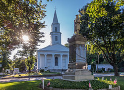
Temperance fountain in Uxbridge, Massachusetts.jpg 3,600 × 2,614; 4.41 MB
-
Uxbiridge, MA looking south on Route 122, October 26, 2012.jpg 3,264 × 2,448; 2.73 MB
-
Uxbridge Center, 1839.png 1,404 × 878; 1.29 MB
-
Uxbridge, Mass. 1880. LOC 75694607.jpg 8,960 × 7,136; 10.77 MB
-
Uxbridge, Mass. 1880. LOC 75694607.tif 8,960 × 7,136; 182.93 MB
-
West Hill 2005.JPG 3,072 × 2,048; 4.15 MB
-
Whd topo.jpg 816 × 1,056; 942 KB


