Category:Utkinton and Cotebrook
Jump to navigation
Jump to search
English: Utkinton and Cotebrook is a civil parish in the Cheshire West and Chester district, in the county of Cheshire, England.
civil parish in Cheshire West and Chester, Cheshire, England | |||||
| Upload media | |||||
| Instance of | |||||
|---|---|---|---|---|---|
| Location | Cheshire West and Chester, Cheshire, North West England, England | ||||
 | |||||
Subcategories
This category has the following 3 subcategories, out of 3 total.
Media in category "Utkinton and Cotebrook"
The following 42 files are in this category, out of 42 total.
-
 A49 at Lime Tree Farm - geograph.org.uk - 2900280.jpg 640 × 479; 82 KB
-
 A49 at Sadlers Lane - geograph.org.uk - 2777238.jpg 640 × 480; 58 KB
-
 A49 near Lime Tree Farm - geograph.org.uk - 2777214.jpg 640 × 480; 58 KB
-
 A49 near Luddington Hill - geograph.org.uk - 2777210.jpg 640 × 480; 65 KB
-
 A49 north of Tarporley Road - geograph.org.uk - 2777193.jpg 640 × 480; 63 KB
-
 A49 Tarporley Road - geograph.org.uk - 1827013.jpg 640 × 480; 51 KB
-
 A49 Tarporley Road, near Tarporley - geograph.org.uk - 5017405.jpg 640 × 427; 305 KB
-

-
 Eaton Lane - geograph.org.uk - 3996040.jpg 2,784 × 1,568; 2.09 MB
-
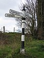 Fingerpost for Tarporley, Kelsall and Duddon - geograph.org.uk - 5685960.jpg 768 × 1,024; 443 KB
-
 Fishergreen Farm near Tarporley - geograph.org.uk - 2180488.jpg 640 × 451; 159 KB
-
 Footpath to Hollins House - geograph.org.uk - 5039565.jpg 4,000 × 3,000; 3.76 MB
-
 Forest Farm - geograph.org.uk - 6246629.jpg 5,475 × 3,260; 1.71 MB
-
 Fox Covert, Tarporley Road - geograph.org.uk - 3996052.jpg 2,784 × 1,568; 2.14 MB
-
 Heaths Lane-Quarry Bank junction - geograph.org.uk - 2808586.jpg 640 × 464; 91 KB
-
 High Billinge - geograph.org.uk - 3303536.jpg 1,600 × 1,200; 1.59 MB
-
 Hollins Hill - geograph.org.uk - 5039661.jpg 4,000 × 3,000; 4.34 MB
-
 Hollins Hill-Heaths Lane junction - geograph.org.uk - 2808540.jpg 640 × 480; 39 KB
-
 John Street-Smithy Lane junction - geograph.org.uk - 2808627.jpg 640 × 480; 100 KB
-
 Knights Lane - geograph.org.uk - 5037498.jpg 4,000 × 3,000; 4.47 MB
-

-
 Quarry Bank - geograph.org.uk - 5037487.jpg 4,000 × 3,000; 3.16 MB
-
 Quarry Bank near Rowley Farm - geograph.org.uk - 2808616.jpg 640 × 480; 119 KB
-

-
 Ridgehill Farm - geograph.org.uk - 5071362.jpg 5,068 × 3,241; 4.45 MB
-
 Ruined Building near High Billinge - geograph.org.uk - 5039578.jpg 4,000 × 3,000; 4.68 MB
-
 Sandstone Trail, Fishergreen - geograph.org.uk - 2180489.jpg 640 × 470; 157 KB
-
 Shetland Pony and Boat - geograph.org.uk - 4169574.jpg 4,000 × 3,000; 3.47 MB
-
 Tarporley Road (A49) - geograph.org.uk - 3996064.jpg 2,784 × 1,568; 2.07 MB
-
 Tarporley Road - geograph.org.uk - 6266092.jpg 4,000 × 3,000; 6.92 MB
-
 Tarporley Road junction with A49 - geograph.org.uk - 4440301.jpg 640 × 335; 50 KB
-
 Thatched cottage near Lime Tree Farm - geograph.org.uk - 4440307.jpg 640 × 329; 45 KB
-
 The A49 at Luddington Hill - geograph.org.uk - 3867608.jpg 3,931 × 2,186; 4.43 MB
-
 The Sandstone Trail at Ash Wood - geograph.org.uk - 5071338.jpg 5,184 × 3,456; 7.17 MB
-
 The Sandstone Trail at Fishersgreen Farm - geograph.org.uk - 5071380.jpg 5,000 × 3,333; 5.04 MB
-
 The Sandstone Trail at Fishersgreen Farm - geograph.org.uk - 5071398.jpg 5,000 × 3,333; 5.57 MB
-
 The Sandstone Trail at Ridgehill Farm - geograph.org.uk - 5071368.jpg 5,100 × 3,400; 6.33 MB
-
 The Sandstone Trail heading north - geograph.org.uk - 5071350.jpg 5,000 × 3,333; 5.78 MB
-
 The Sandstone Trail near Oxpasture Wood - geograph.org.uk - 5071402.jpg 5,000 × 3,333; 6.02 MB
-
 View towards High Billinge - geograph.org.uk - 5037461.jpg 5,410 × 2,690; 4.89 MB
-

-
 Wood Lane and a boundary stone - geograph.org.uk - 5686096.jpg 1,024 × 768; 567 KB


_-_geograph.org.uk_-_3996064.jpg)


