Category:Utility poles in Cambridgeshire
Jump to navigation
Jump to search
Subcategories
This category has only the following subcategory.
Media in category "Utility poles in Cambridgeshire"
The following 26 files are in this category, out of 26 total.
-
 Water tower and wheat field, Clay Lane - geograph.org.uk - 466980.jpg 640 × 480; 107 KB
-
 Former shop in Alconbury Weston - geograph.org.uk - 1420146.jpg 640 × 480; 66 KB
-
 Cottages, Mill Road, Buckden - geograph.org.uk - 466286.jpg 640 × 480; 84 KB
-
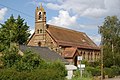
 St Mary and The Holy Host of Heaven - geograph.org.uk - 1429384.jpg 640 × 480; 73 KB
-

-
 Cheveley-church.jpg 2,272 × 1,704; 842 KB
-
 Crossing cottage - geograph.org.uk - 440025.jpg 640 × 426; 117 KB
-
 Feeder wagon ready to go - geograph.org.uk - 1214266.jpg 640 × 480; 67 KB
-
 Field beside footpath - geograph.org.uk - 1267584.jpg 517 × 640; 76 KB
-
 Post Street - geograph.org.uk - 605354.jpg 640 × 427; 68 KB
-

-
 Corner Cottage Great Gidding - geograph.org.uk - 1148839.jpg 640 × 480; 53 KB
-
 Mill Tower Great Gidding - geograph.org.uk - 1125223.jpg 640 × 480; 59 KB
-
 House on Gosmoor Lane - geograph.org.uk - 1266921.jpg 640 × 462; 76 KB
-
 The Anchor, Little Paxton - geograph.org.uk - 1255263.jpg 640 × 480; 73 KB
-
 Cottages in Molesworth - geograph.org.uk - 345554.jpg 640 × 480; 60 KB
-

-
 Former church, now a private dwelling - geograph.org.uk - 472991.jpg 640 × 426; 143 KB
-
 The former church of St Etheldreda - geograph.org.uk - 1617965.jpg 640 × 480; 112 KB
-
 St John The Baptist Church, Somersham - geograph.org.uk - 57713.jpg 640 × 480; 61 KB
-
 Farmhouse, Spaldwick - geograph.org.uk - 638952.jpg 640 × 480; 68 KB
-
 Trumpington, St Mary and St Michael - geograph.org.uk - 1654399.jpg 640 × 480; 91 KB
-
 Farm Close, Upwood - geograph.org.uk - 286857.jpg 640 × 480; 71 KB
-
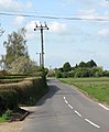 View west along Gosmoor Lane - geograph.org.uk - 1266919.jpg 530 × 640; 77 KB
-
 Cottages on corner of Church End - geograph.org.uk - 389739.jpg 640 × 480; 68 KB
-
 Parallel lines - geograph.org.uk - 465217.jpg 480 × 640; 110 KB


