Category:User:JarrahTree/aerial
Jump to navigation
Jump to search

Media in category "User:JarrahTree/aerial"
The following 42 files are in this category, out of 42 total.
-
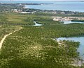 Above Ludmilla looking south.jpg 2,052 × 1,668; 921 KB
-
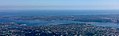 Aerial view of Melville Water on swan river.jpg 1,634 × 491; 212 KB
-
 Canning River and further metro area to the west from the air.jpg 1,072 × 1,310; 484 KB
-
 Canning River middle reaches from the air.jpg 1,686 × 877; 711 KB
-
 Canning Vale industrial area from the air.jpg 1,759 × 941; 550 KB
-
 Cherry Lake, Seaholme and Port Phillip Bay.jpg 4,928 × 3,264; 2.73 MB
-
 Darwin Dam, Tasmania from air.JPG 3,095 × 1,496; 1.33 MB
-
 Darwin from the air, above Berrimah.jpg 1,323 × 1,588; 628 KB
-
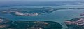 Darwin harbour from the air looking south west.jpg 1,725 × 583; 218 KB
-
 Denham from the air 2009.jpg 2,816 × 2,112; 1.47 MB
-
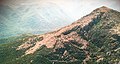
 Eldon Peak from air, from north.JPG 2,356 × 1,449; 1.23 MB
-
 Eldon Peak from south east.JPG 3,923 × 2,082; 2.81 MB
-
 Eldon Peak, from west.JPG 3,215 × 1,522; 1.43 MB
-
 Hamadan, Iran from the air.jpg 2,259 × 1,881; 735 KB
-
 Hazelmere from the air.JPG 2,816 × 2,112; 2.03 MB
-
 Huxley from air 75.JPG 2,421 × 1,897; 1.02 MB
-
 Island near Esperance.jpg 3,335 × 2,209; 872 KB
-
 Island off south coast of WA near Esperance.jpg 4,246 × 1,454; 935 KB
-
 Kazemi dam from the air.jpg 2,353 × 1,906; 631 KB
-
 Kimberley region feature from the air.jpg 1,936 × 1,225; 669 KB
-
 King river at macquarie harbour.jpg 892 × 586; 174 KB
-
 Lake Beatrice from the air 2000 from the east.jpg 6,992 × 4,512; 2.45 MB
-
 Luristan hills from the air.jpg 2,498 × 2,663; 1.12 MB
-
 Mount Huxley from air.jpg 4,652 × 3,031; 3.9 MB
-
 Mount Huxley from the air.jpg 1,667 × 1,320; 1.07 MB
-
 Mount Jukes and burbury.JPG 3,382 × 1,702; 1.82 MB
-
 Mount Jukes, Western Tasmania, from the air.jpg 4,469 × 2,878; 3.43 MB
-
 Mt McCall track from the air in the 1970s.jpg 4,176 × 2,720; 842 KB
-
 Northern end of Mount Darwin, Tasmania.jpg 4,553 × 3,003; 3.7 MB
-
 Northside of Jukes.jpg 2,006 × 1,929; 446 KB
-
 OceanBeachCarpark from the air.jpg 2,592 × 3,872; 3.3 MB
-
 OceanBeachwest from air.jpg 1,765 × 1,182; 383 KB
-
 Queenstown aerodrome from the air.jpg 3,872 × 2,592; 4.16 MB
-
 Rainstorm over Melville Water October 2019.jpg 3,462 × 1,110; 793 KB
-
 Southern end of Lake Argyle from the air.jpg 1,808 × 1,304; 569 KB
-
 Steep Point.JPG 2,816 × 2,112; 1.39 MB
-
 Strahan Airport landing strip from north.JPG 3,301 × 1,256; 817 KB
-
 Strahan Airport landing strip.JPG 2,340 × 3,255; 1.71 MB
-
 Tanami desert from air.jpg 3,502 × 2,123; 1.02 MB
-
 Urmia lake, Iran from the air.jpg 2,204 × 2,747; 780 KB
-
 West Coast Range - from above Tyndalls looking south.jpg 3,072 × 2,304; 853 KB
-
 Wheatbelt from the air.jpg 4,928 × 3,264; 2.51 MB


