Category:Usan, Angus
Jump to navigation
Jump to search
fishing station and settlement in Angus, Scotland, UK  | |||||
| Upload media | |||||
| Instance of | |||||
|---|---|---|---|---|---|
| Location | Angus, Scotland | ||||
| Located in or next to body of water | |||||
 | |||||
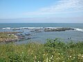
English: Usan is a fishing village and salmon station in Angus, Scotland, three miles south of the town of Montrose.

Subcategories
This category has only the following subcategory.
Media in category "Usan, Angus"
The following 56 files are in this category, out of 56 total.
-
 "The Spindle on the Rock" Usan - geograph.org.uk - 4611107.jpg 992 × 1,404; 356 KB
-
-

-
 A View of Mains of Usan Farm - geograph.org.uk - 1211257.jpg 640 × 426; 52 KB
-
 Archipelago of small islands near Rashick Knap - geograph.org.uk - 6256179.jpg 3,264 × 2,448; 1.4 MB
-

-
 Black cattle grazing by Rashick Knap - geograph.org.uk - 6260828.jpg 5,377 × 3,585; 3.53 MB
-
 Black Rock near Fishtown of Usan - geograph.org.uk - 6176146.jpg 3,264 × 2,448; 2.57 MB
-
 Brans Craig, Usan - geograph.org.uk - 6187484.jpg 5,472 × 3,648; 5.68 MB
-
 Broad Rock - geograph.org.uk - 531082.jpg 640 × 405; 244 KB
-
 Channel cut into Broad Rock, Usan - geograph.org.uk - 5302816.jpg 3,264 × 2,448; 2.35 MB
-
 Chapel Cottage - geograph.org.uk - 1125186.jpg 640 × 426; 73 KB
-

-
 Clifftop view across the harbour at Usan toward Broad Rock - geograph.org.uk - 6375822.jpg 5,127 × 3,418; 5.01 MB
-
 Clifftop view of a boat in the harbour at Fishtown of Usan - geograph.org.uk - 6372283.jpg 3,128 × 2,345; 3.69 MB
-
 Coast south of Usan - geograph.org.uk - 6605788.jpg 1,024 × 684; 318 KB
-
 Coastal, rough grazing by Fishtown of Usan - geograph.org.uk - 6265577.jpg 5,472 × 3,648; 4.28 MB
-
 Cow standing on grass by Rashick Knap - geograph.org.uk - 6261002.jpg 5,472 × 3,648; 2.4 MB
-
 East Coast Railway Near Ferryden - geograph.org.uk - 122028.jpg 475 × 640; 120 KB
-
 Eroded, north facing coast of Broad Rock, Usan - geograph.org.uk - 6193466.jpg 5,472 × 3,648; 7.04 MB
-
 Erosional features of the coast near Usan - geograph.org.uk - 6383935.jpg 5,203 × 3,468; 5.76 MB
-
 Fish shed at Fishtown of Usan - geograph.org.uk - 6368217.jpg 3,264 × 2,448; 2.37 MB
-
 Fishtown of Usan - geograph.org.uk - 24539.jpg 640 × 480; 89 KB
-
 Fishtown of Usan - geograph.org.uk - 531087.jpg 640 × 427; 228 KB
-
 Fishtown of Usan - geograph.org.uk - 531092.jpg 640 × 427; 193 KB
-
 Fishtown of Usan beach - geograph.org.uk - 6181028.jpg 5,472 × 3,648; 5.27 MB
-
 Fishtown of Usan beach and harbour - geograph.org.uk - 6367007.jpg 3,199 × 2,399; 4.35 MB
-
 Geese at Usan - geograph.org.uk - 3489181.jpg 1,194 × 796; 228 KB
-

-
 Map of Forfarshire Sheet 035, Ordnance Survey, 1865-1869.jpg 10,688 × 7,156; 5.78 MB
-
 Map of Forfarshire Sheet 035, Ordnance Survey, 1865-1869.tiff 10,688 × 7,156; 218.82 MB
-
 On to Usan - geograph.org.uk - 5818245.jpg 4,272 × 2,848; 2.61 MB
-
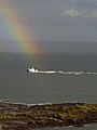 Paint the whole world with a RAINBOW^ - geograph.org.uk - 190475.jpg 480 × 640; 45 KB
-
 Pebble Rock, Usan - geograph.org.uk - 6179932.jpg 3,264 × 2,448; 2.59 MB
-
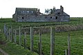
 Remains of the hermit's cottage and the nearby Pebble Rock - geograph.org.uk - 6382610.jpg 4,943 × 3,296; 4.65 MB
-
 Rock composed of two lava flows - geograph.org.uk - 6256520.jpg 5,472 × 3,648; 6.62 MB
-
 Rock pools on the wave-cut platform by Rashick Knap - geograph.org.uk - 6257213.jpg 5,472 × 3,648; 3.36 MB
-

-
 Rock, near Broad Rock, that is a peninsula at low tide - geograph.org.uk - 6395383.jpg 5,472 × 3,648; 7.2 MB
-
 Sea stack near Fishtown of Usan - geograph.org.uk - 6415298.jpg 5,472 × 3,648; 5.8 MB
-
 Seaward entrance to the 'cut' at Broad Rock, Usan - geograph.org.uk - 6181590.jpg 5,472 × 3,648; 7.02 MB
-
 Shoreline leading to Usan near Montrose - geograph.org.uk - 5231645.jpg 5,184 × 2,920; 4.69 MB
-
 Small blowhole within the larger blowhole at Usan - geograph.org.uk - 5266831.jpg 2,000 × 1,333; 3.07 MB
-
 Small-scale chain of islands by Rashick Knap - geograph.org.uk - 6255461.jpg 5,472 × 3,648; 5.1 MB
-
 SSW view of the 'flatties' on Broad Rock - geograph.org.uk - 6186056.jpg 5,472 × 3,648; 7.15 MB
-
 Surf marking the seaward edge of Broad Rock, Usan - geograph.org.uk - 6367052.jpg 3,264 × 2,448; 1.38 MB
-
 The 'cut' at Fishtown of Usan - geograph.org.uk - 6181595.jpg 5,472 × 3,648; 5.15 MB
-
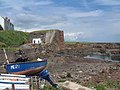
 The Harbour, Fishtown of Usan. - geograph.org.uk - 117128.jpg 640 × 435; 127 KB
-
 The Spindle on the Rock formation by Usan - geograph.org.uk - 6413355.jpg 5,472 × 3,648; 5.81 MB
-
 Unnamed islet lying off the northeastern side of Broad Rock, - geograph.org.uk - 6186905.jpg 5,472 × 3,648; 6.74 MB
-
 Usan Harbour - geograph.org.uk - 6605801.jpg 1,024 × 578; 233 KB
-
 View from Broad Rock to Long Craig and Brans Craig - geograph.org.uk - 6186959.jpg 5,472 × 3,648; 5.72 MB
-
 View towards Long Craig, Fishtown of Usan - geograph.org.uk - 5288181.jpg 3,264 × 2,448; 2.94 MB
-
 Wave -cut platform between Brans Craig and Long Craig - geograph.org.uk - 6189003.jpg 5,472 × 3,648; 5.65 MB
-
 Wave-cut platform at Usan - geograph.org.uk - 6416894.jpg 5,434 × 3,622; 3.36 MB
-


