Category:Urswick
Jump to navigation
Jump to search
civil parish in Cumbria, UK  | |||||
| Upload media | |||||
| Instance of | |||||
|---|---|---|---|---|---|
| Location | South Lakeland, Cumbria, North West England, England | ||||
| Population |
| ||||
 | |||||
Subcategories
This category has the following 4 subcategories, out of 4 total.
Media in category "Urswick"
The following 200 files are in this category, out of 213 total.
(previous page) (next page)-
 A narrow road through Great Urswick - geograph.org.uk - 1941056.jpg 2,560 × 1,456; 2.51 MB
-
 A narrow road through Great Urswick - geograph.org.uk - 1941640.jpg 2,560 × 1,780; 3.5 MB
-
 A narrow road through Great Urswick - geograph.org.uk - 1942085.jpg 2,528 × 1,876; 3.34 MB
-
 A5087 Priory Road - geograph.org.uk - 5685651.jpg 640 × 481; 109 KB
-
 A5087, Coast Road, at Bardsea - geograph.org.uk - 6585913.jpg 1,024 × 682; 497 KB
-
 Above the beach - geograph.org.uk - 6537403.jpg 1,024 × 683; 495 KB
-
 Appleby Hill - geograph.org.uk - 6545840.jpg 1,024 × 683; 510 KB
-
 Bardsea - geograph.org.uk - 6545865.jpg 1,024 × 683; 441 KB
-
 Bardsea from Birkrigg Common - geograph.org.uk - 5659766.jpg 5,067 × 2,850; 6.53 MB
-
 Bardsea from Ulverston Sands - geograph.org.uk - 5659765.jpg 5,067 × 2,850; 5.66 MB
-
 Bardsea Monument - geograph.org.uk - 4634124.jpg 640 × 480; 63 KB
-
 Bardsea Village View - geograph.org.uk - 5694620.jpg 640 × 397; 73 KB
-
 Beach Wood, Conishead Priory - geograph.org.uk - 5114995.jpg 640 × 512; 234 KB
-
 Beach Wood, Conishead Priory - geograph.org.uk - 5114998.jpg 640 × 425; 164 KB
-
 Bend on White Gill Lane - geograph.org.uk - 6545859.jpg 1,024 × 683; 485 KB
-
 Birkrigg Common - geograph.org.uk - 4518111.jpg 640 × 480; 74 KB
-
 Birkrigg Common - geograph.org.uk - 4602227.jpg 2,339 × 1,668; 2.96 MB
-
 Birkrigg Stone Circle - geograph.org.uk - 5770861.jpg 640 × 480; 258 KB
-
 Birkrigg Stone Circle - geograph.org.uk - 5770863.jpg 640 × 480; 242 KB
-
 Bracken beside the road - geograph.org.uk - 6545824.jpg 1,024 × 683; 576 KB
-
 Bracken beside White Gill Lane - geograph.org.uk - 6545851.jpg 1,024 × 683; 557 KB
-
 Bracken on the common - geograph.org.uk - 6545825.jpg 1,024 × 683; 548 KB
-

-
 Burial chamber, Tosthills near Great Urswick (geograph 2488857).jpg 640 × 480; 138 KB
-
 Bus Shelter in Little Urswick - geograph.org.uk - 3174058.jpg 1,575 × 1,125; 1.53 MB
-
 Cars parked on Birkrigg Common - geograph.org.uk - 6545845.jpg 1,024 × 683; 419 KB
-
 Cattle Grid on White Gill Lane - geograph.org.uk - 6545855.jpg 1,024 × 683; 464 KB
-
 Cattle near Birkrigg Common - geograph.org.uk - 6545857.jpg 1,024 × 683; 461 KB
-
 Channel in the sand - geograph.org.uk - 3983949.jpg 1,520 × 1,008; 1.05 MB
-
 Channel in the sand - geograph.org.uk - 3998040.jpg 1,508 × 988; 1.18 MB
-
 Channel meandering through the sand - geograph.org.uk - 3992338.jpg 1,476 × 980; 906 KB
-
 Channel running through the sand - geograph.org.uk - 3952548.jpg 1,520 × 1,004; 1,007 KB
-
 Chill and Grill Ice Cream - geograph.org.uk - 6537407.jpg 1,024 × 683; 448 KB
-
 Coastal Path - geograph.org.uk - 5694633.jpg 640 × 464; 151 KB
-

-
 Country Lane - geograph.org.uk - 1940664.jpg 2,560 × 1,456; 2.72 MB
-
 Country lane - geograph.org.uk - 3167867.jpg 1,530 × 1,018; 1.17 MB
-

-
 Dalton-in-Furness from the air - geograph.org.uk - 4604062.jpg 640 × 480; 128 KB
-

-
 DOCK MUSEUM.jpg 1,842 × 1,291; 865 KB
-
 Down White Gill Lane - geograph.org.uk - 6545861.jpg 1,024 × 683; 521 KB
-
 Drift Lumber in the sand - geograph.org.uk - 3980213.jpg 1,524 × 1,012; 1.05 MB
-
 Electricity pylon - geograph.org.uk - 3769091.jpg 1,528 × 1,204; 1.15 MB
-
 Farmland above Bardsea - geograph.org.uk - 6545863.jpg 1,024 × 683; 470 KB
-

-
 Farmland, Birkrigg - geograph.org.uk - 5916697.jpg 1,280 × 720; 347 KB
-
 Fields near Birkrigg Common - geograph.org.uk - 6545856.jpg 1,024 × 683; 465 KB
-
 Finger Post on Birkrigg Common - geograph.org.uk - 3182838.jpg 1,483 × 942; 1.1 MB
-
 Flush bracket S5374 - geograph.org.uk - 5916702.jpg 1,280 × 1,280; 426 KB
-
 Footpath on Skeldon Moor - geograph.org.uk - 2488791.jpg 640 × 480; 109 KB
-
 Footpath to Little Urswick - geograph.org.uk - 2488846.jpg 640 × 480; 124 KB
-
 Grass footpath on Birkrigg Common - geograph.org.uk - 5961990.jpg 4,000 × 3,000; 3.02 MB
-
 Gully in the sand - geograph.org.uk - 3977635.jpg 1,612 × 1,044; 1.3 MB
-

-
 Holy Trinity, Bardsea, churchyard (2) - geograph.org.uk - 4490559.jpg 640 × 480; 131 KB
-

-
 Holy Trinity, Bardsea, mid-February 2015 - geograph.org.uk - 4353134.jpg 640 × 480; 114 KB
-
 Houses beside A5087 - geograph.org.uk - 6541286.jpg 1,024 × 683; 452 KB
-
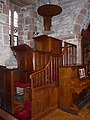
 Inside Holy Trinity, Bardsea (1) - geograph.org.uk - 4490569.jpg 640 × 480; 65 KB
-
 Inside Holy Trinity, Bardsea (2) - geograph.org.uk - 4490573.jpg 640 × 480; 67 KB
-
 Inside Holy Trinity, Bardsea (3) - geograph.org.uk - 4490577.jpg 640 × 480; 65 KB
-
 Inside Holy Trinity, Bardsea (4) - geograph.org.uk - 4490582.jpg 640 × 480; 74 KB
-
 Inside Holy Trinity, Bardsea (5) - geograph.org.uk - 4490588.jpg 640 × 480; 55 KB
-
 Inside Holy Trinity, Bardsea (6) - geograph.org.uk - 4490591.jpg 640 × 480; 87 KB
-

-

-
-

-

-

-
 Kissing gate - geograph.org.uk - 3163660.jpg 1,950 × 1,300; 1.72 MB
-
 Lane entering Bardsea from the west - geograph.org.uk - 6496015.jpg 1,799 × 1,199; 429 KB
-
 Layby on A5087 - geograph.org.uk - 6541282.jpg 1,024 × 683; 506 KB
-
 Leaving Bardsea - geograph.org.uk - 5694591.jpg 640 × 477; 96 KB
-
 Limekiln - geograph.org.uk - 896253.jpg 640 × 426; 127 KB
-
 Limestone boulders, Little Urswick - geograph.org.uk - 2488804.jpg 640 × 480; 153 KB
-
 Limestone cliffs - geograph.org.uk - 6545849.jpg 1,024 × 683; 518 KB
-
 Limestone outcrops below the fort - geograph.org.uk - 2487228.jpg 1,024 × 686; 193 KB
-
 Limestone outcrops, Birkrigg Common - geograph.org.uk - 2487247.jpg 800 × 600; 211 KB
-
 Limestone outcrops, Great Urswick - geograph.org.uk - 2488866.jpg 640 × 480; 150 KB
-

-
 Limestone Pavement, Birkrigg Common - geograph.org.uk - 5916704.jpg 1,280 × 850; 730 KB
-
 Little Urswick Crags (93m) - geograph.org.uk - 2488827.jpg 640 × 480; 130 KB
-
 Little Urswick Crags (93m) - geograph.org.uk - 2488832.jpg 640 × 480; 81 KB
-

-
 Looking out over Ulverston Sands - geograph.org.uk - 6537402.jpg 1,024 × 546; 427 KB
-
 Main Street through Bardsea - geograph.org.uk - 5962003.jpg 4,000 × 3,000; 3.23 MB
-
 Meadow below the village of Bardsea - geograph.org.uk - 3997282.jpg 1,512 × 988; 1.42 MB
-
 Meadow, northeast of Woodside Farm - geograph.org.uk - 1941505.jpg 2,560 × 1,456; 2.8 MB
-
 Minor road and dwellings at Wellhouse Farm - geograph.org.uk - 5962001.jpg 3,892 × 2,919; 2.62 MB
-
 Minor road descending towards Sunbrick - geograph.org.uk - 5961995.jpg 4,000 × 3,000; 3.59 MB
-

-
 Minor road to Urswick and Lindal - geograph.org.uk - 5962005.jpg 4,000 × 3,000; 3.16 MB
-
 North from the fort above Great Urswick - geograph.org.uk - 2487221.jpg 800 × 600; 178 KB
-
 North west from Birkrigg Common - geograph.org.uk - 2487370.jpg 800 × 600; 199 KB
-
 Old Boundary Marker - geograph.org.uk - 6444834.jpg 480 × 640; 262 KB
-
 Old Boundary Marker - geograph.org.uk - 6444837.jpg 480 × 640; 249 KB
-

-

-

-
 Old Wayside Cross - geograph.org.uk - 6493777.jpg 480 × 640; 219 KB
-
 On The Shoreline Path At Bardsea - geograph.org.uk - 5694614.jpg 640 × 399; 85 KB
-
 Ordnance Survey Cut Mark - geograph.org.uk - 5967740.jpg 4,000 × 3,000; 3.94 MB
-
 Ordnance Survey Cut Mark - geograph.org.uk - 6293411.jpg 1,024 × 835; 318 KB
-
 Ordnance Survey Cut Mark - geograph.org.uk - 6293412.jpg 1,024 × 863; 128 KB
-
 Parked cars in Sea Wood - geograph.org.uk - 6541288.jpg 1,024 × 683; 713 KB
-
 Ploughed Field - geograph.org.uk - 3175774.jpg 1,530 × 1,018; 1.47 MB
-
 Reed Gardens - geograph.org.uk - 864310.jpg 640 × 480; 156 KB
-
 Remains of the Track - geograph.org.uk - 5694625.jpg 640 × 465; 123 KB
-
 Road from Scales - geograph.org.uk - 6545839.jpg 1,024 × 683; 466 KB
-
 Road Sign - geograph.org.uk - 3179849.jpg 1,520 × 1,005; 1.23 MB
-
 Road to Gleaston from Dendron - geograph.org.uk - 6545790.jpg 1,024 × 683; 504 KB
-
 Road to Scales - geograph.org.uk - 6545827.jpg 1,024 × 683; 484 KB
-
 Roadside barn - geograph.org.uk - 864311.jpg 640 × 480; 232 KB
-
 Roadside Sign - geograph.org.uk - 3178153.jpg 1,530 × 1,018; 1.38 MB
-
 Rocky outcrop on Birkrigg Common - geograph.org.uk - 5770868.jpg 640 × 480; 269 KB
-
 Royal Mail Post Box in Little Urswick - geograph.org.uk - 3172010.jpg 1,536 × 1,035; 1.56 MB
-
 Sand flat in the intertidal zone - geograph.org.uk - 3992590.jpg 1,472 × 972; 1.03 MB
-
 Settlement, Birkrigg Common - geograph.org.uk - 5916705.jpg 1,280 × 720; 448 KB
-
 Sheep and cars, Birkrigg Common - geograph.org.uk - 2487234.jpg 800 × 518; 110 KB
-
 Sheep beside White Gill Lane - geograph.org.uk - 6545850.jpg 1,024 × 683; 462 KB
-
 Sheep pasture above Wellhouse Wood - geograph.org.uk - 2487378.jpg 640 × 480; 104 KB
-
 Shoreline Path Near Bardsea - geograph.org.uk - 5694584.jpg 640 × 414; 107 KB
-
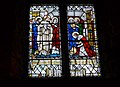
 St Mary and St Michael's Church - geograph.org.uk - 4602221.jpg 2,560 × 1,642; 2.87 MB
-

-

-

-

-

-

-

-

-

-

-

-

-

-

-

-

-

-

-

-

-

-

-

-

-

-

-

-

-

-

-

-

-

-

-

-

-

-

-

-

-

-

-
-

-

-

-

-

-

-
 Stainton Lane - geograph.org.uk - 3445840.jpg 640 × 480; 127 KB
-
 Stone Circle on Birkrigg Common - geograph.org.uk - 1922771.jpg 2,528 × 1,438; 2.81 MB
-
 Stone Circle on Birkrigg Common - geograph.org.uk - 1922799.jpg 2,560 × 1,456; 2.55 MB
-
 Stone Circle on Birkrigg Common - geograph.org.uk - 1922821.jpg 2,540 × 1,446; 2.53 MB
-
 Stone Circle on Birkrigg Common - geograph.org.uk - 1922837.jpg 2,520 × 1,434; 2.68 MB
-
 Stone circle or enclosure on Birkrigg Common - geograph.org.uk - 5989906.jpg 1,600 × 899; 388 KB
-
 Stone circle, Birkrigg Common - geograph.org.uk - 5916710.jpg 1,280 × 850; 945 KB
-
 Stone Pier and Revetment - geograph.org.uk - 3695015.jpg 1,520 × 1,000; 1.22 MB
-
 Stone revetment - geograph.org.uk - 3949030.jpg 1,516 × 996; 1.56 MB
-
 Tarn (unnamed) near Lindal in Furness - geograph.org.uk - 3166230.jpg 1,530 × 1,018; 1,013 KB
-
 The Derby Arms Public House - geograph.org.uk - 1939961.jpg 2,560 × 1,456; 2.48 MB
-

-
 The Furness Peninsula from the air - geograph.org.uk - 4604068.jpg 640 × 434; 111 KB
-
 The Priapus Stone - geograph.org.uk - 3172932.jpg 1,530 × 1,018; 1.45 MB
-
 The Ship Inn - geograph.org.uk - 5694610.jpg 640 × 464; 87 KB
-
 The slopes of Little Urswick Crags - geograph.org.uk - 2488817.jpg 640 × 480; 106 KB
-
 Towards Birkrigg - geograph.org.uk - 6545844.jpg 1,024 × 683; 473 KB
-
 Track End - geograph.org.uk - 5694627.jpg 640 × 424; 127 KB
-
 Track off Stainton Lane - geograph.org.uk - 3445839.jpg 640 × 480; 164 KB
-
 Triangulation Pillar on the summit of Birkrigg Common - geograph.org.uk - 1928138.jpg 2,560 × 1,456; 2.68 MB
-
 Triangulation Pillar on the summit of Birkrigg Common - geograph.org.uk - 1928149.jpg 2,560 × 1,456; 2.66 MB
-
 Triangulation Pillar on the summit of Birkrigg Common - geograph.org.uk - 1928164.jpg 2,560 × 1,456; 2.57 MB
-
 Trig Point, Birkrigg Common - geograph.org.uk - 5916700.jpg 1,280 × 850; 466 KB
-
 Tumulus near Woodside Farm - geograph.org.uk - 2487213.jpg 960 × 674; 189 KB
-
 Two Parks at Bardsea - geograph.org.uk - 5694589.jpg 640 × 423; 127 KB
-
 Ulverston Sands - geograph.org.uk - 6585907.jpg 1,024 × 768; 446 KB


.jpg)


_-_geograph.org.uk_-_4490552.jpg)
_-_geograph.org.uk_-_4490559.jpg)
_-_geograph.org.uk_-_4490563.jpg)


_-_geograph.org.uk_-_4490569.jpg)
_-_geograph.org.uk_-_4490573.jpg)
_-_geograph.org.uk_-_4490577.jpg)
_-_geograph.org.uk_-_4490582.jpg)
_-_geograph.org.uk_-_4490588.jpg)
_-_geograph.org.uk_-_4490591.jpg)
_-_geograph.org.uk_-_4469368.jpg)
_-_geograph.org.uk_-_4469370.jpg)
_-_geograph.org.uk_-_4469373.jpg)
_-_geograph.org.uk_-_4469380.jpg)
_-_geograph.org.uk_-_4469375.jpg)
_-_geograph.org.uk_-_4469378.jpg)


_-_geograph.org.uk_-_2488827.jpg)
_-_geograph.org.uk_-_2488832.jpg)


_-_geograph.org.uk_-_5961998.jpg)


_-_geograph.org.uk_-_4469387.jpg)
_-_geograph.org.uk_-_4469390.jpg)
_-_geograph.org.uk_-_4469392.jpg)
_-_geograph.org.uk_-_4469344.jpg)
_-_geograph.org.uk_-_4469346.jpg)
_-_geograph.org.uk_-_4469348.jpg)
_-_geograph.org.uk_-_4469351.jpg)
_-_geograph.org.uk_-_4469362.jpg)
_-_geograph.org.uk_-_4469352.jpg)
_-_geograph.org.uk_-_4469353.jpg)
_-_geograph.org.uk_-_4469357.jpg)
_-_geograph.org.uk_-_4469360.jpg)
_-_geograph.org.uk_-_4469367.jpg)
_-_geograph.org.uk_-_4469311.jpg)
_-_geograph.org.uk_-_4469312.jpg)
_-_geograph.org.uk_-_4469316.jpg)
_-_geograph.org.uk_-_4469321.jpg)
_-_geograph.org.uk_-_4469322.jpg)
_-_geograph.org.uk_-_4469325.jpg)
_-_geograph.org.uk_-_4469329.jpg)
_-_geograph.org.uk_-_4469330.jpg)
_-_geograph.org.uk_-_4469336.jpg)
_-_geograph.org.uk_-_4469383.jpg)


_-_geograph.org.uk_-_4469408.jpg)
_-_geograph.org.uk_-_4469410.jpg)
_-_geograph.org.uk_-_4469412.jpg)
_-_geograph.org.uk_-_4469414.jpg)
_-_geograph.org.uk_-_4469415.jpg)
_-_geograph.org.uk_-_4469416.jpg)
_-_geograph.org.uk_-_4469417.jpg)
_-_geograph.org.uk_-_4469422.jpg)
_-_geograph.org.uk_-_4469426.jpg)
_-_geograph.org.uk_-_4469420.jpg)


_-_geograph.org.uk_-_4469398.jpg)
_-_geograph.org.uk_-_4469399.jpg)
_-_geograph.org.uk_-_4469401.jpg)
_-_geograph.org.uk_-_4469402.jpg)
_-_geograph.org.uk_-_4469403.jpg)
_-_geograph.org.uk_-_4469407.jpg)


_near_Lindal_in_Furness_-_geograph.org.uk_-_3166230.jpg)


