Category:Urbanisation maps of Lorient
Jump to navigation
Jump to search
Media in category "Urbanisation maps of Lorient"
The following 8 files are in this category, out of 8 total.
-
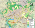
 56121-Lorient-Sols.png 3,270 × 2,598; 6.46 MB
-
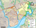
 56-Intercos2019-200042174.png 3,519 × 2,480; 3.46 MB
-
 56036-Caudan-Sols.png 3,270 × 2,598; 4.88 MB
-
 56083-Hennebont-Sols.png 3,270 × 2,598; 4.17 MB
-
 56098-Lanester-Sols.png 3,270 × 2,598; 5.06 MB
-
 56107-Larmor-Plage-Sols.png 3,270 × 2,598; 3.67 MB
-
 56162-Plœmeur-Sols.png 3,270 × 2,598; 3.85 MB
-
 56185-Quéven-Sols.png 3,270 × 2,598; 3.59 MB


