Category:Urban landscapes in the Archives municipales (Lyon)
Jump to navigation
Jump to search
Subcategories
This category has only the following subcategory.
H
Media in category "Urban landscapes in the Archives municipales (Lyon)"
The following 124 files are in this category, out of 124 total.
-
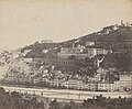
 177 Lyon — Panorama pris de l'ascenseur de la tour de Fourvière — LL.tif 1,629 × 1,034; 4.83 MB
-

-
 323 Lyon — Panorama pris de la Croix-Rousse.tif 1,601 × 1,074; 4.93 MB
-
 400 Lyon — Panorama de la ville — La place Bellecour — LL.tif 1,607 × 1,032; 4.75 MB
-
 52 Lyon — Place des Terreaux, panorama pris de l'Hôtel de Ville.tif 1,663 × 1,086; 5.18 MB
-
 Berges de la Saône aux Étroits.jpg 1,988 × 1,347; 806 KB
-
 Château de Pierre Scize, reproduction.jpg 4,657 × 3,254; 2.3 MB
-
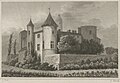
 Château de Pierre-Scize.jpg 2,911 × 1,939; 1.31 MB
-
 Colline de Fourvière vue du quai Saint-Antoine.jpg 11,324 × 5,428; 9.98 MB
-
 Couvent des Lazaristes à Lyon.jpg 3,588 × 2,466; 912 KB
-
 Démolition de l'ancien quartier Grolée en 1890.jpg 4,778 × 4,978; 5.98 MB
-
 Désastre arrivé au pont Morand le 22 octobre 1825.jpg 2,894 × 1,919; 980 KB
-
 Eboulement de la colline de Fourvière, à Lyon, le 13 novembre 1930 01.jpg 1,934 × 1,413; 446 KB
-
 Exposition de Lyon, 1894.jpg 2,275 × 1,085; 339 KB
-
 Exposition universelle de Lyon 1894.jpg 4,344 × 2,888; 1.99 MB
-
 Inondation du Rhône à Lyon - 1856-06-02 - vue quai de Retz.jpg 8,519 × 6,320; 3.24 MB
-
 Inondations 1856 Lyon.jpg 8,396 × 6,288; 5.49 MB
-
 Jardin zoologique Bidel au parc de la Tête-d'Or.tif 1,799 × 1,135; 5.85 MB
-
 Jolimont - Le pont Tilsitt sur la Saône.jpg 1,582 × 966; 356 KB
-
 Joseph Fructus - Vue de la Duchère.jpg 2,037 × 1,470; 402 KB
-

-
 Joseph Fructus - Vue du pont de la Mulatière, 1820.jpg 1,583 × 1,393; 432 KB
-
 L'ancien couvent des Carmes Déchaussés depuis la Saône.jpg 2,500 × 2,015; 794 KB
-
 La Cité de Lyon (détail).jpg 4,779 × 3,341; 2.49 MB
-
 La fête vénitienne sur la Saône coteaux de Fourvière et de la Croix-Rousse.jpg 3,095 × 2,223; 2.73 MB
-
 Les industries lyonnaises La belle jardinière rue du Bât-d'Argent.jpg 5,474 × 6,756; 7.57 MB
-
 Lugdunum Hoefnagel.jpg 6,092 × 4,608; 6.13 MB
-
 Lugdunum Lyon par Israël Silvestre.jpg 7,283 × 2,834; 2.85 MB
-
 Lugdunum vulgo Lyon (Archives Lyon).jpg 3,815 × 1,619; 1.32 MB
-
 Lyon - Estampe du Pont de Pierre (Pont du Change avant 1842).jpg 4,896 × 3,363; 2.07 MB
-
 Lyon - Inondations 1856 Saône Pont du Change.jpg 7,672 × 5,660; 8.7 MB
-
 Lyon - Inondations 1856 Saône Quai Saint-Antoine (1).jpg 8,287 × 6,182; 4.59 MB
-
 Lyon - Inondations 1856 Saône Quai Saint-Antoine (2).jpg 8,304 × 6,154; 4.32 MB
-
 Lyon - Inondations 1856 Saône Quai Saint-Antoine (3).jpg 8,303 × 6,198; 5.21 MB
-
 Lyon - Inondations 1856, bâtiments détruits vers chemin du Sacré-Coeur.jpg 8,450 × 6,265; 5.28 MB
-
 Lyon - Inondations 1856, bâtiments endommagés, quartier Molière-Part-Dieu.jpg 8,431 × 6,329; 6.02 MB
-
 Lyon - Inondations 1856, dégâts quartier Lafayette-Part-Dieu.jpg 8,315 × 6,206; 5.69 MB
-
 Lyon - Inondations Saône place de la Préfecture - 1856-05-19.jpg 8,380 × 6,218; 5 MB
-
 Lyon - Vue de Vaise près du pont du port Mouton - 1854-09.jpg 3,742 × 2,728; 1.43 MB
-
 Lyon - Vue de Vaise près du pont du Port Mouton - 1855-05.jpg 3,715 × 2,731; 1.32 MB
-
 Lyon - Vue du quai de Vaise - 1855-05.jpg 3,540 × 2,547; 1.23 MB
-
 Lyon - Vue du quai de Vaise et de la gare du chemin de fer de Paris - 1855-05 (1).jpg 3,741 × 2,073; 829 KB
-
 Lyon - Vue du quai de Vaise et de la gare du chemin de fer de Paris - 1855-05 (2).jpg 3,718 × 2,283; 877 KB
-
 Lyon - Vue futur Parc de la Tête d'Or avant travaux - 1855.jpg 11,068 × 8,359; 8.85 MB
-
 Lyon - Vue Saône, commanderie et quartier Saint-Georges - vers 1855.jpg 4,067 × 2,447; 1.12 MB
-
 Lyon 3e quartier de la Part Dieu vers 1850.tif 1,536 × 1,024; 1.5 MB
-
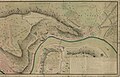
 Lyon, jonction du Rhône et de la Saône.jpg 2,102 × 1,722; 480 KB
-
 Lyon-depuis-le-Pont-de-Pierre.jpg 2,236 × 1,509; 973 KB
-
 Lyon-Eglise St-Jean.jpg 1,030 × 819; 389 KB
-
 Panorama de Lyon pris depuis la colline de la Croix-Rousse 1.jpg 2,925 × 2,216; 997 KB
-
 Panorama de Lyon pris depuis la colline de la Croix-Rousse 2.jpg 2,786 × 2,296; 975 KB
-
 Place et rue de la République avec le magasin Aux deux Passages.jpg 704 × 534; 110 KB
-
 Plan de distribution de la presqu'île Perrache 1828.jpg 2,456 × 1,208; 589 KB
-
 Plan de la Ville de Lyon et ses environs en 1830.jpg 10,683 × 6,862; 16.02 MB
-
 Plan de Vaise avec les quartiers de Pierre Scize, de Serin et de Fourvière en 1789.jpg 11,326 × 7,288; 14.06 MB
-
 Plan général de la Ville de Lyon, levé et gravé par Claude Séraucourt.jpg 11,589 × 9,232; 30.06 MB
-

-
 Plan géométral de la partie méridionale de la Ville de Lyon levé en 1791.jpg 2,492 × 872; 360 KB
-
 Plan géométral de la Ville de Lyon par Jacquemin en 1747.jpg 6,943 × 5,365; 7.54 MB
-

-
 Plan topographique de la Ville de Lyon et ses environs de Rembielinski et Dignoscyo en 1847.jpg 12,414 × 8,615; 17.32 MB
-
 Plan topographique historique de la Ville de Lyon en 1350 par Benoît Vermorel feuille 11.jpg 5,948 × 4,341; 3.95 MB
-

-
 Projet de M. Perrache, pour la partie méridionale de la Ville de Lyon 1760.jpg 2,392 × 1,608; 837 KB
-
 Prosp. du palais et du port roÿal de Lion.jpg 2,619 × 1,999; 883 KB
-
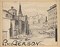 Quartier Saint-Paul place Gerson.jpg 7,343 × 5,843; 8.94 MB
-
 Quartier Saint-Polycarpe rue Vieille-Monnaie et place Croix-Paquet.jpg 6,323 × 5,323; 8.31 MB
-
 Scène de genre.jpg 4,784 × 3,304; 1.94 MB
-

-
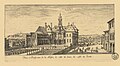 Veuë et perspective de la Maison de ville de Lion, du costé du jardin.jpg 2,188 × 1,200; 495 KB
-
 Vue aérienne de Lyon 2.jpg 2,692 × 1,963; 948 KB
-
 Vue aérienne de Lyon 3.jpg 2,636 × 1,979; 1,012 KB
-
 Vue d'une entrée de Lyon prise au-dessus du plan de Vaise 01.jpg 2,717 × 2,040; 778 KB
-
 Vue d'une partie de l'Ile-Barbe à Lyon.jpg 2,500 × 1,967; 662 KB
-

-

-

-
 Vue de l'église archiepiscopale, de St Jean à Lyon.jpg 3,005 × 2,302; 2.8 MB
-
 Vue de l'Île-Barbe prise du Vernay.jpg 2,856 × 1,984; 682 KB
-
 Vue de la place de Bellecourt à Lyon.jpg 2,988 × 2,280; 1.38 MB
-
 Vue de la place de Consort, dite la place des Dominiquains.jpg 3,036 × 2,271; 1.48 MB
-
 Vue de la Quarantaine.jpg 3,501 × 1,962; 1.33 MB
-
 Vue de la rue de la République depuis la place de la République.jpg 1,496 × 1,068; 427 KB
-
 Vue de la ville de Lyon et du chateau de Pierre-Encize, près du bureau des Coches.jpg 4,750 × 3,267; 3.29 MB
-
 Vue de Lyon depuis la colline de Croix-Rousse.jpg 6,736 × 4,637; 4.56 MB
-
 Vue des restes d'un aqueduc bati par les Romains, à la porte de St Just à Lyon.jpg 2,983 × 2,290; 2.89 MB
-
 Vue du château de la Duchère.jpg 2,717 × 2,013; 769 KB
-
 Vue du fort St Jean sur Saone, à l'entrée de Lyon.jpg 2,994 × 2,295; 1.45 MB
-
 Vue du pont de la Guillotière, et du nouvel hopital de Lyon.jpg 6,165 × 4,112; 3.69 MB
-
 Vue du pont de la Guillotière.jpg 2,799 × 2,063; 677 KB
-
 Vue du pont de la Mulatière.jpg 2,770 × 2,080; 806 KB
-
 Vue du pont Morand sur le Rhône à Lyon - HD.jpg 6,640 × 3,890; 4.24 MB
-
 Vue du pont St Clair et de la montagne de la Croix Rousse, prise dans le Breteau.jpg 2,988 × 2,238; 1.39 MB
-
 Vue du pont volant et du pont de pierre.jpg 2,721 × 2,047; 831 KB
-
 Vue du Rhône à Lyon.jpg 2,558 × 1,937; 951 KB
-
 Vue panoramique de Lyon et de ses environs 5.jpg 4,982 × 3,220; 3.86 MB
-
 Vue panoramique de Lyon et de ses environs 6.jpg 4,974 × 3,231; 3.96 MB
-
 Vue panoramique de Lyon et de ses environs 7.jpg 4,970 × 3,214; 4.54 MB
-

-
-
 Vue perspective de l'entrepôt général des liquides de la ville de Lyon.jpg 6,627 × 4,207; 2.77 MB
-
 Vue perspective de l'exposition internationale urbaine de Lyon de 1914.jpg 3,218 × 2,085; 1.64 MB
-
 Vue perspective de la place Bellecour.jpg 3,271 × 1,886; 904 KB
-
 Vue perspective de la ville de Lyon.jpg 3,250 × 2,327; 1.51 MB
-
 Vue perspective du quartier Saint-Clair et du pont en bois sur le Rhône (cropped).jpg 7,523 × 3,838; 6.33 MB
-
 Vue perspective du quartier Saint-Clair et du pont en bois sur le Rhône.jpg 8,169 × 4,046; 7.39 MB
-
 Vue prise de la Claire.jpg 3,496 × 1,915; 1.31 MB
-
 Vue-du-Rhône-depuis-le-quai-Saint-Clair.jpg 1,469 × 1,151; 631 KB
-
 Vues de Lyon - Planche 22 - Pont de la Guillotière.jpg 4,984 × 3,613; 3.03 MB
-
 Vues de Lyon - Planche 24 - Château.jpg 4,264 × 3,010; 2.43 MB
-
 Vues de Lyon - Planche 26 - Église de l’Observance, 1830 (cropped).jpg 3,351 × 2,140; 2.47 MB
-
 Vues de Lyon - Planche 26 - Église de l’Observance, 1830.jpg 3,929 × 2,679; 1.92 MB
-
 Vues de Lyon - Planche 29 - Église du collège (royal).jpg 2,940 × 4,231; 2.47 MB
-
 Vues de Lyon - Planche 30 - Église de la Charité, 1830.jpg 2,910 × 4,299; 2.35 MB
-
 Vues de Lyon - Planche 31 - Château de la Duchère, 1830.jpg 4,257 × 2,957; 2.56 MB
-
 Vues de Lyon - Planche 32 - porte de la ville de Lyon (cropped).jpg 3,337 × 2,178; 1.56 MB
-
 Vues de Lyon - Planche 32 - porte de la ville de Lyon.jpg 4,293 × 2,944; 2.31 MB
-
 Vues de Lyon - Planche 33 - Château de La Motte, 1830 (cropped).jpg 3,392 × 2,353; 1.6 MB
-
 Vues de Lyon - Planche 33 - Château de La Motte, 1830.jpg 4,219 × 2,959; 2.17 MB
-
 Vues de Lyon - Planche 34 - Pont Tilsitt.jpg 4,267 × 2,943; 2.08 MB
-
 Vues de Lyon - Planche 35 - Pont de la Mulatière et vue sur Perrache.jpg 4,292 × 2,909; 2.1 MB
-

-
 Église des Cordeliers de l’Observance depuis la montée de l’Observance (cropped).jpg 3,769 × 2,715; 1.72 MB
-
 Église des Cordeliers de l’Observance depuis la montée de l’Observance.jpg 4,819 × 3,366; 2.16 MB


.jpg)


.jpg)
.jpg)

.jpg)
.jpg)
.jpg)


.jpg)
.jpg)


.jpg)


.jpg)


.jpg)

.jpg)


.jpg)

.jpg)


.jpg)
