Category:Upplands runinskrifter 478
Jump to navigation
Jump to search
| Object location | | View all coordinates using: OpenStreetMap |
|---|
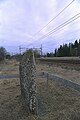
Uppland runinscription 478  | |||||
| Upload media | |||||
| Instance of |
| ||||
|---|---|---|---|---|---|
| Location | Knivsta socken, Ärlinghundra hundred, Stockholm County, Sweden | ||||
| Heritage designation |
| ||||
 | |||||
|
This is a category about an archaeological site or a monument in Sweden, number 10024801460001 in the RAÄ Fornsök database. |
Media in category "Upplands runinskrifter 478"
The following 25 files are in this category, out of 25 total.
-
 Knivsta runestone U478.JPG 1,236 × 1,662; 1.12 MB
-
 Runsten Knivsta.jpg 3,280 × 4,928; 12.33 MB
-
 U478 Knivsta - KMB - 16000300012882.jpg 512 × 768; 60 KB
-
 U478 Knivsta - KMB - 16000300012884.jpg 768 × 512; 52 KB
-
 U478 Knivsta - KMB - 16000300012885.jpg 512 × 768; 96 KB
-
 U478 Knivsta - KMB - 16000300012887.jpg 768 × 512; 101 KB
-
 U478 Knivsta - KMB - 16000300012888.jpg 768 × 512; 59 KB
-
 U478 Knivsta - KMB - 16000300012889.jpg 512 × 768; 88 KB
-
 U478 Knivsta - KMB - 16000300012890.jpg 512 × 768; 90 KB
-
 U478 Knivsta - KMB - 16000300012891.jpg 768 × 512; 64 KB
-
 U478 Knivsta - KMB - 16000300012892.jpg 512 × 768; 139 KB
-
 U478 Knivsta - KMB - 16000300026591.jpg 512 × 768; 108 KB
-
 U478 Knivsta - KMB - 16000300026592.jpg 512 × 768; 171 KB
-
 U478 Knivsta - KMB - 16000300026593.jpg 512 × 768; 159 KB
-
 U478 Knivsta - KMB - 16000300026594.jpg 512 × 768; 166 KB
-
 U478 Knivsta - KMB - 16000300026602.jpg 512 × 768; 141 KB
-
 U478 Knivsta - KMB - 16000300026604.jpg 768 × 512; 203 KB
-
 U478 Knivsta - KMB - 16000300026605.jpg 512 × 768; 210 KB
-
 U478 Knivsta - KMB - 16000300026606.jpg 512 × 768; 227 KB
-
 U478 Knivsta - KMB - 16000300026607.jpg 512 × 768; 208 KB
-
 U478 Knivsta - KMB - 16000300026608.jpg 768 × 512; 238 KB
-
 U478 Knivsta - KMB - 16000300026609.jpg 768 × 512; 233 KB
-
 U478 Knivsta - KMB - 16000300026610.jpg 512 × 768; 173 KB
-
 U478 Knivsta - KMB - 16000300026611.jpg 512 × 768; 117 KB
-
 U478 Knivsta - KMB - 16000300026612.jpg 768 × 512; 135 KB


