Category:Upplands runinskrifter 1050
Jump to navigation
Jump to search
| Object location | | View all coordinates using: OpenStreetMap |
|---|
 | |||||
| Upload media | |||||
| Instance of |
| ||||
|---|---|---|---|---|---|
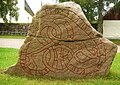
| Location | Björklinge Church, Uppsala Municipality, Uppsala County, Sweden | ||||
| Heritage designation |
| ||||
 | |||||
|
This is a category about an archaeological site or a monument in Sweden, number 67dbdcf3-7c65-4b47-991e-d5f93d985d99 in the RAÄ Fornsök database. |
Media in category "Upplands runinskrifter 1050"
The following 5 files are in this category, out of 5 total.
-
 U1050.jpg 1,000 × 721; 244 KB
-
 Upplands runinskrifter 1050 2009.jpg 1,000 × 707; 345 KB
-
 Upplands runinskrifter U1050 runes.png 376 × 40; 3 KB
-
 U1050 Björklinge kyrka - KMB - 16001000201404.jpg 787 × 522; 109 KB
-
 U1050 Björklinge kyrka - KMB - 16001000201424.jpg 787 × 522; 103 KB


