Category:Upplands runinskrifter 1019
Jump to navigation
Jump to search
| Object location | | View all coordinates using: OpenStreetMap |
|---|
 | |||||
| Upload media | |||||
| Instance of | |||||
|---|---|---|---|---|---|
| Location | Q10726032, Norunda hundred | ||||
| Heritage designation |
| ||||
 | |||||
|
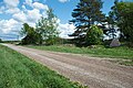
This is a category about an archaeological site or a monument in Sweden, number 10030001660001 in the RAÄ Fornsök database. |
Media in category "Upplands runinskrifter 1019"
The following 10 files are in this category, out of 10 total.
-
 U 1019, Kyrsta.JPG 1,200 × 1,600; 839 KB
-
 Upplands runinskrifter 1019.JPG 3,872 × 2,592; 4.45 MB
-
 U1019 Kyrsta - KMB - 16001000036904.jpg 522 × 787; 123 KB
-
 U1019 Kyrsta - KMB - 16001000037024.jpg 522 × 787; 116 KB
-
 U1019 Kyrsta - KMB - 16001000037026.jpg 787 × 522; 115 KB
-
 U1019 Kyrsta - KMB - 16001000037028.jpg 787 × 522; 128 KB
-
 U1019 Kyrsta - KMB - 16001000037030.jpg 787 × 522; 138 KB
-
 U1019 Kyrsta - KMB - 16001000037032.jpg 787 × 522; 110 KB
-
 U1019 Kyrsta - KMB - 16001000037034.jpg 522 × 787; 83 KB
-
 U1019 Kyrsta - KMB - 16001000039244.jpg 522 × 787; 121 KB


