Category:Upper Saxondale
Jump to navigation
Jump to search
English: Upper Saxondale is a settlement and civil parish in the Rushcliffe district, in the county of Nottinghamshire, England.
Village and civil parish in Nottinghamshire, United Kingdom | |||||
| Upload media | |||||
| Instance of |
| ||||
|---|---|---|---|---|---|
| Location |
| ||||
 | |||||
Media in category "Upper Saxondale"
The following 27 files are in this category, out of 27 total.
-
 Blackthorn in flower, Upper Saxondale - geograph.org.uk - 6808876.jpg 1,024 × 768; 195 KB
-
 Bus turnround - geograph.org.uk - 1615709.jpg 640 × 479; 86 KB
-
 Catalyst Church, Saxondale - geograph.org.uk - 6810405.jpg 1,024 × 768; 151 KB
-

-
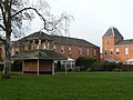
 Former wards, Nottinghamshire County Asylum - geograph.org.uk - 6810450.jpg 1,024 × 768; 240 KB
-
 Henson Lane - geograph.org.uk - 1615707.jpg 640 × 479; 105 KB
-
 Henson Lane - geograph.org.uk - 1615710.jpg 640 × 479; 108 KB
-
 House on the old A52, Saxondale - geograph.org.uk - 5212468.jpg 1,024 × 768; 170 KB
-
 Houses on Buckingham Drive - geograph.org.uk - 1614871.jpg 640 × 479; 119 KB
-
 Houses on Saxondale Drive - geograph.org.uk - 1615706.jpg 640 × 479; 104 KB
-
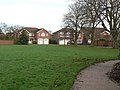
 Housing at Upper Saxondale - geograph.org.uk - 1614848.jpg 640 × 479; 124 KB
-
 Housing at Upper Saxondale - geograph.org.uk - 1614851.jpg 640 × 479; 106 KB
-
 Lings Farm - geograph.org.uk - 5274150.jpg 1,024 × 768; 177 KB
-
 Millennium Walk (1) - geograph.org.uk - 1614856.jpg 640 × 479; 127 KB
-
 Millennium Walk (2) - geograph.org.uk - 1614859.jpg 479 × 640; 136 KB
-
 Millennium Walk (3) - geograph.org.uk - 1614862.jpg 640 × 479; 161 KB
-
 Millennium Walk (4) - geograph.org.uk - 1614865.jpg 479 × 640; 133 KB
-
 Millennium Walk (5) - geograph.org.uk - 1614867.jpg 479 × 640; 113 KB
-
 Oilseed rape, Upper Saxondale - geograph.org.uk - 6808871.jpg 1,024 × 768; 140 KB
-
 Ploughed field between the Fosse Way and the A46 - geograph.org.uk - 5274085.jpg 1,024 × 768; 208 KB
-
 Postbox, Henson Lane (ref NG12 169) - geograph.org.uk - 1615712.jpg 640 × 479; 174 KB
-
 Saxondale Drive - geograph.org.uk - 1615713.jpg 640 × 479; 107 KB
-
 Shaftesbury Avenue - geograph.org.uk - 1614869.jpg 640 × 479; 86 KB
-
 Shelter at Upper Saxondale - geograph.org.uk - 1614849.jpg 479 × 640; 147 KB
-
 Sunset from near Saxondale - geograph.org.uk - 5065131.jpg 1,280 × 721; 179 KB
-
 View towards A52-A46 roundabout - geograph.org.uk - 5271320.jpg 1,024 × 768; 136 KB
-
 View towards Upper Brackendale Farm - geograph.org.uk - 5274153.jpg 1,024 × 768; 199 KB


_-_geograph.org.uk_-_1614856.jpg)
_-_geograph.org.uk_-_1614859.jpg)
_-_geograph.org.uk_-_1614862.jpg)
_-_geograph.org.uk_-_1614865.jpg)
_-_geograph.org.uk_-_1614867.jpg)


_-_geograph.org.uk_-_1615712.jpg)


