Category:Upper Don Trail
Jump to navigation
Jump to search

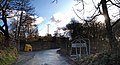
The Upper Don Trail is part of the Trans Pennine Trail. It is approximately 20 miles long, and runs between Dunford Bridge and Thurgoland via Penistone, South Yorkshire, England.
| Upload media | |||||
| Instance of |
| ||||
|---|---|---|---|---|---|
| Part of | |||||
| Named after | |||||
| Location |
| ||||
| Terminus | |||||
| |||||
Media in category "Upper Don Trail"
The following 6 files are in this category, out of 6 total.
-
-

-
 Entrance to the Upper Don Trail - geograph.org.uk - 1760469.jpg 389 × 518; 177 KB
-
 The Trans-Pennine Trail - geograph.org.uk - 135462.jpg 480 × 640; 119 KB
-
 Upper Don Trail - geograph.org.uk - 374059.jpg 640 × 480; 72 KB
-
 Yep Let's Hit The Upper Don Trail. - geograph.org.uk - 594713.jpg 640 × 480; 81 KB


,_Dunford_Bridge_-_geograph.org.uk_-_935197.jpg)