Category:Upper Borth
Jump to navigation
Jump to search
village in Ceredigion, Wales, UK  | |||||
| Upload media | |||||
| Instance of | |||||
|---|---|---|---|---|---|
| Location | Ceredigion, Wales | ||||
 | |||||
Media in category "Upper Borth"
The following 42 files are in this category, out of 42 total.
-
 Beach at Pen y Graig Borth - geograph.org.uk - 5603385.jpg 4,608 × 3,456; 4.19 MB
-
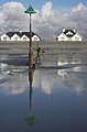 Beacon and groyne at Borth - geograph.org.uk - 742357.jpg 407 × 620; 47 KB
-
 Borth beach at low spring tide - geograph.org.uk - 557236.jpg 640 × 427; 51 KB
-
 Carreg Mulfran - geograph.org.uk - 4078076.jpg 3,264 × 2,448; 3.84 MB
-
 Carreg Mulfran - geograph.org.uk - 5603389.jpg 4,608 × 3,456; 3.34 MB
-
 Carreg Mulfran - geograph.org.uk - 70853.jpg 640 × 480; 125 KB
-
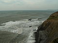
 Cliffs south of Borth - geograph.org.uk - 558581.jpg 640 × 427; 60 KB
-
 Coastal path sign - geograph.org.uk - 686973.jpg 640 × 480; 63 KB
-
 Fisherman on the rocks - geograph.org.uk - 4343547.jpg 960 × 640; 99 KB
-
 Greyness - geograph.org.uk - 606272.jpg 640 × 427; 57 KB
-
 Groynes on Borth beach - geograph.org.uk - 742351.jpg 640 × 427; 46 KB
-
 Parallel lines - geograph.org.uk - 606269.jpg 640 × 427; 101 KB
-
 Pasture north of Wallog - geograph.org.uk - 1168165.jpg 640 × 480; 218 KB
-
 Path south of Wallog - geograph.org.uk - 1168052.jpg 640 × 480; 186 KB
-
 The shoreline south-west of Borth - geograph.org.uk - 2535817.jpg 2,592 × 1,944; 2.1 MB
-
 A perfect evening, Borth - geograph.org.uk - 1806317.jpg 3,504 × 2,336; 1.35 MB
-

-
 A view towards Borth - geograph.org.uk - 1170280.jpg 640 × 480; 157 KB
-
 A view towards Carreg Mulfran - geograph.org.uk - 1170297.jpg 640 × 480; 190 KB
-
 A view towards Craig Y Delyn - geograph.org.uk - 1170246.jpg 640 × 480; 173 KB
-

-
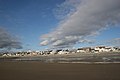
 Borth sea front - geograph.org.uk - 480097.jpg 640 × 372; 65 KB
-
 Cambrian view - geograph.org.uk - 22052.jpg 640 × 480; 94 KB
-
 Carreg Mulfran - geograph.org.uk - 1439372.jpg 640 × 426; 330 KB
-
 Ceredigion coastal path - geograph.org.uk - 70858.jpg 640 × 480; 155 KB
-
 Cliff path between Wallog and Borth - geograph.org.uk - 23368.jpg 640 × 480; 147 KB
-
 Cliff scenery, Borth - geograph.org.uk - 606240.jpg 427 × 640; 46 KB
-
 Coast near Sarn Gynfelyn - geograph.org.uk - 23370.jpg 640 × 480; 144 KB
-
 Coastal footpath and monument - geograph.org.uk - 1439378.jpg 640 × 426; 316 KB
-
 Cove south of Borth - geograph.org.uk - 582780.jpg 1,000 × 750; 254 KB
-
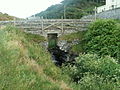 Dam, Wallog - geograph.org.uk - 23367.jpg 640 × 480; 198 KB
-
 Ffosygrafel-uchaf - geograph.org.uk - 23359.jpg 640 × 480; 127 KB
-
 Footpath to Wallog - geograph.org.uk - 23366.jpg 640 × 480; 223 KB
-
 January storm, Borth - geograph.org.uk - 558954.jpg 640 × 427; 64 KB
-
 Maize fields - geograph.org.uk - 23357.jpg 640 × 480; 137 KB
-
 Near Bryn-bwl - geograph.org.uk - 23356.jpg 640 × 480; 150 KB
-
 November sunset, Borth - geograph.org.uk - 545268.jpg 640 × 450; 35 KB
-
 Old Kiln By Sarn Gynfelyn - geograph.org.uk - 226582.jpg 640 × 480; 139 KB
-
 Sarn Gynfelyn - geograph.org.uk - 226583.jpg 640 × 480; 106 KB
-
 South end of Borth beach - geograph.org.uk - 582781.jpg 1,000 × 743; 297 KB
-
 The last graze - geograph.org.uk - 612683.jpg 640 × 427; 56 KB
-
 Wileiriog-fach - geograph.org.uk - 23364.jpg 640 × 480; 166 KB


