Category:Upper Batley
Jump to navigation
Jump to search
suburb of Batley, West Yorkshire, England, UK  | |||||
| Upload media | |||||
| Instance of | |||||
|---|---|---|---|---|---|
| Part of | |||||
| Location | Kirklees, West Yorkshire, Yorkshire and the Humber, England | ||||
 | |||||
Media in category "Upper Batley"
The following 19 files are in this category, out of 19 total.
-
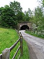 Big "K" shows the way-Howley Mill Viaduct - geograph.org.uk - 442996.jpg 480 × 640; 126 KB
-
 Easter Sunday 2008 - geograph.org.uk - 771371.jpg 640 × 480; 74 KB
-

-

-
 Houses on Howley Mill Lane - geograph.org.uk - 1204427.jpg 640 × 427; 125 KB
-

-

-

-
 Kirklees Way at Howley Mill Lane - geograph.org.uk - 1204449.jpg 640 × 427; 131 KB
-
 Kirklees Way, Upper Batley - geograph.org.uk - 158537.jpg 640 × 480; 112 KB
-
 Level Crossing near Howley Mill Lane - geograph.org.uk - 1204434.jpg 640 × 427; 99 KB
-
 Playing Fields, Upper Batley - geograph.org.uk - 775068.jpg 640 × 480; 74 KB
-

-

-
 Upper Batley - geograph.org.uk - 308633.jpg 640 × 480; 53 KB
-
 Upper Batley - geograph.org.uk - 31039.jpg 640 × 480; 82 KB
-
 Upper Batley Low Lane - geograph.org.uk - 771426.jpg 640 × 480; 112 KB
-
 Upper Batley Low Lane - geograph.org.uk - 796346.jpg 640 × 480; 93 KB
-
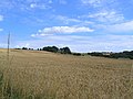
 View of fields of Upper Batley - geograph.org.uk - 308865.jpg 640 × 480; 89 KB


