Category:Uphill, Somerset
Jump to navigation
Jump to search
Uphill is a village in the civil parish of Weston-super-Mare in North Somerset, England, at the southern edge of the town, on the Bristol Channel coast.
village in Somerset, United Kingdom  | |||||
| Upload media | |||||
| Instance of |
| ||||
|---|---|---|---|---|---|
| Location | Weston-super-Mare, Weston-Super-Mare, North Somerset, Somerset, South West England, England | ||||
 | |||||
Subcategories
This category has the following 8 subcategories, out of 8 total.
Media in category "Uphill, Somerset"
The following 101 files are in this category, out of 101 total.
-
 A beacon on the windmill - geograph.org.uk - 3417995.jpg 2,304 × 1,704; 1.43 MB
-
 A mighty span - geograph.org.uk - 3421250.jpg 2,304 × 1,704; 1.45 MB
-
 A surprisingly good place to beachcomb - geograph.org.uk - 357339.jpg 640 × 480; 121 KB
-
 At the top - geograph.org.uk - 584950.jpg 640 × 480; 58 KB
-
 Bad parking! - geograph.org.uk - 357322.jpg 640 × 480; 145 KB
-
 Black Rock - geograph.org.uk - 2659703.jpg 4,320 × 2,432; 3.34 MB
-
 Black Rock - geograph.org.uk - 77583.jpg 640 × 426; 88 KB
-
 Bleadon levels - geograph.org.uk - 4202.jpg 640 × 480; 67 KB
-
 Boats, cliff and the old St Nicholas's church, Uphill - geograph.org.uk - 2051137.jpg 1,600 × 1,200; 628 KB
-
 Brean Down farm - geograph.org.uk - 83857.jpg 640 × 480; 61 KB
-
 Brean, the Axe approaches the Severn - geograph.org.uk - 854078.jpg 640 × 480; 52 KB
-

-

-
 Derelict Lime Kiln, Uphill. - panoramio.jpg 2,112 × 2,816; 1.42 MB
-
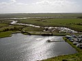
 Estuaries at Uphill - geograph.org.uk - 1887217.jpg 640 × 449; 84 KB
-
 Estuary near Uphill - geograph.org.uk - 5177476.jpg 800 × 533; 268 KB
-
 Estuary of the River Axe at Uphill - geograph.org.uk - 4751845.jpg 3,648 × 2,048; 1.34 MB
-
 Former windmill, Uphill - geograph.org.uk - 1653642.jpg 640 × 480; 59 KB
-
 High and Dry ^ - geograph.org.uk - 1542295.jpg 640 × 480; 112 KB
-
 Impressive house Uphill - geograph.org.uk - 1569764.jpg 640 × 427; 63 KB
-
 Lodge House for the Grange - geograph.org.uk - 1748893.jpg 640 × 480; 74 KB
-
 Low tide at Uphill - geograph.org.uk - 1542260.jpg 640 × 480; 64 KB
-
 Marina and Church - geograph.org.uk - 1194929.jpg 640 × 480; 81 KB
-
 Old Church Road, Uphill.jpg 1,024 × 683; 603 KB
-
 On the hill above Uphill - geograph.org.uk - 1653609.jpg 640 × 480; 71 KB
-
 Ship Inn, Uphill.jpg 1,024 × 768; 333 KB
-
 Site of former ferry crossing on the River Axe - geograph.org.uk - 4918781.jpg 1,024 × 768; 130 KB
-
 Slimeridge Farm, Uphill.jpg 1,024 × 768; 516 KB
-
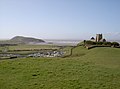
 St Nicholas church tower, Uphill - geograph.org.uk - 1188480.jpg 640 × 426; 50 KB
-
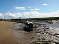
 Stuck in the mud^ - geograph.org.uk - 1194900.jpg 640 × 480; 99 KB
-
 The Marina, Uphill - geograph.org.uk - 1653632.jpg 640 × 480; 74 KB
-
 The mouth of the R Axe ^ view to Brean Down at Uphill - geograph.org.uk - 5239015.jpg 5,184 × 2,920; 4.76 MB
-
 The mouth of the R Axe ^ view to Brean Down at Uphill - geograph.org.uk - 5239017.jpg 5,184 × 2,920; 4.65 MB
-
 Tortured trees - geograph.org.uk - 586742.jpg 640 × 480; 93 KB
-
 Tower on Uphill, Weston-super-Mare.jpg 3,888 × 2,592; 2.19 MB
-
 Trig point on Brean Down - geograph.org.uk - 929829.jpg 640 × 480; 241 KB
-
 UK - Weston-super-Mare (30158911013).jpg 2,500 × 1,667; 1.61 MB
-
 UK - Weston-super-Mare (30159517193).jpg 2,448 × 3,264; 2.76 MB
-
 UK - Weston-super-Mare (30162715004).jpg 2,500 × 1,408; 1.17 MB
-
 UK - Weston-super-Mare (30162716514).jpg 2,500 × 1,408; 1.24 MB
-
 UK - Weston-super-Mare (30493921510).jpg 13,632 × 3,056; 9.06 MB
-
 UK - Weston-super-Mare (30677475752).jpg 2,500 × 1,615; 1.7 MB
-
 UK - Weston-super-Mare (30706332021).jpg 3,161 × 2,375; 1.96 MB
-
 UK - Weston-super-Mare (30757716816).jpg 2,500 × 1,408; 1.2 MB
-
 Uphill - Brighton and Hove 992 GHT127.jpg 1,024 × 768; 311 KB
-
 Uphill - Crosville DFG81 891VFM.jpg 1,024 × 768; 370 KB
-
 Uphill - geograph.org.uk - 5029014.jpg 2,399 × 1,599; 661 KB
-
 Uphill - Old Church of St Nicholas - geograph.org.uk - 5239013.jpg 5,184 × 2,920; 4.66 MB
-

-
 Uphill at night - panoramio.jpg 4,928 × 3,264; 9.48 MB
-
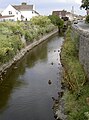
 Uphill Beck - geograph.org.uk - 2449842.jpg 800 × 500; 109 KB
-
 Uphill boat yard - geograph.org.uk - 3590032.jpg 2,304 × 1,704; 1.82 MB
-
 Uphill Boat Yard - panoramio.jpg 4,928 × 3,264; 1.72 MB
-
 Uphill Church - panoramio.jpg 4,928 × 3,264; 3.67 MB
-
 Uphill Church and Tower - panoramio.jpg 4,928 × 3,264; 2.9 MB
-
 Uphill Community Primary School - geograph.org.uk - 5027112.jpg 2,000 × 1,333; 1.26 MB
-
 Uphill Grange in the snow - geograph.org.uk - 1436314.jpg 640 × 480; 161 KB
-
 Uphill Grange Road - SPS 31 (YC68VKM).JPG 1,366 × 1,024; 482 KB
-
 Uphill Great Rhyne - geograph.org.uk - 1887116.jpg 640 × 480; 79 KB
-
 Uphill Great Rhyne - geograph.org.uk - 3590027.jpg 1,024 × 1,385; 826 KB
-
 Uphill in a nutshell - geograph.org.uk - 3418000.jpg 2,304 × 1,704; 1.51 MB
-
 Uphill Links Road (First 41333 - V433HBY).jpg 1,366 × 910; 702 KB
-
 Uphill Links Road - Crosville V135LGC.jpg 1,366 × 1,024; 421 KB
-
 Uphill marina - geograph.org.uk - 3417948.jpg 2,304 × 1,704; 1.65 MB
-
 Uphill Marina - geograph.org.uk - 5029018.jpg 2,399 × 1,599; 593 KB
-
 Uphill marina - geograph.org.uk - 5177468.jpg 800 × 533; 459 KB
-
 Uphill Nature Reserve - geograph.org.uk - 5025350.jpg 2,000 × 1,334; 1.23 MB
-
 Uphill pumping station - geograph.org.uk - 3590002.jpg 2,304 × 1,704; 1.63 MB
-
 Uphill quarry climbers.jpg 1,024 × 1,366; 503 KB
-
 Uphill River Axe.jpg 1,366 × 1,024; 395 KB
-
 Uphill Road South - First 32006 (KFX791).JPG 1,366 × 1,024; 540 KB
-
 Uphill Tower - geograph.org.uk - 3592725.jpg 1,920 × 1,272; 389 KB
-
 Uphill Village - geograph.org.uk - 302237.jpg 640 × 426; 88 KB
-
 Uphill Way - Bristol 8579 (869NHT).JPG 2,048 × 1,366; 1.26 MB
-
 Uphill Way - King Alfred HOR590E.JPG 1,366 × 1,024; 508 KB
-
 Uphill Wharf - King Alfred HOR590E.JPG 1,366 × 1,024; 516 KB
-
 Uphill Wharf 41334.jpg 1,366 × 1,024; 384 KB
-
 Uphill, beacon and Severn view - geograph.org.uk - 852742.jpg 640 × 480; 48 KB
-
 Uphill, downhill view over village - geograph.org.uk - 852735.jpg 640 × 480; 98 KB
-
 Uphill, looking through the beacon - geograph.org.uk - 852755.jpg 480 × 640; 48 KB
-
 Uphill, marina - geograph.org.uk - 854083.jpg 640 × 480; 65 KB
-

-
 Uphill, remains of windmill - geograph.org.uk - 852739.jpg 640 × 480; 51 KB
-
-
 Uphill, view through the letter 's' - geograph.org.uk - 852750.jpg 480 × 640; 33 KB
-
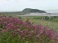
 Uphill, view towards Flat Holm - geograph.org.uk - 854074.jpg 640 × 480; 59 KB
-
 Uphill.jpg 639 × 434; 95 KB
-
 UphillCliffs.jpg 640 × 427; 118 KB
-
 View from Uphill, Weston-super-Mare 1.jpg 3,888 × 2,592; 2.29 MB
-
 View from Uphill, Weston-super-Mare 2.jpg 3,888 × 2,592; 2.07 MB
-
 View from Uphill, Weston-super-Mare 3.jpg 3,888 × 2,592; 1.73 MB
-
 View of Uphill Hill from Bristol 8579 (869NHT).JPG 1,024 × 1,366; 510 KB
-
 View of Uphill Links Road from Bristol 8579 (869NHT).JPG 1,366 × 910; 495 KB
-
 Walborough from sea wall.jpg 1,366 × 820; 321 KB
-
 Weston General Hospital - Crosville 311 (W963TRP).jpg 1,024 × 683; 340 KB
-
 Weston-Super-Mare from Uphill beach - geograph.org.uk - 1748878.jpg 640 × 480; 47 KB
-
 Weston-Super-Mare view.jpg 640 × 480; 222 KB
-
 Weston-super-Mare, boatyard at Uphill - geograph.org.uk - 134704.jpg 640 × 427; 98 KB
-
 Coronation Estate Park - geograph.org.uk - 74414.jpg 640 × 480; 56 KB
-
 Field of Brean Farm - geograph.org.uk - 77587.jpg 640 × 480; 55 KB
-
 Weston-super-Mare Golf Course - geograph.org.uk - 74408.jpg 640 × 480; 54 KB


.jpg)
.jpg)
.jpg)
.jpg)
.jpg)
.jpg)
.jpg)


.JPG)


.jpg)


.JPG)


.JPG)


.JPG)
.JPG)

.jpg)


.jpg)