Category:Up Hatherley
Jump to navigation
Jump to search
district of Cheltenham  | |||||
| Upload media | |||||
| Instance of | |||||
|---|---|---|---|---|---|
| Location | Cheltenham, Gloucestershire, South West England, England | ||||
| Population |
| ||||
 | |||||
Subcategories
This category has only the following subcategory.
Media in category "Up Hatherley"
The following 71 files are in this category, out of 71 total.
-
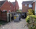
 Allotments access lane, Cheltenham - geograph.org.uk - 5117110.jpg 798 × 800; 168 KB
-
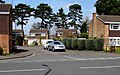
 Alma Road, Cheltenham - geograph.org.uk - 2552591.jpg 1,024 × 680; 157 KB
-
 Alma Road, Cheltenham - geograph.org.uk - 6458927.jpg 1,024 × 937; 194 KB
-
 Brakeville, Up Hatherley, Cheltenham - geograph.org.uk - 4892245.jpg 800 × 503; 111 KB
-
 Bronte Close - geograph.org.uk - 4273107.jpg 640 × 480; 74 KB
-
 Browning Mews - geograph.org.uk - 4273115.jpg 640 × 480; 66 KB
-
 Bungalows in suburban Cheltenham - geograph.org.uk - 5117058.jpg 800 × 522; 104 KB
-
 Bus Shelter, The Poplars, Cheltenham - geograph.org.uk - 2536458.jpg 640 × 480; 77 KB
-
 Bus stop near the shops, Up Hatherley - geograph.org.uk - 1082665.jpg 640 × 480; 170 KB
-

-
 Bushes and bungalows, Cheltenham - geograph.org.uk - 5117020.jpg 800 × 492; 95 KB
-
 Caernarvon Road shops - geograph.org.uk - 3373735.jpg 1,280 × 861; 709 KB
-

-
 Church centre, Up Hatherley - geograph.org.uk - 1082691.jpg 640 × 480; 105 KB
-

-
 Davallia Drive, Up Hatherley - geograph.org.uk - 3373746.jpg 1,024 × 768; 214 KB
-
 Deacon Close, Cheltenham - geograph.org.uk - 5117303.jpg 800 × 600; 140 KB
-
 December day on Leckhampton Hill - geograph.org.uk - 1082702.jpg 640 × 458; 118 KB
-

-
 Farmfield Road, Warden Hill - geograph.org.uk - 3373757.jpg 1,169 × 834; 506 KB
-
 Footpath between houses - geograph.org.uk - 3373782.jpg 1,280 × 960; 1.37 MB
-
 Four-storey block of flats, Alma Road, Cheltenham - geograph.org.uk - 6458912.jpg 1,600 × 1,267; 260 KB
-
 Fuel filling station, Morrisons - geograph.org.uk - 3373729.jpg 1,280 × 960; 842 KB
-
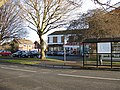
 Greatfield Park Primary School - geograph.org.uk - 3373806.jpg 1,280 × 735; 636 KB
-
 Harrington Drive, Cheltenham - geograph.org.uk - 5117062.jpg 800 × 523; 115 KB
-
-
 Hatherley Brake, Cheltenham - geograph.org.uk - 4892289.jpg 800 × 503; 134 KB
-
 Hatherley Bridge - geograph.org.uk - 1690649.jpg 1,500 × 974; 288 KB
-

-
 Hatherley Bridge, Cheltenham - geograph.org.uk - 5100991.jpg 800 × 396; 85 KB
-
 Hatherley Lane houses, Cheltenham - geograph.org.uk - 4892070.jpg 800 × 520; 108 KB
-
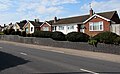
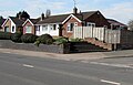 Hatherley Road bungalows, Cheltenham - geograph.org.uk - 5116965.jpg 800 × 513; 95 KB
-

-
-
 Hatherley Road houses, Cheltenham - geograph.org.uk - 5117004.jpg 800 × 492; 110 KB
-
 Hatherley Road pelican crossing, Cheltenham - geograph.org.uk - 6458894.jpg 1,600 × 1,213; 453 KB
-

-

-
 Langdale Road, Hatherley - geograph.org.uk - 3126666.jpg 640 × 449; 53 KB
-
 Library, Up Hatherley - geograph.org.uk - 3373814.jpg 1,280 × 960; 701 KB
-
 Manse Gardens, Cheltenham - geograph.org.uk - 6458886.jpg 1,024 × 631; 169 KB
-

-
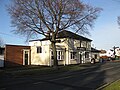
 Old Coaching Inn - geograph.org.uk - 1772563.jpg 1,600 × 1,200; 394 KB
-
 Paragon House, Cheltenham - geograph.org.uk - 5116978.jpg 800 × 519; 84 KB
-

-

-
 Rippledale Close, Cheltenham - geograph.org.uk - 4892273.jpg 800 × 589; 101 KB
-
 Runnymede - geograph.org.uk - 1656128.jpg 640 × 425; 84 KB
-
 Short footpath in Chargrove Lane - geograph.org.uk - 1082712.jpg 640 × 419; 89 KB
-
-
 Squeaky clean since 1918, Cheltenham - geograph.org.uk - 5116987.jpg 800 × 771; 112 KB
-
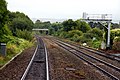 The Down Goods Loop at Hatherley - geograph.org.uk - 1690651.jpg 1,500 × 1,000; 268 KB
-
 The Greatfield, Up Hatherley - geograph.org.uk - 3373742.jpg 1,280 × 960; 847 KB
-
 The Hatherley - geograph.org.uk - 1082659.jpg 640 × 480; 116 KB
-

-

-
 Up Hatherley church - geograph.org.uk - 2329625.jpg 1,024 × 768; 243 KB
-
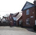
 Up Hatherley Post Office, Cheltenham - geograph.org.uk - 4892300.jpg 800 × 615; 94 KB
-
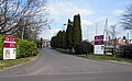
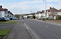
 Up Hatherley Way - geograph.org.uk - 2255350.jpg 1,024 × 681; 133 KB
-
 Up Hatherley, Cheltenham, P.O. (2550631195).jpg 1,280 × 960; 171 KB
-
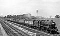 Up Hatherley, Gloucestershire geograph-2716907-by-Ben-Brooksbank.jpg 2,409 × 1,449; 643 KB
-
 Wards Road - geograph.org.uk - 4049042.jpg 3,264 × 2,448; 1.74 MB
-

-

-

-
-

-

-
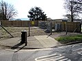
 Gateway to South Park - geograph.org.uk - 705238.jpg 640 × 480; 88 KB
-
 South Park - geograph.org.uk - 705243.jpg 640 × 480; 61 KB
-
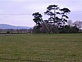 Trees in the grounds of South Park - geograph.org.uk - 705242.jpg 640 × 480; 70 KB


.jpg)


