Category:Up Cerne
Jump to navigation
Jump to search
village and civil parish in Dorset, England, UK  | |||||
| Upload media | |||||
| Instance of | |||||
|---|---|---|---|---|---|
| Location | Dorset, South West England, England | ||||
| Population |
| ||||
 | |||||
Subcategories
This category has the following 3 subcategories, out of 3 total.
C
- Up Cerne Church (7 F)
- Corner Cottage, Up Cerne (5 F)
M
- Up Cerne Manor House (7 F)
Media in category "Up Cerne"
The following 65 files are in this category, out of 65 total.
-
 'Crossroads' in Bridleways - geograph.org.uk - 248527.jpg 640 × 480; 98 KB
-
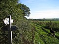
 A signposted crossing of the ways on the Dorset downs - geograph.org.uk - 4637491.jpg 1,920 × 1,080; 611 KB
-
 Approaching Gore Hill - geograph.org.uk - 5021452.jpg 640 × 427; 77 KB
-
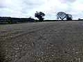
 Arable field, Up Cerne - geograph.org.uk - 5525226.jpg 3,072 × 2,048; 1.39 MB
-
 Ash Tree. Wether Hill - geograph.org.uk - 855886.jpg 426 × 640; 97 KB
-
 Bridleway on East Hill - geograph.org.uk - 5523887.jpg 2,621 × 1,859; 1.13 MB
-
 Bridleway on East Hill - geograph.org.uk - 5523890.jpg 3,072 × 2,048; 2.08 MB
-
 Bridleway on Farm Hill - geograph.org.uk - 5523897.jpg 2,048 × 3,072; 1.82 MB
-

-
 Bridleway through Up Cerne Wood - geograph.org.uk - 5115713.jpg 640 × 480; 146 KB
-
 Bridleway to Great Pond - geograph.org.uk - 5523960.jpg 3,072 × 2,048; 2.04 MB
-
 Bridleway to Great Pond - geograph.org.uk - 5524042.jpg 2,048 × 3,072; 2.2 MB
-
 Byway on Seldon Hill - geograph.org.uk - 5108584.jpg 640 × 480; 94 KB
-
 Combe above Up Cerne - geograph.org.uk - 5523909.jpg 2,875 × 1,851; 1.22 MB
-
 Combe above Up Cerne - geograph.org.uk - 5523940.jpg 2,283 × 1,489; 792 KB
-
 Cottages at Up Cerne hamlet - geograph.org.uk - 5021500.jpg 640 × 427; 68 KB
-
 Crops at Telegraph Hill - geograph.org.uk - 5021520.jpg 640 × 427; 67 KB
-
 Farmland above Up Cerne - geograph.org.uk - 5523921.jpg 3,072 × 2,048; 1.43 MB
-
 Farmland above Up Cerne - geograph.org.uk - 5523950.jpg 3,011 × 1,907; 1.55 MB
-
 Field by the Wessex Ridgeway - geograph.org.uk - 5524160.jpg 3,072 × 2,048; 1.28 MB
-
 Field by the Wessex Ridgeway - geograph.org.uk - 5524238.jpg 2,986 × 1,941; 1.43 MB
-
 Flattened rights of way signpost, Up Cerne - geograph.org.uk - 5524357.jpg 2,048 × 3,072; 1.48 MB
-
 Footpath up Seldon Hill - geograph.org.uk - 5021513.jpg 640 × 427; 54 KB
-
 Gore Hill - geograph.org.uk - 4465493.jpg 800 × 533; 181 KB
-
 Gore Hill Trig Point - geograph.org.uk - 4414187.jpg 3,072 × 2,304; 3.51 MB
-
 Gore Hill trigpoint - geograph.org.uk - 5021508.jpg 640 × 427; 60 KB
-
 Gore Hill, cereal field - geograph.org.uk - 4723853.jpg 1,024 × 768; 226 KB
-
 Green at Up Cerne - geograph.org.uk - 5524453.jpg 2,802 × 1,755; 1,020 KB
-
 Lake, Up Cerne - geograph.org.uk - 1093473.jpg 640 × 480; 117 KB
-
 Newly Sprouting Crops , Up Cerne - geograph.org.uk - 1291013.jpg 640 × 452; 125 KB
-
 Path, East Hill - geograph.org.uk - 5523847.jpg 3,072 × 2,048; 1.34 MB
-
 Postbox, Up Cerne - geograph.org.uk - 5524501.jpg 1,757 × 2,788; 724 KB
-
 Ramshorn Hill - geograph.org.uk - 4465452.jpg 800 × 600; 293 KB
-
 Rush hour at Up Cerne - geograph.org.uk - 3124037.jpg 640 × 480; 132 KB
-
 Sheep, Up Cerne - geograph.org.uk - 5525103.jpg 3,072 × 2,048; 1.77 MB
-
 Sunlit Woods on Telegraph Hill - geograph.org.uk - 1120126.jpg 640 × 428; 115 KB
-
 Telegraph Hill - geograph.org.uk - 4414185.jpg 3,072 × 2,304; 3.05 MB
-
 The Dower House, Up Cerne - geograph.org.uk - 5524368.jpg 2,992 × 1,816; 1.22 MB
-
 Towards Barn Bottom - geograph.org.uk - 855890.jpg 640 × 426; 75 KB
-
 Track at Wether Hill - geograph.org.uk - 3248521.jpg 3,264 × 2,448; 1.87 MB
-
 Track from Great Pond - geograph.org.uk - 3248509.jpg 3,264 × 2,448; 2.05 MB
-
 Track near Lynch Coppice - geograph.org.uk - 3248517.jpg 2,448 × 3,264; 2.15 MB
-

-
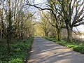
 Tree-lined road, Up Cerne - geograph.org.uk - 5108587.jpg 640 × 480; 85 KB
-
 Tree-lined road, Up Cerne - geograph.org.uk - 5525204.jpg 2,048 × 2,806; 1.14 MB
-
 Up Cerne - geograph.org.uk - 1291014.jpg 640 × 480; 99 KB
-
 Up Cerne - geograph.org.uk - 1292195.jpg 640 × 480; 91 KB
-
 Up Cerne - geograph.org.uk - 5524410.jpg 2,894 × 1,817; 1.26 MB
-
 Up Cerne Manor House and Church - geograph.org.uk - 4461122.jpg 1,920 × 1,080; 611 KB
-
 Up Cerne, farm track - geograph.org.uk - 4723991.jpg 1,024 × 768; 328 KB
-
 Up Cerne, fields and Giant view - geograph.org.uk - 1343862.jpg 480 × 640; 47 KB
-
 Up Cerne, maize field - geograph.org.uk - 4723974.jpg 1,024 × 768; 211 KB
-
 Up Cerne, manor and church - geograph.org.uk - 5525087.jpg 2,917 × 1,766; 951 KB
-
 Up Cerne, manor and church - geograph.org.uk - 5525212.jpg 1,936 × 1,196; 491 KB
-
 Up Cerne, matching brickwork - geograph.org.uk - 486222.jpg 640 × 409; 106 KB
-
 Up Cerne, postbox No. DT2 20 - geograph.org.uk - 1343866.jpg 480 × 640; 128 KB
-

-
 Up Cerne, shy postbox - geograph.org.uk - 1343869.jpg 480 × 640; 109 KB
-
 Up Cerne, signpost - geograph.org.uk - 4724013.jpg 1,024 × 768; 193 KB
-
 Up Cerne, view through three pipes - geograph.org.uk - 1343859.jpg 640 × 480; 102 KB
-
 Up Cerne, Wessex Ridgeway - geograph.org.uk - 4724002.jpg 1,024 × 768; 222 KB
-
 Wancombe Hill - geograph.org.uk - 1485570.jpg 640 × 480; 97 KB
-
 Wessex Ridgeway approaching Up Cerne - geograph.org.uk - 5524277.jpg 3,072 × 2,048; 1.23 MB
-
 Wessex Ridgeway on Balls Hill - geograph.org.uk - 1492700.jpg 640 × 480; 129 KB
-
 Wessex Ridgeway west of Up Cerne - geograph.org.uk - 5524017.jpg 3,039 × 1,878; 1.16 MB


