Category:Untergasse 19 (Alsfeld)
Jump to navigation
Jump to search
| Object location | | View all coordinates using: OpenStreetMap |
|---|
This is the category of the Hessian Kulturdenkmal (cultural monument) with the ID 13254 (Wikidata)
|
| Upload media | |||||
| Instance of | |||||
|---|---|---|---|---|---|
| Location | Alsfeld, Vogelsbergkreis, Giessen Government Region, Hesse, Germany | ||||
| Heritage designation | |||||
 | |||||
Media in category "Untergasse 19 (Alsfeld)"
The following 10 files are in this category, out of 10 total.
-
 Alsfeld Burggäßchen southeastern direction.jpg 4,000 × 6,000; 18.78 MB
-
 Alsfeld Untergasse 19 Rentamt detail l 13254.png 2,120 × 2,865; 8.64 MB
-
 Alsfeld Untergasse 19 Rentamt detail r 13254.png 2,017 × 2,953; 10.22 MB
-
 Alsfeld, Untergasse 19, Am Judenbad-20160504-001.jpg 3,763 × 5,637; 9.96 MB
-
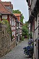
 Alsfeld, Untergasse 19, vom Burggäßchen.JPG 3,264 × 4,928; 6.29 MB
-
 Alsfeld, Untergasse 19-20160504-002.jpg 3,763 × 5,637; 11.59 MB
-
 Alsfeld, Untergasse 19-20160504-003.jpg 3,784 × 5,668; 11.88 MB
-
 Alsfeld, Untergasse 19-20160504-004.jpg 5,637 × 3,763; 11.12 MB
-
 Alsfeld, Untergasse 19-20160504-005.jpg 5,637 × 3,763; 10.61 MB
-
 Alsfeld, Untergasse 19-20160504-006.jpg 6,016 × 4,016; 12.35 MB


