Category:Unsourced maps of Moghulistan
Jump to navigation
Jump to search
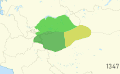
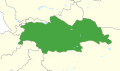
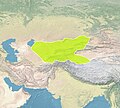
These maps are all self-sourced maps created by the uploader, with a modern country borders background, with minimal to no description and sometimes no date or year given.
Media in category "Unsourced maps of Moghulistan"
The following 17 files are in this category, out of 17 total.
-
 1514 Moghulistan.png 1,551 × 1,083; 152 KB
-
 Maps of Moghul Khanate.gif 1,780 × 1,095; 1.43 MB
-
 Maps of Moghulistan.gif 1,780 × 1,095; 1.33 MB
-
 Mirza Abu Bakr 1490s.png 1,558 × 919; 115 KB
-
 Mirza Abu Bark.png 1,323 × 874; 133 KB
-
 Moghulistan (1640-ning yillar).png 1,573 × 970; 137 KB
-
 MoghulKhanate1465-01-01.svg 512 × 300; 330 KB
-
 MoghulKhanate1640sFar.svg 512 × 459; 2.61 MB
-
 MoghulKhanate1640Small.svg 512 × 300; 327 KB
-
 QarakhanidMap1000.jpg 828 × 746; 94 KB
-
 Yarkent we Turpan Xanliqi 3.png 1,461 × 951; 119 KB
-
 Yarkent we Turpan Xanliqi 4.png 1,456 × 964; 119 KB
-
 Yarkent we Turpan Xanliqi.png 1,560 × 962; 107 KB
-
 Yarkent we Turpan Xanliqi2.png 1,583 × 973; 109 KB
-
 Yerkend Xanliqi.png 1,582 × 972; 105 KB
-
 Государство Яркенд (Эмират Мирзы Абу Бакра).png 1,588 × 972; 180 KB
-
 ﻳﻪﻛﻪﻥ ﺧﺎﻧﻠﺌﻘﻰ(Yeken Xanliqi).png 1,583 × 950; 127 KB


.png)


.png)
.png)