Category:United States photographs taken on 2013-10-20
Jump to navigation
Jump to search
Countries of North America: Canada · Costa Rica · El Salvador · Mexico · Panama · United States of America‡
‡: partly located in North America
‡: partly located in North America
| ← | Sunday 20 October 2013 | → | ||
| ← | October 2013 | → | ||

United States of America photographs taken on 20 October 2013.
Image files should be categorized here automatically using {{taken on}} template. Direct categorisation is also possible, if automatic is impossible.
Media in category "United States photographs taken on 2013-10-20"
The following 200 files are in this category, out of 236 total.
(previous page) (next page)-
 'Gator Bn.' stays flexible in training 131020-M-BW898-008.jpg 5,373 × 3,022; 10.95 MB
-
 'Gator Bn.' stays flexible in training 131020-M-BW898-009.jpg 5,760 × 3,240; 11.97 MB
-
 'Gator Bn.' stays flexible in training 131020-M-BW898-013.jpg 4,474 × 2,983; 4.82 MB
-
 131020-M-LK971-148 (10557249693).jpg 5,616 × 3,744; 12.72 MB
-

-

-

-
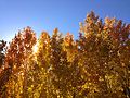
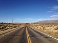
 2013-10-20 13 49 46 Aspens on the west side of Harrison Pass.JPG 3,264 × 2,448; 3.18 MB
-
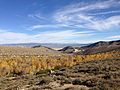
 2013-10-20 13 52 48 View south from Harrison Pass.JPG 3,264 × 2,448; 2.2 MB
-

-

-

-

-
-

-

-
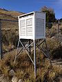
 2013-10-20 14 19 03 Maximum and Minimum Thermometers within a Cotton Region Shelter.jpg 3,264 × 2,448; 2.4 MB
-
 2013-10-20 14 20 39 Anemometer used to measure for wind movement at an evaporation pan.JPG 2,448 × 3,264; 4.09 MB
-
 2013-10-20 14 21 47 Entrance sign at Ruby Lake National Wildlife Refuge.JPG 3,264 × 2,448; 2.84 MB
-

-
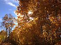
 2013-10-20 14 39 19 Aspens on the east side of Harrison Pass.JPG 2,448 × 3,264; 4 MB
-
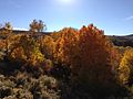
 2013-10-20 14 40 04 Aspens on the east side of Harrison Pass.JPG 2,448 × 3,264; 4.16 MB
-
 2013-10-20 14 40 17 Aspens on the east side of Harrison Pass.JPG 3,264 × 2,448; 4.03 MB
-
 2013-10-20 14 44 25 Aspens on the east side of Harrison Pass.JPG 3,264 × 2,448; 4.29 MB
-
 2013-10-20 14 44 59 Aspens on the east side of Harrison Pass.JPG 3,264 × 2,448; 3.67 MB
-
 2013-10-20 14 59 07 Aspens on the east side of Harrison Pass.JPG 3,264 × 2,448; 3.82 MB
-
 2013-10-20 15 00 00 Aspens on the east side of Harrison Pass.JPG 3,264 × 2,448; 2.95 MB
-
 2013-10-20 15 00 05 Aspens on the east side of Harrison Pass.JPG 3,264 × 2,448; 3.37 MB
-
 2013-10-20 15 00 18 Aspens on the east side of Harrison Pass.JPG 3,264 × 2,448; 4.02 MB
-
 2013-10-20 15 00 57 Aspens on the east side of Harrison Pass.JPG 3,264 × 2,448; 3.02 MB
-
 2013-10-20 15 01 20 Aspens on the east side of Harrison Pass.JPG 3,264 × 2,448; 3.53 MB
-
 2013-10-20 15 01 27 Aspens on the east side of Harrison Pass.JPG 3,264 × 2,448; 3.49 MB
-
 2013-10-20 15 01 32 Aspens on the east side of Harrison Pass.JPG 3,264 × 2,448; 3.59 MB
-
 2013-10-20 15 01 40 Aspens on the east side of Harrison Pass.JPG 3,264 × 2,448; 3.1 MB
-
 2013-10-20 15 01 42 Aspens on the east side of Harrison Pass.JPG 3,264 × 2,448; 3.58 MB
-
 2013-10-20 15 01 48 Aspens on the east side of Harrison Pass.JPG 3,264 × 2,448; 3.56 MB
-
 2013-10-20 15 02 18 Aspens on the east side of Harrison Pass.JPG 3,264 × 2,448; 3.31 MB
-
 2013-10-20 15 07 02 View east from Harrison Pass.JPG 3,264 × 2,448; 3.13 MB
-
 2013-10-20 15 07 30 Panorama east from Harrison Pass.JPG 8,096 × 2,544; 13.11 MB
-

-

-
 2013-10-20 15 10 52 View west from Harrison Pass.JPG 3,264 × 2,448; 2.66 MB
-
 2013-10-20 15 11 08 Panorama west from Harrison Pass.JPG 6,720 × 2,412; 10.32 MB
-

-

-

-
 2013-10-20 15 18 01 Aspens on the west side of Harrison Pass.JPG 3,264 × 2,448; 2.77 MB
-
 2013-10-20 15 18 34 Aspens on the west side of Harrison Pass.JPG 3,264 × 2,448; 3.05 MB
-
 2013-10-20 15 18 54 Aspens on the west side of Harrison Pass.JPG 3,264 × 2,448; 3.99 MB
-
 2013-10-20 15 19 17 Aspens on the west side of Harrison Pass.JPG 2,448 × 3,264; 4.2 MB
-
 2013-10-20 15 20 14 Aspens on the west side of Harrison Pass.JPG 3,264 × 2,448; 2.78 MB
-
 2013-10-20 15 21 49 Aspens on the west side of Harrison Pass.JPG 3,264 × 2,448; 3.21 MB
-
 2013-10-20 15 24 51 Aspens on the west side of Harrison Pass.JPG 3,264 × 2,448; 2.87 MB
-

-

-

-
 2013-10-20 15 37 03 View south along Elko County Route 717 (Jiggs Road).JPG 3,264 × 2,448; 3.03 MB
-
 2013-10-20 15 37 09 View north along Elko County Route 717 (Jiggs Road).JPG 3,264 × 2,448; 3.15 MB
-

-
-
 2013-10-20 15 43 18 Helecoptor transporting cargo near Jiggs, Nevada.JPG 2,448 × 3,264; 2.73 MB
-
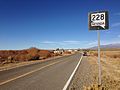 2013-10-20 15 43 53 View north from the south end of Nevada State Route 228.JPG 3,264 × 2,448; 2.97 MB
-
 2013-10-20 15 44 55 View north along Nevada State Route 228 just south of Jiggs.JPG 3,264 × 2,448; 2.81 MB
-
 2013-10-20 15 46 04 View north along Nevada State Route 228 in Jiggs.JPG 3,264 × 2,448; 2.8 MB
-
 2013-10-20 15 47 12 View south along Nevada State Route 228 entering Jiggs.JPG 3,264 × 2,448; 2.97 MB
-
 2013-10-20 15 49 10 View south along Nevada State Route 228 just north of Jiggs.JPG 3,264 × 2,448; 2.78 MB
-
 2013-10-20 15 53 37 View south along Nevada State Route 228 north of Jiggs.JPG 3,264 × 2,448; 2.93 MB
-
 2013-10-20 15 58 19 View of Ruby Dome from Nevada State Route 228.JPG 3,264 × 2,448; 3.14 MB
-

-

-

-

-

-

-

-
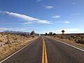
 2013-10-20 16 21 41 View north along Nevada State Route 228 in Spring Creek.JPG 3,264 × 2,448; 2.99 MB
-

-

-

-
 29th Army Ten-Miler 131020-A-EE013-554.jpg 3,571 × 2,757; 2.93 MB
-
 A home for Forest Nymphs - panoramio.jpg 2,592 × 3,888; 8.86 MB
-
 Above the clouds - panoramio (3).jpg 4,928 × 3,264; 3.01 MB
-
 Alanis Morissette 10 20 2013 -12 (10395265186).jpg 1,600 × 2,200; 3.87 MB
-
 Alanis Morissette 10 20 2013 -13 (10395221685).jpg 1,600 × 2,400; 2.3 MB
-
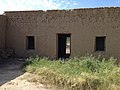
 Alvino House 1.JPG 3,264 × 2,448; 6.19 MB
-
 Alvino House 2.JPG 3,264 × 2,448; 6 MB
-
 Alvino House 3.JPG 3,264 × 2,448; 5.33 MB
-
 Alvino House 4.JPG 3,264 × 2,448; 4.69 MB
-
 American Cancer Society's Stride for Life 5K 131020-A-UW671-037.jpg 4,777 × 2,855; 2.11 MB
-
 Ardea alba (Great Egret) 38.jpg 5,184 × 3,456; 5.93 MB
-
 Ardea alba (Great Egret) 39.jpg 1,993 × 809; 616 KB
-
 Ardea alba (Great Egret) 40.jpg 5,184 × 3,456; 5.2 MB
-
 Ardea alba (Great Egret) 41.jpg 5,184 × 3,456; 4.28 MB
-
 Ardea alba (Great Egret) 42.jpg 5,184 × 3,456; 4.58 MB
-
 Aughanbaugh Road Vista (Revisited) (1) (10415404545).jpg 5,184 × 3,456; 15.55 MB
-
 Aughanbaugh Road Vista (Revisited) (2) (10415291744).jpg 5,184 × 3,100; 11.24 MB
-
 Aughanbaugh Road Vista (Revisited) (3) (10415314044).jpg 5,184 × 3,222; 12.95 MB
-
 Aughanbaugh Road Vista (Revisited) (4) (10415377386).jpg 4,709 × 3,181; 11.89 MB
-
 Aughanbaugh Road Vista (Revisited) (5) (10415358525).jpg 4,834 × 2,258; 10.32 MB
-
 Aughanbaugh Road Vista (Revisited) (6) (10395426296).jpg 6,353 × 3,440; 13.8 MB
-
 Aughanbaugh Road Vista (Revisited) (7) (10395596373).jpg 5,184 × 3,456; 9.98 MB
-
 Brown Pelican - Alcatraz (Pelecanus occidentalis occidentalis) (11332622164).jpg 4,083 × 2,722; 5.98 MB
-
 Bull Shoals Lake Misty Morning - panoramio.jpg 3,968 × 2,976; 3.1 MB
-
 Bunker Hill Mill WV1.jpg 5,184 × 3,900; 17.55 MB
-
 Bunker Hill MIll WV1.jpg 3,456 × 5,310; 18 MB
-
 Cloud Forest - panoramio (2).jpg 4,928 × 3,264; 3.38 MB
-
 Cows - panoramio (14).jpg 2,305 × 1,426; 874 KB
-
 Crowd gathered at "Hammer Boy" Banksy in Upper West Side October 2013.jpg 4,926 × 3,263; 12.55 MB
-
 Crystal Springs Rhododendron Garden, Portland (2013) - 22.JPG 3,000 × 4,000; 3.65 MB
-
 Diadophis punctatus Big Bend.JPG 2,448 × 3,264; 6.83 MB
-
 Dorothy Chandler Pavilion (10940243364).jpg 4,515 × 3,010; 2.45 MB
-
 Eastern side of Puerto Rico from El Yunque - panoramio.jpg 4,928 × 3,264; 3.58 MB
-
 Eastern side of Puerto Rico from the rain forest - panoramio.jpg 4,928 × 3,264; 3.25 MB
-
 El Yunque - panoramio.jpg 4,928 × 3,264; 6.27 MB
-
 El Yunque peak - panoramio.jpg 4,928 × 3,264; 3.99 MB
-
 Evening at El Yunque - panoramio.jpg 4,928 × 3,264; 4.73 MB
-
 Evening in the cloud forest - panoramio.jpg 4,928 × 3,264; 4.48 MB
-
 Fall Colors on the Webster Trail - panoramio.jpg 3,888 × 2,592; 13.46 MB
-
 Farm - panoramio (32).jpg 5,184 × 3,456; 4.61 MB
-
 Field and sky - panoramio.jpg 5,184 × 3,456; 4.13 MB
-
 Ghouls, goblins and monsters await patrons at Terror Town 131020-M-JR212-028.jpg 5,760 × 3,840; 7.14 MB
-
 Ghouls, goblins and monsters await patrons at Terror Town 131020-M-JR212-032.jpg 5,760 × 3,840; 2.89 MB
-
 Ghouls, goblins and monsters await patrons at Terror Town 131020-M-JR212-035.jpg 5,760 × 3,840; 3.1 MB
-
 Ghouls, goblins and monsters await patrons at Terror Town 131020-M-JR212-055.jpg 3,840 × 5,760; 2.02 MB
-
 Ghouls, goblins and monsters await patrons at Terror Town 131020-M-JR212-064.jpg 5,760 × 3,840; 1.77 MB
-
 Ghouls, goblins and monsters await patrons at Terror Town 131020-M-JR212-087.jpg 5,760 × 3,840; 2.77 MB
-
 Ghouls, goblins and monsters await Patrons at Terror Town 131020-M-JR212-092.jpg 5,760 × 3,840; 2.24 MB
-
 Ghouls, goblins and monsters await patrons at Terror Town 131020-M-JR212-096.jpg 5,760 × 3,840; 2.99 MB
-
 Ghouls, goblins and monsters await patrons at Terror Town 131020-M-JR212-108.jpg 3,840 × 5,760; 2.94 MB
-
 Ghouls, goblins, monsters await patrons at Terror Town 131020-M-JR212-010.jpg 3,840 × 5,760; 7.15 MB
-
 Gill’s Rock on Highway 42.jpg 6,000 × 4,000; 7.43 MB
-
 Goddess Fitness Dance - panoramio.jpg 3,264 × 2,448; 2.17 MB
-
 Goleta Beach (2013) 07.JPG 4,512 × 3,000; 4.89 MB
-
 Goleta Beach (2013) 08.JPG 4,512 × 3,000; 6.52 MB
-
 Goleta Beach (2013) 16.JPG 4,512 × 3,000; 6.82 MB
-
 Goleta Beach (2013) 17.JPG 4,512 × 3,000; 5.73 MB
-
 Goleta Beach (2013) 18.JPG 4,512 × 3,000; 5.65 MB
-
 Goleta Beach (2013) 19.JPG 923 × 1,496; 542 KB
-
 Goleta Beach (2013) 20.JPG 4,512 × 3,000; 4.96 MB
-
 Guard's Military Police honored for Cuba service 131020-Z-ZZ999-005.jpg 3,000 × 1,987; 848 KB
-
 Guard's Military Police honored for Cuba service 131020-Z-ZZ999-006.jpg 3,000 × 1,987; 1.03 MB
-
 Guard's Military Police honored for Cuba service 131020-Z-ZZ999-008.jpg 3,000 × 2,009; 937 KB
-
 Holeb Beach - panoramio.jpg 2,815 × 1,583; 1.23 MB
-
 Island of culebra and St Thomas - panoramio.jpg 4,652 × 3,082; 2.73 MB
-
 JBLM soldiers run for personal records in Army 10-miler 131020-A-ER359-062.jpg 1,024 × 683; 180 KB
-
 Kalbfleisch Road Vista (10433274465).jpg 4,693 × 2,543; 11.58 MB
-
 Kansas Guardsmen go to work in Colorado 131020-Z-AB123-431.jpg 1,400 × 2,100; 2.32 MB
-
 Lia Hona Lodge Chimney - panoramio.jpg 2,592 × 3,888; 8.59 MB
-
 Lia Hona Lodge HDR - panoramio.jpg 3,881 × 2,579; 12.12 MB
-
 Adventure Quest Raceway all lined up ready to go.JPG 4,320 × 3,240; 4.42 MB
-
 Alapaha Trail sign at Wild Adventures.JPG 4,320 × 3,240; 4.42 MB
-
 Bengal Tiger at Wild Adventures.JPG 4,320 × 3,240; 4.5 MB
-
 Billy Goat at Wild Adventures.JPG 4,320 × 3,240; 4.55 MB
-
 Chickens at Wild Adventures 2.JPG 4,320 × 3,240; 4.38 MB
-
 Chickens at Wild Adventures.JPG 4,320 × 3,240; 4.5 MB
-
 Ducks and chicks at Wild Adventures.JPG 4,320 × 3,240; 4.39 MB
-
 Ducks at Wild Adventures.JPG 4,320 × 3,240; 4.49 MB
-
 Giraffes at Wild Adventures 2.JPG 4,320 × 3,240; 4.44 MB
-
 Giraffes at Wild Adventures.JPG 4,320 × 3,240; 4.49 MB
-
 Goats at Wild Adventures.JPG 4,320 × 3,240; 4.48 MB
-
 Macaws at Wild Adventures 1.JPG 4,320 × 3,240; 4.33 MB
-
 Macaws at Wild Adventures 2.JPG 4,320 × 3,240; 4.44 MB
-
 Rabbits at Wild Adventures.JPG 4,320 × 3,240; 4.46 MB
-
 Sandhill Cranes at Wild Adventures.JPG 4,320 × 3,240; 4.42 MB
-
 Wild Adventures Bird House 102013 1.JPG 4,320 × 3,240; 4.38 MB
-
 Wild Adventures Bird House 102013 10.JPG 4,320 × 3,240; 4.48 MB
-
 Wild Adventures Bird House 102013 11.JPG 4,320 × 3,240; 4.41 MB
-
 Wild Adventures Bird House 102013 2.JPG 4,320 × 3,240; 4.43 MB
-
 Wild Adventures Bird House 102013 3.JPG 4,320 × 3,240; 4.44 MB
-
 Wild Adventures Bird House 102013 4.JPG 4,320 × 3,240; 4.39 MB
-
 Wild Adventures Bird House 102013 5.JPG 4,320 × 3,240; 4.41 MB
-
 Wild Adventures Bird House 102013 6.JPG 4,320 × 3,240; 4.53 MB
-
 Wild Adventures Bird House 102013 7.JPG 4,320 × 3,240; 4.39 MB
-
 Wild Adventures Bird House 102013 8.JPG 4,320 × 3,240; 4.41 MB
-
 Wild Adventures Bird House 102013 9.JPG 4,320 × 3,240; 4.45 MB
-
 Wild Adventures October 2013.JPG 4,320 × 3,240; 4.49 MB
-
 YoYo in Motion at Wild Adventures.JPG 4,320 × 3,240; 4.36 MB
-
 Middleway HD1.jpg 5,010 × 3,054; 17.4 MB
-
 Miller rd - panoramio.jpg 5,184 × 3,456; 2.63 MB
-
 Motivation (10700526063).jpg 3,920 × 2,204; 2.22 MB
-
 Mule Ears Spring 1.JPG 3,264 × 2,448; 6.35 MB
-
 Mule Ears Spring 2.JPG 2,448 × 3,264; 8.28 MB
-
 Multifunctional Farm (10448544234).jpg 4,552 × 2,521; 8.03 MB
-
 No ball playing allowed (10700351345).jpg 2,204 × 3,920; 2.8 MB
-
 Northeast of Puerto Rico from the El Yunque Rain Forest - panoramio.jpg 4,928 × 3,264; 3.46 MB
-
 Northeast Puerto Rico from atop El Yunque - panoramio.jpg 4,928 × 3,264; 3.15 MB
-
 Oak Creek RV Park on Oct 19, 2013 - panoramio (1).jpg 5,184 × 3,456; 10.3 MB
-
 Oak Creek RV Park on Oct 19, 2013 - panoramio (2).jpg 5,184 × 3,456; 5.66 MB
-
 Oak Creek RV Park on Oct 19, 2013 - panoramio (3).jpg 5,184 × 3,456; 11.5 MB
-
 Oak Creek RV Park on Oct 19, 2013 - panoramio.jpg 5,184 × 3,456; 9.27 MB
-
 Old machinery Big Bend.JPG 3,264 × 2,448; 5.03 MB
-
 On the Thirty Restaurant and Wine Bar - panoramio.jpg 2,868 × 2,400; 2.57 MB
-
 Pierce Tower demolition (10700651373).jpg 2,204 × 3,920; 1.69 MB
-
 Port Townsend, WA 98368, USA - panoramio (2).jpg 2,448 × 2,448; 2 MB
-
 Port Townsend, WA 98368, USA - panoramio.jpg 2,448 × 2,448; 2.65 MB
-
 Protostropharia luteonitens 383438.jpg 3,648 × 1,918; 988 KB
-
 Radar towers - panoramio (1).jpg 4,928 × 3,264; 3.76 MB
-
 Radar towers - panoramio.jpg 4,928 × 3,264; 3.47 MB
-
 Radar towers atop a mountain at El Yunque rain forest - panoramio.jpg 4,928 × 3,264; 3.5 MB
-
 Road at el Yunque rain forest - panoramio.jpg 4,928 × 3,264; 7.32 MB


.jpg)

_2.4_miles_east_of_Elko_County_Route_717_(Jiggs_Road).JPG)
_2.4_miles_east_of_Elko_County_Route_717_(Jiggs_Road).JPG)


.JPG)
.JPG)
_where_it_intersects_Elko_County_Route_788_(Ruby_Valley_Road).JPG)


_north_of_the_headquarters_of_Ruby_Lake_National_Wildlife_Refuge.JPG)


_at_Harrison_Pass.JPG)
_at_Harrison_Pass.JPG)

_just_west_of_Harrison_Pass.JPG)
_at_the_beginning_of_pavement_just_west_of_Harrison_Pass.JPG)
_at_the_end_of_pavement_just_west_of_Harrison_Pass.JPG)


_towards_the_south_end_of_Elko_County_Route_717_(Jiggs_Road).JPG)
_towards_the_west_end_of_Elko_County_Route_718_(Harrison_Pass_Road).JPG)
.JPG)
.JPG)
_towards_Nevada_State_Route_228.JPG)


.jpg)
.jpg)
.jpg)


_38.jpg)
_40.jpg)
_41.jpg)
_42.jpg)
_(1)_(10415404545).jpg)
_(2)_(10415291744).jpg)
_(3)_(10415314044).jpg)
_(4)_(10415377386).jpg)
_(5)_(10415358525).jpg)
_(6)_(10395426296).jpg)
_(7)_(10395596373).jpg)
_(11332622164).jpg)


.jpg)
.jpg)

_-_22.JPG)

.jpg)


.jpg)


_07.JPG)
_08.JPG)
_16.JPG)
_17.JPG)
_18.JPG)
_19.JPG)
_20.JPG)


.jpg)


.jpg)


.jpg)
.jpg)


.jpg)
.jpg)
.jpg)


.jpg)
.jpg)


.jpg)


_towards_the_west_end_of_Elko_County_Route_718_(Harrison_Pass_Road).JPG)
_towards_Harrison_Pass.JPG)
_39.jpg)