Category:United States photographs taken on 2013-09-30
Jump to navigation
Jump to search
Countries of North America: Canada · Mexico · Panama · United States of America‡
‡: partly located in North America
‡: partly located in North America
Ok
| ← | Monday 30 September 2013 | → | ||
| ← | September 2013 | → | ||

United States of America photographs taken on 30 September 2013.
Image files should be categorized here automatically using {{taken on}} template. Direct categorisation is also possible, if automatic is impossible.
Media in category "United States photographs taken on 2013-09-30"
The following 200 files are in this category, out of 604 total.
(previous page) (next page)-
-
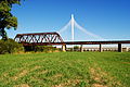
 Old State House, Washington St, Boston. - panoramio (2).jpg 3,688 × 2,457; 3.23 MB
-
 2nd Medical Battalion change of command ceremony 130930-M-IU187-104.jpg 2,560 × 3,276; 1.13 MB
-
 2nd Medical Battalion change of command ceremony 130930-M-IU187-130.jpg 1,864 × 2,296; 706 KB
-
 2nd Medical Battalion change of command ceremony 130930-M-IU187-198.jpg 2,560 × 3,360; 1.77 MB
-
 A. Marachowsky Building - panoramio.jpg 4,000 × 3,000; 2.8 MB
-
 Abandoned Home Depot Building - panoramio.jpg 4,000 × 3,000; 3.65 MB
-
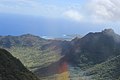
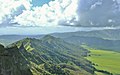
 Abrams Mountain SW.jpg 2,416 × 1,943; 1.42 MB
-
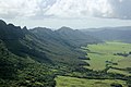
 Aerial View of Kauai From Helicopter Hawaii - panoramio (1).jpg 5,184 × 3,456; 5.51 MB
-
 Aerial View of Kauai From Helicopter Hawaii - panoramio (10).jpg 5,126 × 3,368; 3.76 MB
-
 Aerial View of Kauai From Helicopter Hawaii - panoramio (11).jpg 4,990 × 2,347; 3 MB
-
 Aerial View of Kauai From Helicopter Hawaii - panoramio (12).jpg 5,184 × 3,456; 2.67 MB
-
 Aerial View of Kauai From Helicopter Hawaii - panoramio (13).jpg 3,590 × 2,325; 1.85 MB
-
 Aerial View of Kauai From Helicopter Hawaii - panoramio (14).jpg 5,184 × 3,456; 5.05 MB
-
 Aerial View of Kauai From Helicopter Hawaii - panoramio (15).jpg 4,474 × 2,113; 2.35 MB
-
 Aerial View of Kauai From Helicopter Hawaii - panoramio (16).jpg 5,094 × 3,314; 3.52 MB
-
 Aerial View of Kauai From Helicopter Hawaii - panoramio (17).jpg 5,184 × 3,456; 2.96 MB
-
 Aerial View of Kauai From Helicopter Hawaii - panoramio (18).jpg 5,184 × 3,456; 2.26 MB
-
 Aerial View of Kauai From Helicopter Hawaii - panoramio (19).jpg 5,184 × 3,456; 2.51 MB
-
 Aerial View of Kauai From Helicopter Hawaii - panoramio (2).jpg 4,840 × 2,046; 3.53 MB
-
 Aerial View of Kauai From Helicopter Hawaii - panoramio (20).jpg 4,972 × 3,104; 3.28 MB
-
 Aerial View of Kauai From Helicopter Hawaii - panoramio (21).jpg 5,182 × 3,452; 3.94 MB
-
 Aerial View of Kauai From Helicopter Hawaii - panoramio (22).jpg 5,184 × 3,456; 5.65 MB
-
 Aerial View of Kauai From Helicopter Hawaii - panoramio (23).jpg 5,168 × 3,432; 4.03 MB
-
 Aerial View of Kauai From Helicopter Hawaii - panoramio (24).jpg 5,110 × 3,344; 5.98 MB
-
 Aerial View of Kauai From Helicopter Hawaii - panoramio (25).jpg 3,670 × 3,450; 6.37 MB
-
 Aerial View of Kauai From Helicopter Hawaii - panoramio (26).jpg 5,166 × 3,428; 3.81 MB
-
 Aerial View of Kauai From Helicopter Hawaii - panoramio (27).jpg 4,108 × 2,514; 3.05 MB
-
 Aerial View of Kauai From Helicopter Hawaii - panoramio (28).jpg 4,141 × 3,454; 6.93 MB
-
 Aerial View of Kauai From Helicopter Hawaii - panoramio (29).jpg 5,162 × 3,422; 4.96 MB
-
 Aerial View of Kauai From Helicopter Hawaii - panoramio (3).jpg 5,054 × 3,248; 5.45 MB
-
 Aerial View of Kauai From Helicopter Hawaii - panoramio (30).jpg 4,908 × 2,976; 3.98 MB
-
 Aerial View of Kauai From Helicopter Hawaii - panoramio (31).jpg 4,758 × 2,560; 4.7 MB
-
 Aerial View of Kauai From Helicopter Hawaii - panoramio (32).jpg 4,750 × 2,312; 3.71 MB
-
 Aerial View of Kauai From Helicopter Hawaii - panoramio (33).jpg 5,184 × 3,456; 3.64 MB
-
 Aerial View of Kauai From Helicopter Hawaii - panoramio (34).jpg 2,948 × 4,896; 3.67 MB
-
 Aerial View of Kauai From Helicopter Hawaii - panoramio (35).jpg 4,972 × 3,104; 7.5 MB
-
 Aerial View of Kauai From Helicopter Hawaii - panoramio (36).jpg 5,010 × 3,172; 4.48 MB
-
 Aerial View of Kauai From Helicopter Hawaii - panoramio (37).jpg 3,422 × 5,162; 6.79 MB
-
 Aerial View of Kauai From Helicopter Hawaii - panoramio (38).jpg 3,540 × 3,144; 4.08 MB
-
 Aerial View of Kauai From Helicopter Hawaii - panoramio (39).jpg 4,746 × 2,366; 2.28 MB
-
 Aerial View of Kauai From Helicopter Hawaii - panoramio (4).jpg 5,036 × 3,220; 5.8 MB
-
 Aerial View of Kauai From Helicopter Hawaii - panoramio (40).jpg 4,642 × 2,054; 2.6 MB
-
 Aerial View of Kauai From Helicopter Hawaii - panoramio (41).jpg 2,313 × 2,361; 1.6 MB
-
 Aerial View of Kauai From Helicopter Hawaii - panoramio (42).jpg 4,750 × 2,312; 3.79 MB
-
 Aerial View of Kauai From Helicopter Hawaii - panoramio (43).jpg 5,184 × 3,456; 7.32 MB
-
 Aerial View of Kauai From Helicopter Hawaii - panoramio (44).jpg 4,806 × 2,714; 3.38 MB
-
 Aerial View of Kauai From Helicopter Hawaii - panoramio (45).jpg 3,046 × 2,783; 1.91 MB
-
 Aerial View of Kauai From Helicopter Hawaii - panoramio (46).jpg 3,972 × 3,454; 4.34 MB
-
 Aerial View of Kauai From Helicopter Hawaii - panoramio (47).jpg 5,126 × 3,368; 4.03 MB
-
 Aerial View of Kauai From Helicopter Hawaii - panoramio (48).jpg 4,852 × 2,840; 3.14 MB
-
 Aerial View of Kauai From Helicopter Hawaii - panoramio (49).jpg 5,170 × 3,434; 4.11 MB
-
 Aerial View of Kauai From Helicopter Hawaii - panoramio (5).jpg 5,184 × 3,456; 2.57 MB
-
 Aerial View of Kauai From Helicopter Hawaii - panoramio (50).jpg 5,184 × 3,456; 3.68 MB
-
 Aerial View of Kauai From Helicopter Hawaii - panoramio (51).jpg 2,954 × 3,168; 2.18 MB
-
 Aerial View of Kauai From Helicopter Hawaii - panoramio (52).jpg 5,028 × 2,792; 3.31 MB
-
 Aerial View of Kauai From Helicopter Hawaii - panoramio (53).jpg 5,184 × 2,774; 3.65 MB
-
 Aerial View of Kauai From Helicopter Hawaii - panoramio (54).jpg 4,335 × 2,809; 2.77 MB
-
 Aerial View of Kauai From Helicopter Hawaii - panoramio (55).jpg 4,013 × 3,290; 2.63 MB
-
 Aerial View of Kauai From Helicopter Hawaii - panoramio (56).jpg 5,120 × 3,358; 4.22 MB
-
 Aerial View of Kauai From Helicopter Hawaii - panoramio (57).jpg 3,162 × 3,169; 3.45 MB
-
 Aerial View of Kauai From Helicopter Hawaii - panoramio (58).jpg 5,168 × 2,435; 2.62 MB
-
 Aerial View of Kauai From Helicopter Hawaii - panoramio (59).jpg 3,446 × 4,436; 4.14 MB
-
 Aerial View of Kauai From Helicopter Hawaii - panoramio (6).jpg 5,088 × 3,308; 4.97 MB
-
 Aerial View of Kauai From Helicopter Hawaii - panoramio (60).jpg 2,936 × 4,870; 3.22 MB
-
 Aerial View of Kauai From Helicopter Hawaii - panoramio (61).jpg 3,456 × 5,184; 6.4 MB
-
 Aerial View of Kauai From Helicopter Hawaii - panoramio (62).jpg 4,627 × 2,183; 2.09 MB
-
 Aerial View of Kauai From Helicopter Hawaii - panoramio (63).jpg 5,184 × 2,307; 2.87 MB
-
 Aerial View of Kauai From Helicopter Hawaii - panoramio (64).jpg 5,182 × 3,452; 3.49 MB
-
 Aerial View of Kauai From Helicopter Hawaii - panoramio (65).jpg 4,936 × 3,034; 3.95 MB
-
 Aerial View of Kauai From Helicopter Hawaii - panoramio (66).jpg 5,074 × 3,282; 5.36 MB
-
 Aerial View of Kauai From Helicopter Hawaii - panoramio (67).jpg 5,072 × 3,280; 4.23 MB
-
 Aerial View of Kauai From Helicopter Hawaii - panoramio (68).jpg 5,018 × 3,188; 4.33 MB
-
 Aerial View of Kauai From Helicopter Hawaii - panoramio (69).jpg 4,168 × 3,256; 3.79 MB
-
 Aerial View of Kauai From Helicopter Hawaii - panoramio (7).jpg 5,184 × 3,456; 6.5 MB
-
 Aerial View of Kauai From Helicopter Hawaii - panoramio (70).jpg 5,082 × 3,298; 3.32 MB
-
 Aerial View of Kauai From Helicopter Hawaii - panoramio (71).jpg 5,132 × 3,378; 4.15 MB
-
 Aerial View of Kauai From Helicopter Hawaii - panoramio (8).jpg 4,924 × 3,008; 4.02 MB
-
 Aerial View of Kauai From Helicopter Hawaii - panoramio (9).jpg 3,912 × 3,410; 2.4 MB
-
 Aerial View of Kauai From Helicopter Hawaii - panoramio.jpg 5,148 × 2,995; 4.51 MB
-
 Ailman House 2.jpg 640 × 480; 578 KB
-
 Ailman House became the Municipal Museum in 1970.jpg 640 × 480; 452 KB
-
 Al Ringling Theatre - panoramio.jpg 4,000 × 3,000; 3.78 MB
-
 Albion Historic District.JPG 6,000 × 4,000; 6.46 MB
-
 Albrecht C. Ringling House - panoramio.jpg 4,000 × 3,000; 4.96 MB
-
 ALDI - panoramio.jpg 4,000 × 3,000; 2.8 MB
-
 Alexander Herschel and Pauline G. McMicken House.jpg 2,324 × 2,448; 2.37 MB
-
 American Packaging Corporation - panoramio.jpg 4,000 × 3,000; 3.25 MB
-
 AmericInn® Lodge ^ Suites - panoramio (1).jpg 3,954 × 2,411; 1.77 MB
-
 Annunciation Catholic Church Fox Lake, WI - panoramio.jpg 4,000 × 3,000; 3.28 MB
-
 Arcadia MD1.jpg 4,872 × 3,700; 13.08 MB
-
 ATC Electrical Substation - panoramio (2).jpg 4,000 × 3,000; 2.64 MB
-
 ATC Friesland Substation - panoramio.jpg 4,000 × 3,000; 2.84 MB
-
 ATC Power Line - panoramio (86).jpg 3,000 × 4,000; 3.33 MB
-
 ATC Power Line - panoramio (87).jpg 4,000 × 3,000; 2.22 MB
-
 ATC Power Line ^ Canadian Pacific Railway Tracks - panoramio.jpg 3,954 × 2,571; 1.71 MB
-
 ATC Power Line ^ Glacier Hills Wind Energy Center - panoramio.jpg 3,289 × 3,000; 2.22 MB
-
 August Kleist Studio, Porter's Jewelry Building - panoramio.jpg 4,000 × 3,000; 3.33 MB
-
 Back Alley in Portage - panoramio.jpg 4,000 × 3,000; 3.82 MB
-
 Baraboo Banner.jpg 4,000 × 571; 937 KB
-
 Baraboo Fire Department - panoramio.jpg 4,000 × 3,000; 2.69 MB
-
 Baraboo Municipal Building ^ Police Department - panoramio.jpg 4,000 × 3,000; 3.51 MB
-
 Baraboo Range - panoramio (5).jpg 3,954 × 2,273; 2.2 MB
-
 Baraboo Range - panoramio (6).jpg 4,000 × 3,000; 2.5 MB
-
 Barker Civic Center Michigan City - panoramio.jpg 4,000 × 2,670; 2.63 MB
-
 Barn and Silo - panoramio (2).jpg 4,000 × 3,000; 2.62 MB
-
 Barn near Beaver Dam - panoramio.jpg 4,000 × 3,000; 2.67 MB
-
 Barn with Two Silos near Randolph - panoramio.jpg 3,832 × 2,686; 3.67 MB
-
 Barns on Highway 33 - panoramio.jpg 4,000 × 3,000; 2.78 MB
-
 Beattie Block - panoramio.jpg 3,000 × 4,000; 4.13 MB
-
 Beaver Dam 151 Business Park Water Tower - panoramio.jpg 3,000 × 4,000; 2 MB
-
 Beaver Dam Ford® - panoramio.jpg 4,000 × 3,000; 3.58 MB
-
 Beaver Dam High School - panoramio.jpg 4,000 × 3,000; 3.42 MB
-
 Beaver Dam Pond with a Fountain - panoramio.jpg 4,000 × 3,000; 2.41 MB
-
 Beaver Dam Water Plant - panoramio.jpg 3,778 × 2,740; 2.94 MB
-
 Best Western - panoramio.jpg 3,977 × 2,349; 1.87 MB
-
 Bethlehem Lutheran Church Portage, WI - panoramio.jpg 4,000 × 3,000; 2.83 MB
-
 Boston Common, Boston. - panoramio (1).jpg 2,248 × 3,371; 2.15 MB
-
 Boston Common, Boston. - panoramio.jpg 2,517 × 3,780; 2.21 MB
-
 Boston Public Garden, Boston. - panoramio (1).jpg 3,301 × 1,855; 3.27 MB
-
 Boston Public Garden, Boston. - panoramio (2).jpg 2,664 × 4,000; 3.18 MB
-
 Boston Public Garden, Boston. - panoramio (3).jpg 3,954 × 2,220; 3.25 MB
-
 Boston Public Garden, Boston. - panoramio (4).jpg 3,903 × 2,192; 4.39 MB
-
 Boston Public Garden, Boston. - panoramio (5).jpg 2,480 × 3,733; 2.99 MB
-
 Boston Public Garden, Boston. - panoramio (6).jpg 3,965 × 2,640; 3.59 MB
-
 Boston Public Garden, Boston. - panoramio.jpg 3,766 × 2,510; 5.2 MB
-
 Boston Store - panoramio (1).jpg 3,931 × 2,556; 1.88 MB
-
 Boston Women's Memorial, Commonwealth Ave, Boston. - panoramio (1).jpg 2,595 × 3,896; 2.36 MB
-
 Boston Women's Memorial, Commonwealth Ave, Boston. - panoramio (2).jpg 3,965 × 2,640; 3.46 MB
-
 Boston Women's Memorial, Commonwealth Ave, Boston. - panoramio (3).jpg 2,496 × 2,496; 2.29 MB
-
 Boston Women's Memorial, Commonwealth Ave, Boston. - panoramio.jpg 2,532 × 3,376; 2.75 MB
-
 Bowden Hall 1.jpg 640 × 480; 560 KB
-
 Bowden Hall 2.jpg 640 × 480; 419 KB
-
 Brooklyn=DSC06898---Industrial Complex at 221 McKibbin Street.JPG 3,072 × 2,304; 3.11 MB
-
 Brooklyn=DSC06899---Industrial Complex at 221 McKibbin Street.JPG 3,072 × 2,304; 2.88 MB
-
 Buckeystown MD1.jpg 5,207 × 3,496; 13.62 MB
-
 BURGER KING® - panoramio (5).jpg 4,000 × 3,000; 2.85 MB
-
 Buried Mountain Range - panoramio.jpg 4,000 × 3,000; 2.69 MB
-
 Cactus Club - panoramio.jpg 4,000 × 3,000; 2.77 MB
-
 Cambria Freight Station.JPG 2,521 × 1,207; 1.14 MB
-
 Capri Steak House - panoramio.jpg 4,000 × 3,000; 3.01 MB
-
 Carter's Creek on the Rappahannock River, Irvington, Virginia - panoramio (1).jpg 4,288 × 2,848; 1.9 MB
-
 Carter's Creek on the Rappahannock River, Irvington, Virginia - panoramio.jpg 4,288 × 2,432; 2.46 MB
-
 Cascade Mountain - panoramio (3).jpg 4,000 × 3,000; 2.86 MB
-
 Cathay Garden - panoramio.jpg 3,977 × 2,610; 2.05 MB
-
 Cawley Building - panoramio.jpg 4,000 × 3,000; 4.28 MB
-
 Cell Tower - panoramio (17).jpg 4,000 × 3,000; 2.24 MB
-
 Cell Tower - panoramio (18).jpg 4,000 × 3,000; 1.96 MB
-
 Cell Tower - panoramio (19).jpg 4,000 × 3,000; 2.35 MB
-
 Cell Tower - panoramio (20).jpg 4,000 × 3,000; 2.34 MB
-
 Cell Tower - panoramio (21).jpg 4,000 × 3,000; 2.42 MB
-
 Cell Tower - panoramio (22).jpg 4,000 × 3,000; 2.64 MB
-
 Cell Tower near Beaver Dam - panoramio.jpg 4,000 × 3,000; 2.43 MB
-
 Central Heating plant - relief2.jpg 383 × 292; 81 KB
-
 Cheek-Spruill House (Dunwoody Farmhouse).jpg 2,499 × 2,000; 1.13 MB
-
 Cheek-Spruill House.jpg 2,989 × 1,987; 1.62 MB
-
 Chicago (10069635805).jpg 2,048 × 1,536; 527 KB
-
 Christ Episcopal Church crosses and sky.JPG 2,848 × 4,288; 3.73 MB
-
 Christ Episcopal Church facade detail.JPG 4,288 × 2,848; 4.37 MB
-
 Christ Episcopal Church facade distant.JPG 2,848 × 4,288; 6.2 MB
-
 Christ Episcopal Church facade with crosses.JPG 2,848 × 4,288; 4.57 MB
-
 Christian Kurth House - panoramio.jpg 4,000 × 3,000; 6.11 MB
-

-
 Club 51 - panoramio.jpg 3,335 × 2,648; 2.16 MB
-
 Cold Spring Harbor Beach Club.JPG 3,648 × 2,736; 2.06 MB
-
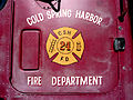
 Cold Spring Harbor Fire Department Plaque.JPG 3,648 × 2,736; 4.5 MB
-
 Cold Spring Harbor Fire District Hook and Ladder Company Building.JPG 3,321 × 3,365; 2.45 MB
-
 Cold Spring Harbor Fire Truck.JPG 3,648 × 2,736; 2.85 MB
-
 Columbia County Farm - panoramio.jpg 4,000 × 3,000; 3.86 MB
-
 Columbia County Jail - panoramio.jpg 4,000 × 3,000; 3.59 MB
-
 Columbia County Law Enforcement Center - panoramio.jpg 4,000 × 3,000; 3.38 MB
-
 Columbia Energy Center in the Distance - panoramio.jpg 4,000 × 3,000; 2.56 MB
-
 Columbia Energy Center Stacks - panoramio.jpg 4,000 × 3,000; 2.63 MB
-
 Columbus City Hall - panoramio (1).jpg 4,000 × 3,000; 4.15 MB
-
 Columbus Elementary School - panoramio.jpg 4,000 × 3,000; 2.93 MB
-
 Columbus Family Restaurant - panoramio.jpg 3,977 × 2,464; 2.04 MB
-
 Columbus Fire Department - panoramio.jpg 4,000 × 3,000; 3.06 MB
-
 Columbus Hospital - panoramio.jpg 4,000 × 3,000; 3.21 MB
-
 Columbus Middle School - panoramio.jpg 4,000 × 3,000; 3.87 MB
-
 Columbus Post Office 53925 - panoramio.jpg 4,000 × 3,000; 3.53 MB
-
 Columbus Public Safety Building - panoramio.jpg 4,000 × 3,000; 3.41 MB
-
 Columbus United Methodist Church - panoramio.jpg 4,000 × 3,000; 3.72 MB
-
 Communication Tower - panoramio (4).jpg 4,000 × 3,000; 2.5 MB
-
 Cottonwood Bar ^ Grill ^ Shamrock Bar and Grill - panoramio.jpg 4,000 × 3,000; 4.06 MB
-
 County Building and Park.JPG 3,264 × 2,448; 3.22 MB
-
 Court St, Boston. - panoramio.jpg 1,948 × 3,466; 2.27 MB
-
 Craig's Popcorn Corner - panoramio.jpg 4,000 × 3,000; 4.07 MB
-
 Culver's® - panoramio (3).jpg 4,000 × 3,000; 3.16 MB
-
 Dairy Farm - panoramio (4).jpg 4,000 × 3,000; 2.82 MB
-
 Dairy Farm at the Baraboo Narrows - panoramio.jpg 4,000 × 3,000; 2.77 MB
-
 Dairy Farm near Beaver Dam - panoramio.jpg 3,924 × 2,418; 1.79 MB
-
 Dairy Farm with Four Silos - panoramio (1).jpg 4,000 × 3,000; 2.36 MB
-
 Dairy Farm with Four Silos - panoramio (2).jpg 3,977 × 2,510; 2.54 MB
-
 Dairy Farm with Three Silos - panoramio (3).jpg 4,000 × 3,000; 3.15 MB
-
 Dairy Farms - panoramio (1).jpg 4,000 × 3,000; 3.15 MB
-
 Dairy Farms - panoramio.jpg 4,000 × 3,000; 2.89 MB
-
 Dane County Farmland - panoramio (2).jpg 4,000 × 3,000; 2.47 MB
-
 David S. Conger House - panoramio.jpg 4,000 × 3,000; 5.55 MB
-
 Deforest High School - panoramio.jpg 4,000 × 3,000; 2.52 MB
-
 Deforest High School Football Stadium - panoramio.jpg 4,000 × 3,000; 2.47 MB
.jpg)
.jpg)


.jpg)
.jpg)
.jpg)
.jpg)
.jpg)
.jpg)
.jpg)
.jpg)
.jpg)
.jpg)
.jpg)
.jpg)
.jpg)
.jpg)
.jpg)
.jpg)
.jpg)
.jpg)
.jpg)
.jpg)
.jpg)
.jpg)
.jpg)
.jpg)
.jpg)
.jpg)
.jpg)
.jpg)
.jpg)
.jpg)
.jpg)
.jpg)
.jpg)
.jpg)
.jpg)
.jpg)
.jpg)
.jpg)
.jpg)
.jpg)
.jpg)
.jpg)
.jpg)
.jpg)
.jpg)
.jpg)
.jpg)
.jpg)
.jpg)
.jpg)
.jpg)
.jpg)
.jpg)
.jpg)
.jpg)
.jpg)
.jpg)
.jpg)
.jpg)
.jpg)
.jpg)
.jpg)
.jpg)
.jpg)
.jpg)
.jpg)
.jpg)
.jpg)
.jpg)
.jpg)
.jpg)


.jpg)


.jpg)

.jpg)
.jpg)


.jpg)
.jpg)

.jpg)


.jpg)

.jpg)
.jpg)
.jpg)
.jpg)
.jpg)
.jpg)

.jpg)
.jpg)
.jpg)
.jpg)


.jpg)


.jpg)

.jpg)


.jpg)
.jpg)
.jpg)
.jpg)
.jpg)
.jpg)


.jpg)

.jpg)


.jpg)


.jpg)


.jpg)
.jpg)


.jpg)
.jpg)
.jpg)
.jpg)

.jpg)


