Category:United States photographs taken on 2008-10-18
Jump to navigation
Jump to search
Countries of North America: Canada · Cuba · Mexico · United States of America‡
‡: partly located in North America
‡: partly located in North America
| ← | Saturday 18 October 2008 | → | ||
| ← | October 2008 | → | ||

United States of America photographs taken on 18 October 2008.
Image files should be categorized here automatically using {{taken on}} template. Direct categorisation is also possible, if automatic is impossible.
Subcategories
This category has only the following subcategory.
Media in category "United States photographs taken on 2008-10-18"
The following 200 files are in this category, out of 208 total.
(previous page) (next page)-
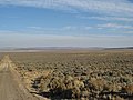
 61 miles to Gerlach.... (3071450561).jpg 3,264 × 2,448; 1.02 MB
-
 Abandoned (2953661062).jpg 1,600 × 1,200; 1.13 MB
-
 Aermotor windmill and tank (3070985325).jpg 3,264 × 2,448; 458 KB
-
 Aermotor windmill and tank (3070985425).jpg 2,448 × 3,264; 474 KB
-
 Basalt ? (3071450989).jpg 3,264 × 2,448; 1.12 MB
-
 Basalt ? (3071451331).jpg 3,264 × 2,448; 1.14 MB
-
 Basalt? Sheldon National Wildlfe Refuge (3071825298).jpg 3,264 × 2,448; 916 KB
-
 Beekman Friends Meeting House ruins, LaGrangeville, NY.jpg 2,134 × 1,562; 3.38 MB
-
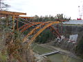
 Bigelow Bridge - 2008.jpg 1,024 × 768; 309 KB
-
 Black Rock Desert (3071453507).jpg 3,264 × 2,448; 694 KB
-
 Black Rock Desert (3071453747).jpg 3,264 × 2,448; 457 KB
-
 Black Rock Desert (3072289694).jpg 3,264 × 2,448; 932 KB
-
 Black Rock Desert (3072290210).jpg 3,264 × 2,448; 538 KB
-
 Bush joined by Sarkozy and Barroso at Camp David.jpg 515 × 343; 82 KB
-
 Bush, Sarkozy and Barroso - Camp David (2008-10-18).jpg 515 × 343; 78 KB
-
 Butte, Washoe County, Nevada (3070984139).jpg 3,264 × 2,448; 1.15 MB
-
 Butte, Washoe County, Nevada (3070984309).jpg 3,264 × 2,448; 1,006 KB
-
 Bykenhulle, Hopewell Junction, NY.jpg 2,150 × 1,450; 2.83 MB
-
 Catchbasin.jpg 3,396 × 2,244; 8.38 MB
-
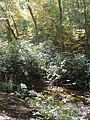
 Catherine Chevalier Woods Forest Preserve - panoramio (3).jpg 1,600 × 1,200; 579 KB
-
 Catherine Chevalier Woods Forest Preserve - panoramio (5).jpg 1,600 × 1,200; 731 KB
-
 Catherine Chevalier Woods Forest Preserve - panoramio (6).jpg 1,600 × 1,200; 651 KB
-
 Cattaraugus County Route 86-2 signage.jpg 1,024 × 768; 307 KB
-
 Cattle on Hwy 8A Nevada (3070911889).jpg 3,264 × 2,448; 1.18 MB
-
 Central Park baseball field in October 2008.jpg 3,316 × 2,487; 5.4 MB
-
 Classic old GMC? truck (3071658040).jpg 3,264 × 2,448; 847 KB
-
 Clouds Rest arete.jpg 1,280 × 960; 238 KB
-
 Coleman Station, NY, landscape.jpg 2,500 × 1,642; 3.6 MB
-
 Colorado River in the Distance - panoramio.jpg 3,264 × 2,448; 2.51 MB
-
 Cosmo Club 122 E66 jeh.JPG 2,304 × 2,625; 809 KB
-
 Dakin-Coleman Farm, Millerton, NY.jpg 2,500 × 1,672; 3.19 MB
-
 Desert ecology (3070986173).jpg 3,264 × 2,448; 1.49 MB
-
 Desert Spider - panoramio.jpg 3,264 × 2,448; 2.82 MB
-
 Downtown Sharon Valley, CT.jpg 1,956 × 1,556; 2.57 MB
-
 Downtown Wassaic, NY.jpg 1,820 × 1,322; 1.86 MB
-
 DSC 6688 89 90 copy - Flickr - Jim Sorbie.jpg 3,692 × 2,501; 1.75 MB
-
 Dust cloud - Nevada desrt road (3071822028).jpg 3,264 × 2,448; 560 KB
-
 Dwelling on edge of Black Rock Desert (3072289936).jpg 2,911 × 1,741; 373 KB
-
 Dwelling? Middle Alkali Lake (3071723484).jpg 3,264 × 2,212; 927 KB
-
 Early morning shadow, Middle Alkali Lake (3070887215).jpg 3,264 × 2,448; 1.3 MB
-
 East Branch Wappingers Creek at Bloomvale, NY.jpg 2,014 × 1,544; 3.53 MB
-
 East Side Access infocent jeh.JPG 2,720 × 1,696; 613 KB
-
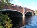 Eliot bridge cambridge.JPG 3,072 × 2,304; 1.41 MB
-
 Entering High Rock Canyon National Conservation Area (3071447869).jpg 3,264 × 2,448; 1.26 MB
-
 Entering High Rock Canyon National Conservation Area (3071448239).jpg 3,264 × 2,448; 1.23 MB
-
 Entering High Rock Canyon National Conservation Area (3071448589).jpg 3,264 × 2,448; 1.28 MB
-
 Ezra Clark House, Millerton, NY.jpg 2,144 × 1,518; 3.78 MB
-
 Fall - panoramio - Ron Shawley (1).jpg 1,920 × 1,080; 1.71 MB
-
 Fall - panoramio - Ron Shawley.jpg 1,920 × 1,080; 2.13 MB
-
 Fall in the Laurels - panoramio.jpg 1,920 × 1,080; 1.67 MB
-
 Fall is here (2953834096).jpg 2,297 × 1,485; 240 KB
-
 Fall season - panoramio.jpg 1,920 × 1,080; 1.65 MB
-
 Farm SE of Olympia, WA, Oct2008 - panoramio.jpg 901 × 1,024; 738 KB
-
 Flat tire above the Black Rock Desert (3071453927).jpg 3,264 × 2,448; 800 KB
-
 For email ssmod 8x10 barge canal fall 2008 IMG 0282.jpg 533 × 400; 201 KB
-
 Grafton Village Overlook - panoramio.jpg 2,856 × 2,142; 2.52 MB
-
 Granville CTA Red Line.jpg 2,592 × 1,944; 1.77 MB
-
 Greenacre Pk 215 E51 jeh.JPG 3,072 × 2,304; 721 KB
-
 Hiddenhurst, Millerton, NY.jpg 2,226 × 1,452; 2.56 MB
-
 High Rock Canyon turnoff (3070984625).jpg 1,989 × 1,593; 244 KB
-
 Indian Rock Schoolhouse, Amenia, NY.jpg 2,502 × 1,850; 3.57 MB
-
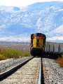
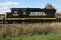 Indiana Northeastern 2230.jpg 1,024 × 673; 204 KB
-
 Interesting geology - what is this amphitheater? (3070986621).jpg 3,264 × 2,448; 1.09 MB
-
 Interesting geology - what is this amphitheater? (3070986987).jpg 3,264 × 2,448; 994 KB
-
 It's a thing of beauty - panoramio.jpg 1,920 × 1,080; 1.9 MB
-
 Kayak Fishing at Okmulgee Lake - Flickr - FreeWine.jpg 650 × 814; 157 KB
-
 Knapp's Covered Bridge 1.JPG 2,048 × 1,536; 1.11 MB
-
 Knapp's Covered Bridge 2.JPG 1,536 × 2,048; 861 KB
-
 Knapp's Covered Bridge 3.jpg 2,574 × 1,969; 747 KB
-
 Knapp's Covered Bridge 4.JPG 2,048 × 1,536; 669 KB
-
 Knapp's Covered Bridge 5.jpg 2,586 × 1,974; 589 KB
-
 Knapp's Covered Bridge 6.jpg 3,005 × 2,025; 1,022 KB
-
 Knapp's Covered Bridge 8.JPG 2,048 × 1,536; 1.11 MB
-
 Krylon Dulling Spray at Photography Studio - Photographing Food (17379793476).jpg 1,200 × 1,555; 1.24 MB
-
 Last Leaves (2988157592).jpg 1,021 × 768; 146 KB
-
 Laurel ridge state park sign - panoramio.jpg 1,920 × 1,080; 1.45 MB
-
 Leaving Sheldon National Wildlfe Refuge (3070989697).jpg 3,264 × 2,448; 1.38 MB
-
 Les feuilles mortes (2953012997).jpg 2,297 × 1,526; 354 KB
-
 Lewis Mumford House, Amenia, NY.jpg 1,862 × 1,458; 2.75 MB
-
 License Plate memorial - North end of Black Rock Desert (3071452615).jpg 3,264 × 2,448; 1.21 MB
-
 Lizzard 1 Shawnee NP.jpg 4,186 × 2,730; 4.37 MB
-
 Looking west to Alturas (3071701000).jpg 3,264 × 2,448; 406 KB
-
 Looking west to Cedarville, California (3070886765).jpg 3,264 × 2,448; 815 KB
-
 Lunch with Joe Biden (2956499427).jpg 2,520 × 3,867; 4.07 MB
-
 Lunch with President-to-be Joe Biden (50572858718).jpg 2,384 × 3,173; 2.48 MB
-
 Lynfeld, Washington, NY.jpg 1,778 × 1,188; 1.87 MB
-
 Map of Black Rock Desert High Rock Canyon National Conservation Area (3072285596).jpg 2,900 × 1,890; 733 KB
-
 McCoyzoneread.jpg 1,726 × 2,299; 1.06 MB
-
 Mervyns Irvine closure signs.jpg 2,046 × 960; 1.33 MB
-
 Middle Alkali Lake (not a lot of water) (3070887667).jpg 3,264 × 2,448; 1.29 MB
-
 Moving Freight Train (2952122815).jpg 2,448 × 3,264; 1.07 MB
-
 My Toyota ready for Nevada (3070888035).jpg 3,264 × 2,448; 670 KB
-
 Near Summit Lake, Nevada (3071826842).jpg 3,264 × 2,448; 1.14 MB
-
 Near Summit Lake, Nevada (3071827206).jpg 3,264 × 2,448; 890 KB
-
 New U.S. Route 219 bridge.jpg 1,024 × 768; 308 KB
-
 Newcomb-Brown Estate, Pleasant Valley, NY.jpg 2,262 × 1,438; 3.24 MB
-
 Nine Partners Friends Meeting House, Millbrook, NY.jpg 2,440 × 1,582; 3.76 MB
-
 North end of Black Rock Desert (3072288924).jpg 3,264 × 2,448; 1.04 MB
-
 NY 179 approaching the Thruway.jpg 1,024 × 768; 315 KB
-
 NY 343 descent into Harlem Valley.jpg 1,802 × 1,482; 1.88 MB
-
 NY 5 at NY 277.JPG 1,600 × 1,200; 180 KB
-
 NY 5 reassurance shield in Williamsville edited.jpg 1,600 × 1,200; 1.06 MB
-
 NY 5 reassurance shield in Williamsville.JPG 1,600 × 1,200; 323 KB
-
 Obsidian Sheldon National Wildlfe Refuge (3071826388).jpg 3,264 × 2,448; 554 KB
-
 Oliver Barrett House, Millerton, NY.jpg 2,402 × 1,490; 3.21 MB
-
 PARenFaire pumpkinhead.jpg 2,906 × 4,372; 6.91 MB
-
 Powerlines, Washoe County, Nevada (3070983825).jpg 3,264 × 2,448; 647 KB
-
 PRR 4859 in Harrisburg.jpg 2,592 × 1,576; 1 MB
-
 Rabun County, GA, USA - panoramio - srbullock (1).jpg 1,944 × 2,592; 2.21 MB
-
 Rabun County, GA, USA - panoramio - srbullock (2).jpg 2,592 × 1,944; 2.27 MB
-
 Rabun County, GA, USA - panoramio - srbullock.jpg 2,592 × 1,944; 2.25 MB
-
 Rabun County, GA, USA - panoramio.jpg 1,944 × 2,592; 3.49 MB
-
 River street bridge cambridge.JPG 3,072 × 2,304; 1.41 MB
-
 Road intersection to Summit Lake (3071823552).jpg 2,359 × 1,882; 321 KB
-
 Rocks - Cedar Pass early morning (3071700908).jpg 3,264 × 2,448; 747 KB
-

-
 Rural Decay - Cedar Pass (3071701264).jpg 3,264 × 2,448; 1.26 MB
-
 San Francisco freeway patterns (7648355896) (2).jpg 2,400 × 1,361; 1.61 MB
-
 Self portrait - Middle Alkali Lake (3070887841).jpg 3,264 × 2,448; 758 KB
-
 Sheldon National Wildlfe Refuge (3070988239).jpg 3,264 × 2,448; 1.21 MB
-
 Sheldon National Wildlfe Refuge (3070988561).jpg 3,264 × 2,448; 927 KB
-
 Sheldon National Wildlfe Refuge (3071824156).jpg 3,264 × 2,448; 1.46 MB
-
 Sheldon National Wildlfe Refuge (3071825670).jpg 3,264 × 2,448; 987 KB
-
 Shiller woods - panoramio.jpg 1,600 × 1,200; 663 KB
-
 Sidetrip to Vya, Nevada (3070927429).jpg 3,264 × 2,448; 1.43 MB
-
 Sidetrip to Vya, Nevada (3070928151).jpg 3,264 × 2,448; 946 KB
-
 Sidetrip to Vya, Nevada (3070928397).jpg 3,264 × 2,448; 1.22 MB
-
 Sidetrip to Vya, Nevada (3071763834).jpg 3,264 × 2,448; 1.06 MB
-
 Sidetrip to Vya, Nevada (3071763968).jpg 3,264 × 2,448; 704 KB
-
 Sidetrip to Vya, Nevada (3071764116).jpg 3,264 × 2,448; 779 KB
-
 Sidetrip up High Rock Canyon road (3071821224).jpg 3,264 × 2,448; 887 KB
-
 Sidetrip up High Rock Canyon road - looking north (3071821450).jpg 3,264 × 2,448; 981 KB
-
 Sidetrip up High Rock Canyon road - looking north (3071821644).jpg 3,264 × 2,448; 918 KB
-
 Silver Lake, Whatcom County, Washington (2008-10-18), 01.jpg 2,272 × 1,704; 1.07 MB
-
 Silver Lake, Whatcom County, Washington (2008-10-18), 02.jpg 2,272 × 1,704; 1.13 MB
-
 Silver Lake, Whatcom County, Washington (2008-10-18), 03.jpg 2,272 × 1,704; 1.15 MB
-
 Silver Lake, Whatcom County, Washington (2008-10-18), 04.jpg 2,272 × 1,704; 1.01 MB
-
 Silver Lake, Whatcom County, Washington (2008-10-18), 05.jpg 2,272 × 1,704; 1.31 MB
-
 Silver Lake, Whatcom County, Washington (2008-10-18), 06.jpg 2,272 × 1,704; 1.35 MB
-
 Silver Lake, Whatcom County, Washington (2008-10-18), 07.jpg 2,272 × 1,704; 1.06 MB
-
 Silver Lake, Whatcom County, Washington (2008-10-18), 08.jpg 2,272 × 1,704; 1.47 MB
-
 Silver Lake, Whatcom County, Washington (2008-10-18), 09.jpg 2,272 × 1,704; 1.2 MB
-
 Silver Lake, Whatcom County, Washington (2008-10-18), 10.jpg 2,048 × 1,536; 1.07 MB
-
 Silver Lake, Whatcom County, Washington (2008-10-18), 11.jpg 2,048 × 1,536; 1.1 MB
-
 Silver Lake, Whatcom County, Washington (2008-10-18), 12.jpg 2,048 × 1,536; 1.03 MB
-
 Silver Lake, Whatcom County, Washington (2008-10-18), 13.jpg 1,704 × 2,272; 1.11 MB
-
 Silver Lake, Whatcom County, Washington (2008-10-18), 14.jpg 1,704 × 2,272; 1.64 MB
-
 Silver Lake, Whatcom County, Washington (2008-10-18), 15.jpg 1,704 × 2,272; 999 KB
-
 Soldier's Meadow ranch (3071449657).jpg 3,264 × 2,448; 1.46 MB
-
 Ssmod 8x10 fallfoliage along the barge canal oct 2008 IMG 0301.jpg 6,396 × 4,800; 13.76 MB
-
 St Thomas Episcopal Church, Amenia Union, NY.jpg 1,640 × 1,594; 2.21 MB
-
 Summit Lake, Nevada (3070992003).jpg 3,264 × 2,448; 1.43 MB
-
 Summit Lake, Nevada (3071827602).jpg 3,264 × 2,448; 1,002 KB
-
 Summit Lake, Nevada (3071827964).jpg 3,264 × 2,448; 978 KB
-
 Tahoe Road trip - Home away from home (3070819061).jpg 3,264 × 2,448; 523 KB
-
 Tarrytown lake - panoramio - cdohsmann.jpg 3,264 × 2,448; 1.93 MB
-
 Tarrytown lake - panoramio.jpg 3,264 × 2,448; 2.56 MB
-
 Tarrytown resservoir - panoramio.jpg 3,264 × 2,448; 2.73 MB
-
 Temple Beth David, Amenia, NY.jpg 1,826 × 1,646; 2.98 MB
-
 Thomas N Wheeler farmhouse, Millerton, NY.jpg 2,002 × 1,366; 2.67 MB
-
 Thorne Memorial School, Millbrook, NY.jpg 2,346 × 1,382; 2.76 MB
-
 Turnoff for Summit Lake (3071822258).jpg 3,264 × 2,448; 1.2 MB
-
 Union Pacific Engine (2953078566).jpg 3,264 × 2,448; 1.99 MB
-

-
 US Navy 081018-N-0773H-020 Capt. George N. Thompson conducts the Navy Band.jpg 3,872 × 2,592; 4.58 MB
-
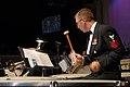 US Navy 081018-N-0773H-052 Musician 1st Class John J. Martinich plays timpani.jpg 3,872 × 2,592; 3.6 MB
-
-
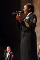
 US Navy 081018-N-0773H-085 Chief Musician Tia F. Wortham plays bassoon.jpg 3,872 × 2,592; 4.51 MB
-

-
 US Route 219 at Mile Strip Road.jpg 1,024 × 768; 306 KB
-
 View of Bel Air, Getty Center, Los Angeles, California (3125793528).jpg 1,280 × 960; 185 KB
-

-
 Watkins Glen Speedway - panoramio.jpg 1,200 × 1,600; 1.26 MB
-
 Welome to Washoe County, Nevada (3071748352).jpg 3,264 × 2,448; 445 KB
-
 Western avenue bridge cambridge.JPG 3,072 × 2,304; 1.45 MB
-
 Whale Scuplture (3070984541).jpg 3,264 × 2,448; 1.1 MB
-
 Williston, North Dakota - 6176554919.jpg 3,264 × 2,448; 534 KB
-
 Williston, North Dakota - 6176556205.jpg 3,264 × 2,448; 573 KB
-
 Williston, North Dakota - 6176556397.jpg 3,264 × 2,448; 643 KB
-
 Williston, North Dakota - 6176557617.jpg 3,264 × 2,448; 556 KB
-
 Williston, North Dakota - 6176557773.jpg 3,264 × 2,448; 549 KB
-
 Williston, North Dakota - 6176558723.jpg 3,264 × 2,448; 717 KB
-
 Williston, North Dakota - 6176561575.jpg 3,138 × 2,353; 781 KB
-
 Williston, North Dakota - 6176563383.jpg 3,264 × 2,448; 645 KB
-
 Williston, North Dakota - 6176564327.jpg 3,264 × 2,448; 782 KB
-
 Williston, North Dakota - 6176564677.jpg 3,264 × 2,448; 803 KB
-
 Williston, North Dakota - 6176566789.jpg 3,264 × 2,448; 595 KB
-
 Williston, North Dakota - 6177081434.jpg 3,264 × 2,448; 694 KB
-
 Williston, North Dakota - 6177082036.jpg 3,264 × 2,448; 650 KB
-
 Williston, North Dakota - 6177082518.jpg 2,971 × 2,228; 587 KB
-
 Williston, North Dakota - 6177083862.jpg 3,264 × 2,448; 556 KB
-
 Williston, North Dakota - 6177085262.jpg 3,086 × 2,314; 600 KB
-
 Williston, North Dakota - 6177086986.jpg 3,264 × 2,448; 557 KB
-
 Williston, North Dakota - 6177087622.jpg 3,264 × 2,448; 750 KB
-
 Williston, North Dakota - 6177087998.jpg 3,264 × 2,448; 711 KB
-
 Williston, North Dakota - 6177088546.jpg 3,264 × 2,448; 743 KB
-
 Williston, North Dakota - 6177088888.jpg 3,264 × 2,448; 608 KB
-
 Williston, North Dakota - 6177090038.jpg 3,264 × 2,448; 713 KB
-
 Williston, North Dakota - 6177091378.jpg 3,264 × 2,448; 665 KB
-
 Williston, North Dakota - 6177093626.jpg 3,264 × 2,448; 1,007 KB
.jpg)
.jpg)
.jpg)
.jpg)
.jpg)
.jpg)
.jpg)


.jpg)
.jpg)
.jpg)
.jpg)

.jpg)
.jpg)
.jpg)


.jpg)
.jpg)
.jpg)

.jpg)

.jpg)


.jpg)


.jpg)
.jpg)
.jpg)
.jpg)


.jpg)
.jpg)
.jpg)

.jpg)


.jpg)


.jpg)


.jpg)


.jpg)
.jpg)


.jpg)
.jpg)

.jpg)
.jpg)

.jpg)

.jpg)
.jpg)
.jpg)
.jpg)

.jpg)


_(3070887667).jpg)
.jpg)
.jpg)
.jpg)
.jpg)


.jpg)


.jpg)


.jpg)

.jpg)
.jpg)


.jpg)
.jpg)
.jpg)
.jpg)
_(2).jpg)
.jpg)
.jpg)
.jpg)
.jpg)
.jpg)

.jpg)
.jpg)
.jpg)
.jpg)
.jpg)
.jpg)
.jpg)
.jpg)
.jpg)
,_01.jpg)
,_02.jpg)
,_03.jpg)
,_04.jpg)
,_05.jpg)
,_06.jpg)
,_07.jpg)
,_08.jpg)
,_09.jpg)
,_10.jpg)
,_11.jpg)
,_12.jpg)
,_13.jpg)
,_14.jpg)
,_15.jpg)
.jpg)


.jpg)
.jpg)
.jpg)
.jpg)


.jpg)
.jpg)


.jpg)
.jpg)

.jpg)

.jpg)


