Category:United States Senate election maps of New York
Jump to navigation
Jump to search
States of the United States: Alabama · Alaska · Arizona · Arkansas · California · Colorado · Connecticut · Delaware · Florida · Hawaii · Idaho · Illinois · Indiana · Iowa · Kansas · Kentucky · Louisiana · Maine · Maryland · Massachusetts · Michigan · Minnesota · Mississippi · Missouri · Montana · Nebraska · Nevada · New Hampshire · New Jersey · New Mexico · New York · North Carolina · North Dakota · Ohio · Oklahoma · Oregon · Pennsylvania · Rhode Island · South Carolina · South Dakota · Tennessee · Texas · Utah · Vermont · Virginia · Washington · West Virginia · Wisconsin · Wyoming
Subcategories
This category has only the following subcategory.
Media in category "United States Senate election maps of New York"
The following 19 files are in this category, out of 19 total.
-
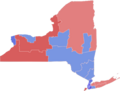
 1916 New York Senate election.svg 800 × 611; 1 MB
-

-

-

-

-
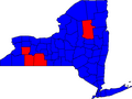
 2022NYSenatebyUSHouse.svg 810 × 621; 119 KB
-
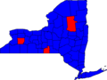
 2022senbycon-removebg-preview.png 572 × 436; 41 KB
-
 New York 1976 Senate Election.gif 342 × 263; 7 KB
-
 New York 1988 Senate Election.gif 342 × 263; 7 KB
-
 New York Senate Election Results by County, 2004.svg 480 × 379; 75 KB
-
 New York Senate Election Results by County, 2012.svg 480 × 379; 42 KB
-
 NewYork 1982 Senate Election.gif 342 × 263; 6 KB
-
 NYSen000Counties.png 657 × 500; 22 KB
-
 NYSen00Counties.png 500 × 376; 13 KB
-
 NYSen04Counties.png 500 × 376; 13 KB
-
 NYSen06Counties.png 500 × 376; 13 KB
-
 NYSen10Counties.png 500 × 376; 13 KB
-
 NYSen98Counties.png 500 × 376; 13 KB
-
 NYSenSE10Counties.png 500 × 376; 13 KB


