Category:United Kingdom photographs taken on 2012-04-08
Jump to navigation
Jump to search
Countries of Europe: Austria · Belgium · Czech Republic · Denmark · Estonia · Finland · France‡ · Germany · Greece · Hungary · Republic of Ireland · Italy · Kazakhstan‡ · Latvia · Malta · Moldova · Monaco · Netherlands‡ · North Macedonia · Poland · Portugal‡ · Russia‡ · Spain‡ · Sweden · Switzerland · Turkey‡ · Ukraine · United Kingdom
‡: partly located in Europe
‡: partly located in Europe
| ← | 8 April 2012 | → | ||
| ← | April 2012 | → | ||

United Kingdom photographs taken on 8 April 2012.
Image files should be categorized here automatically using {{taken on}} template. Direct categorisation is also possible, if automatic is impossible.
Subcategories
This category has only the following subcategory.
Media in category "United Kingdom photographs taken on 2012-04-08"
The following 97 files are in this category, out of 97 total.
-
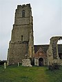 -2012-04-08 The bell tower of Saint Andrews Church, Covehithe.JPG 3,000 × 4,000; 2.01 MB
-
 -2012-04-08 The new church inside the ruins of the old Saint Andrews Church, Covehithe.JPG 3,000 × 4,000; 2.23 MB
-
 -2012-04-08 The ruins of the old Saint Andrews Church, Covehithe (1).JPG 4,000 × 3,000; 2.11 MB
-
 -2012-04-08 The ruins of the old Saint Andrews Church, Covehithe (2).JPG 4,000 × 3,000; 2.07 MB
-
 -2012-04-08 The ruins of the old Saint Andrews Church, Covehithe (3).JPG 3,000 × 4,000; 2.08 MB
-
 -2012-04-08 The ruins of the old Saint Andrews Church, Covehithe (4).JPG 3,000 × 4,000; 2.14 MB
-
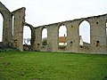 -2012-04-08 The ruins of the old Saint Andrews Church, Covehithe (5).JPG 4,000 × 3,000; 2.06 MB
-
 -2012-04-08 The ruins of the old Saint Andrews Church, Covehithe (6).JPG 3,000 × 4,000; 2.19 MB
-
 -2012-04-08 The ruins of the old Saint Andrews Church, Covehithe (7).JPG 3,000 × 4,000; 2.43 MB
-
 -2012-04-08 The ruins of the old Saint Andrews Church, Covehithe.JPG 4,000 × 3,000; 1.67 MB
-
 Aldeburgh Lifeboat 8 April 2012 (3).JPG 4,000 × 3,000; 2.36 MB
-
 Aldeburgh Lifeboat 8 April 2012 (4).JPG 4,000 × 3,000; 2.4 MB
-
 Aldeburgh Lifeboat 8 April 2012.JPG 4,000 × 3,000; 2.44 MB
-
 Aldeburgh Lifeboat Station 8 April 2012 (1).JPG 4,000 × 3,000; 2.31 MB
-
 Aldeburgh Lifeboat Station 8 April 2012.JPG 4,000 × 3,000; 2.33 MB
-
 Anonymous bridge over the Harland Way (geograph 2890035).jpg 1,024 × 768; 232 KB
-
 Archway entrance to apartments on Queen's Road - geograph.org.uk - 2900250.jpg 683 × 1,024; 168 KB
-
 Arundel Castle...jpg 600 × 372; 201 KB
-
 Barleyfields Road bridge, Wetherby (geograph 2889874).jpg 1,024 × 768; 201 KB
-
 Barleyfields Road, Wetherby (geograph 2889754).jpg 1,024 × 539; 88 KB
-

-
 Bedworth 24-8-69 (39676261605).jpg 2,592 × 1,728; 1.31 MB
-
 Benchmark on archway of Queen's Road building - geograph.org.uk - 2900215.jpg 1,024 × 683; 199 KB
-

-

-
 Benchmark on ^2 Stanford Street - geograph.org.uk - 2902818.jpg 683 × 1,024; 268 KB
-
 Bird Profile (6911926518).jpg 2,848 × 4,288; 5.23 MB
-
 Birnbeck Island First 38005 D705GHY.jpg 1,024 × 768; 453 KB
-
 Boer War Memorial, Llanelli - geograph.org.uk - 3055038.jpg 640 × 617; 96 KB
-
 Bridge taking the A453 over the Beeston Canal - geograph.org.uk - 2902769.jpg 1,024 × 683; 187 KB
-
 Dualling (7058004055).jpg 4,288 × 2,366; 3.32 MB
-
 Duck couple - panoramio.jpg 1,600 × 1,200; 627 KB
-
 Duck dOrange (6911904614).jpg 4,288 × 1,637; 2.89 MB
-
 Enfield Pub - panoramio.jpg 3,456 × 2,304; 2.91 MB
-
 Entrance archway to Eldon Chambers, Wheeler Gate - geograph.org.uk - 2913322.jpg 683 × 1,024; 159 KB
-
 Fighting Flamingos (6911914548).jpg 2,238 × 2,736; 2.34 MB
-
 Flamingo (7058003261).jpg 3,414 × 2,212; 3.48 MB
-
 Flappy (6911913868).jpg 2,799 × 1,890; 2.56 MB
-

-
 Former Maze station near Lisburn - geograph.org.uk - 2890280.jpg 640 × 353; 103 KB
-
 Goose (6911905452).jpg 2,265 × 2,714; 2.74 MB
-
 Goose (6911951762).jpg 2,728 × 2,360; 2.38 MB
-
 Gosling (6911909974).jpg 3,595 × 2,211; 3.65 MB
-
 Gosling (6911911404).jpg 2,363 × 2,229; 2.87 MB
-
 Gracechurch, Wilford Street - geograph.org.uk - 2900308.jpg 1,024 × 683; 166 KB
-
 Hughenden Manor (6930191318).jpg 2,448 × 3,137; 3.99 MB
-
 Hughenden Manor (6930217974).jpg 3,140 × 2,448; 4.03 MB
-
 Hughenden Manor (7076279105).jpg 2,448 × 3,264; 5.7 MB
-
 Junction of Stanford Street and Castle Gate - geograph.org.uk - 2902836.jpg 683 × 1,024; 166 KB
-
 Just A rest - panoramio.jpg 3,488 × 2,616; 4.06 MB
-
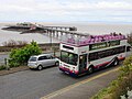
 Knightstone Southern Vectis 573 YDL318.jpg 1,024 × 768; 347 KB
-
 Lazenby Fold and Lazenby Drive (geograph 2890074).jpg 1,024 × 768; 108 KB
-

-
 Lotus Exige S Type 72.jpg 3,568 × 2,344; 3.98 MB
-
 Mill Public House Aldeburgh 8 April 2012.JPG 4,000 × 3,000; 2.3 MB
-
 Northfield Place, Wetherby (geograph 2889756).jpg 1,024 × 768; 125 KB
-
 Old buildings at Aldermaston Park - panoramio.jpg 3,264 × 1,952; 1.38 MB
-
 Quarry Hill bridge, Wetherby (geograph 2889886).jpg 1,024 × 768; 234 KB
-
 Queen Victoria - panoramio (2).jpg 1,600 × 1,200; 581 KB
-
 Rail Balk Lane, Wetherby (geograph 2890054).jpg 912 × 684; 161 KB
-
 Rainy day in Hyde Park - panoramio.jpg 1,600 × 1,200; 709 KB
-
 Rough Hills, Linton Lane - geograph.org.uk - 2890100.jpg 1,024 × 768; 211 KB
-
 Route to Quarry Hill bridleway (geograph 2889751).jpg 1,024 × 768; 231 KB
-
 Salt marsh and sky, an Atlantic grey seal - panoramio.jpg 3,888 × 2,592; 1.42 MB
-
 Salt marsh and sky, passing Titchmarsh Marina - panoramio.jpg 3,888 × 2,592; 1.56 MB
-
 Salt marsh and sky, the Hamford Water National Nature Reserve - panoramio (1).jpg 3,888 × 2,592; 1.55 MB
-
 Salt marsh and sky, the Hamford Water National Nature Reserve - panoramio (2).jpg 3,888 × 2,592; 1.54 MB
-
 Salt marsh and sky, the Hamford Water National Nature Reserve - panoramio (3).jpg 3,888 × 2,592; 1.48 MB
-
 Salt marsh and sky, the Hamford Water National Nature Reserve - panoramio (4).jpg 3,888 × 2,592; 1.21 MB
-
 Salt marsh and sky, the Hamford Water National Nature Reserve - panoramio (5).jpg 3,888 × 2,592; 1.72 MB
-
 Salt marsh and sky, the Hamford Water National Nature Reserve - panoramio (6).jpg 3,888 × 2,592; 1.24 MB
-
 Salt marsh and sky, the Hamford Water National Nature Reserve - panoramio.jpg 3,888 × 2,592; 1.6 MB
-
 Slimeridge Farm, Uphill.jpg 1,024 × 768; 516 KB
-
 Southern Vectis 573 YDL318.jpg 1,024 × 768; 363 KB
-
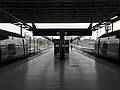 St Pancras International stn platforms 11 and 12 look north2.JPG 2,560 × 1,920; 1.03 MB
-
 St Pancras International stn platforms 12 and 13 look north.JPG 2,560 × 1,920; 1.04 MB
-
 St Pancras International stn platforms 12 and 13 look north2.jpg 2,560 × 1,920; 1.06 MB
-
 Stereo (7057999411).jpg 2,250 × 2,651; 2.32 MB
-
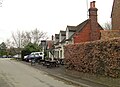 The Crown, Sydenham, Oxfordshire-geograph-2894236-by-Stuart-Logan.jpg 3,525 × 2,556; 1.6 MB
-
 The Glebe Field estate, Wetherby (geograph 2890065).jpg 1,024 × 569; 87 KB
-
 The site of Wetherby Station - geograph.org.uk - 2889736.jpg 1,010 × 758; 462 KB
-
 Tintern Abbey - panoramio (3).jpg 1,600 × 1,200; 331 KB
-

-
 View over the fields towards Lincoln cathedral - panoramio.jpg 3,264 × 2,448; 3.32 MB
-
 Water Tower at Aldermaston Park - panoramio.jpg 3,264 × 1,952; 1.61 MB
-
 Weston-super-Mare Crosville F357WSC passing the Winter Gardens.jpg 1,024 × 768; 356 KB
-
 Weston-super-Mare Crosville L118YOD outside the College.jpg 768 × 1,024; 419 KB
-
 Weston-super-Mare GHT127 outside the Tropicana.jpg 768 × 1,024; 329 KB
-
 Weston-super-Mare station - Bakers Dolphin 94 (AJ58PZC).jpg 1,366 × 820; 225 KB
-
 Weymouth- deckchairs on the promenade (geograph 3398410).jpg 480 × 640; 87 KB
-
 Weymouth- metal detecting on the beach (geograph 3398472).jpg 640 × 481; 42 KB
-
 Weymouth- promenade reflections (geograph 3398469).jpg 640 × 481; 79 KB
-
 Wraxall 2012 MMB 16 Smudge and daffodils.jpg 3,312 × 2,530; 2.97 MB
-
 Wraxall 2012 MMB 17 Smudge and daffodils.jpg 3,768 × 2,519; 3.13 MB
-
 Wraxall 2012 MMB 18 Smudge.jpg 2,721 × 2,486; 2.61 MB
-
 Wraxall 2012 MMB 19 Smudge.jpg 3,558 × 2,438; 4.01 MB
-
 Yellow and purple (6911345542).jpg 3,264 × 4,928; 1.66 MB


.JPG)
.JPG)
.JPG)
.JPG)
.JPG)
.JPG)
.JPG)

.JPG)
.JPG)

.JPG)

.jpg)


.jpg)
.jpg)

.jpg)


.jpg)


.jpg)


.jpg)
.jpg)
.jpg)


.jpg)
.jpg)
.jpg)
.jpg)

.jpg)
.jpg)
.jpg)


.jpg)


.jpg)

.jpg)
.jpg)
.jpg)


.jpg)


.jpg)
.jpg)
.jpg)
.jpg)
.jpg)
.jpg)


.jpg)

.jpg)

.jpg)


.jpg)
.jpg)
.jpg)
.jpg)


.jpg)
.jpg)