Category:United Kingdom photographs taken on 2010-01-26
Jump to navigation
Jump to search
Countries of Europe: Belgium · Bosnia and Herzegovina · Czech Republic · Denmark · Finland · France‡ · Georgia‡ · Germany · Hungary · Italy · Latvia · Netherlands‡ · Poland · Portugal‡ · Russia‡ · Spain‡ · Switzerland · Turkey‡ · Ukraine · United Kingdom
‡: partly located in Europe
‡: partly located in Europe
| ← | 26 January 2010 | → | ||
| ← | January 2010 | → | ||

United Kingdom photographs taken on 26 January 2010.
Image files should be categorized here automatically using {{taken on}} template. Direct categorisation is also possible, if automatic is impossible.
Subcategories
This category has the following 2 subcategories, out of 2 total.
Media in category "United Kingdom photographs taken on 2010-01-26"
The following 102 files are in this category, out of 102 total.
-
 66167 & 60039 Chesterfield (4307626746).jpg 2,500 × 1,667; 3.7 MB
-
 Abney Low - geograph.org.uk - 1722212.jpg 2,560 × 1,920; 770 KB
-
 Afon Dyfrdwy at Gwerclas - geograph.org.uk - 1692007.jpg 640 × 404; 87 KB
-
 Alfoxton Road, Bridgwater - geograph.org.uk - 1691908.jpg 640 × 480; 55 KB
-
 All ready for lambing - geograph.org.uk - 1692080.jpg 640 × 428; 86 KB
-
 Another train approaching Moira - geograph.org.uk - 1684270.jpg 640 × 480; 56 KB
-
 At work in the fields - geograph.org.uk - 1690567.jpg 4,000 × 2,664; 1.43 MB
-
 Bethania Baptist Chapel, William Street - geograph.org.uk - 1691606.jpg 640 × 480; 100 KB
-
 Brent Geese at Brancaster Staithe. - geograph.org.uk - 1680162.jpg 2,048 × 1,536; 1.38 MB
-
 Bridleway, Blackdown Hills - geograph.org.uk - 1692333.jpg 640 × 480; 131 KB
-
 Brook Cottage, Hitcham - geograph.org.uk - 1680120.jpg 640 × 427; 86 KB
-
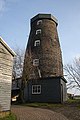 Buxhall Mill - geograph.org.uk - 1680053.jpg 427 × 640; 90 KB
-

-
 Cardigan Memorial Hospital - geograph.org.uk - 1691662.jpg 640 × 475; 113 KB
-
 Cattle shed at Gwerclas - geograph.org.uk - 1691981.jpg 640 × 429; 106 KB
-
 Deep Red Sunset West Beach Bognor - panoramio (1).jpg 2,592 × 1,944; 1.24 MB
-
 Deep Red Sunset West Beach Bognor - panoramio.jpg 2,592 × 1,944; 856 KB
-
 Drainage channel, The Meads - geograph.org.uk - 1692178.jpg 640 × 480; 88 KB
-
 Fairfield Street, Manchester - geograph.org.uk - 1681158.jpg 1,280 × 960; 230 KB
-
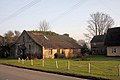
 Farm buildings at Luckey's Farm - geograph.org.uk - 1680115.jpg 640 × 427; 97 KB
-
 Farm track near Hitcham - geograph.org.uk - 1680128.jpg 427 × 640; 105 KB
-
 Farm track south of Hitcham - geograph.org.uk - 1680130.jpg 640 × 427; 89 KB
-
 Farmland and housing at Water Run - geograph.org.uk - 1680113.jpg 640 × 427; 77 KB
-
 Fasbourn Hall - geograph.org.uk - 1680069.jpg 640 × 427; 77 KB
-
 Five Hundred Years of Sailing on the Solent - geograph.org.uk - 1690037.jpg 3,872 × 2,592; 4.28 MB
-
 Footpath at Mill Green, Buxhall - geograph.org.uk - 1680051.jpg 640 × 427; 135 KB
-
 Footpath near Poystreet Green - geograph.org.uk - 1680077.jpg 427 × 640; 100 KB
-
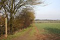
 Footpath sign to Whorrel bank - geograph.org.uk - 1690551.jpg 4,000 × 2,664; 4.45 MB
-
 Footpath to Brettenham Road - geograph.org.uk - 1680081.jpg 640 × 427; 86 KB
-
 Footpath to Gypsy Hall - geograph.org.uk - 1680116.jpg 640 × 427; 74 KB
-
 Footpath to High Street Green - geograph.org.uk - 1680107.jpg 640 × 427; 77 KB
-
 Footpath to Hightown Green - geograph.org.uk - 1680085.jpg 427 × 640; 100 KB
-
 Footpath to Loose Hall - geograph.org.uk - 1680199.jpg 640 × 427; 91 KB
-

-
 Footpath to The Hobbets, Hitcham - geograph.org.uk - 1680119.jpg 640 × 427; 83 KB
-
 Footpath to Wood Hall - geograph.org.uk - 1680048.jpg 427 × 640; 72 KB
-
 Former Assembly Room, Cross Green - geograph.org.uk - 1680117.jpg 640 × 427; 83 KB
-
 Former chapel, Bridgwater - geograph.org.uk - 1691504.jpg 640 × 480; 78 KB
-

-
 Friarn Street, Bridgwater - geograph.org.uk - 1691673.jpg 640 × 480; 78 KB
-
 Greyhound in Portsmouth - geograph.org.uk - 1679838.jpg 3,872 × 2,592; 3.21 MB
-
 Halesleigh Road, Bridgwater - geograph.org.uk - 1691880.jpg 640 × 508; 75 KB
-
 Heiferlaw Tower (geograph 1685400).jpg 600 × 450; 293 KB
-
 Holywood Exchange bus, Belfast - geograph.org.uk - 1679699.jpg 640 × 396; 90 KB
-
 Horse and Groom, Tuesday 26 01 2010.JPG 4,000 × 3,000; 2.33 MB
-
 Houses in Priory Street, Cardigan - geograph.org.uk - 1691635.jpg 640 × 474; 123 KB
-
 Junction with a telephone box - geograph.org.uk - 1690476.jpg 640 × 429; 91 KB
-
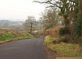
 Lane at Blackmoor - geograph.org.uk - 1692204.jpg 640 × 480; 80 KB
-
 Lane near Glasses - geograph.org.uk - 1692290.jpg 640 × 458; 104 KB
-
 Lane on Wellington Hill - geograph.org.uk - 1692300.jpg 640 × 480; 116 KB
-
 Lane to Llandderfel beside Gwerclas - geograph.org.uk - 1692053.jpg 640 × 429; 112 KB
-
 Lighting-up time, Newbury - geograph.org.uk - 1760592.jpg 640 × 480; 130 KB
-
 Lights in the distance - geograph.org.uk - 1680148.jpg 800 × 531; 38 KB
-
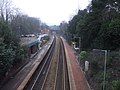 Llanishen Station, Cardiff - geograph.org.uk - 1678670.jpg 3,296 × 2,472; 1.88 MB
-
 Low bridge at Somerset Bridge - geograph.org.uk - 1691044.jpg 640 × 480; 116 KB
-
 Loxleigh Avenue, Bridgwater - geograph.org.uk - 1691386.jpg 640 × 411; 55 KB
-
 Main street through Seething - geograph.org.uk - 1680131.jpg 800 × 531; 148 KB
-
 Maize cover near Wetherden Hall - geograph.org.uk - 1680127.jpg 640 × 427; 104 KB
-
 Mitchery Lane and Walnut Tree Farm - geograph.org.uk - 1680076.jpg 640 × 427; 92 KB
-
 Moira Railway Station (geograph 1684267).jpg 640 × 480; 48 KB
-
 Monument Farm - geograph.org.uk - 1692330.jpg 640 × 436; 84 KB
-
 Moonlit sky - geograph.org.uk - 1680151.jpg 800 × 531; 28 KB
-
 New lambs near Tyn-y-caeau - geograph.org.uk - 1690489.jpg 640 × 428; 95 KB
-
 Newly planted hedge - geograph.org.uk - 1690517.jpg 640 × 429; 91 KB
-
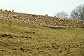
 Offerton Edge - geograph.org.uk - 1722646.jpg 2,560 × 1,920; 1.32 MB
-
 Offerton House and Offerton Hall - geograph.org.uk - 1724936.jpg 2,560 × 1,920; 1.33 MB
-
 Old barn at Castle Farm, Buxhall - geograph.org.uk - 1680095.jpg 640 × 427; 97 KB
-
 Old Wetherden Hall - geograph.org.uk - 1680124.jpg 640 × 427; 79 KB
-
 One of Dunwear Ponds - geograph.org.uk - 1691288.jpg 640 × 480; 133 KB
-
 Orchard, Dunwear - geograph.org.uk - 1691226.jpg 640 × 480; 107 KB
-
 Paddocks near Hightown Green - geograph.org.uk - 1680089.jpg 640 × 427; 63 KB
-
 Pillbox by the canal - geograph.org.uk - 1690911.jpg 640 × 480; 129 KB
-
 Polden Street, Bridgwater - geograph.org.uk - 1691417.jpg 640 × 480; 60 KB
-
 Redgate Street, Bridgwater - geograph.org.uk - 1691364.jpg 640 × 411; 76 KB
-
 Regent Way, Bridgwater - geograph.org.uk - 1692198.jpg 640 × 480; 60 KB
-
 Rhode Lane, Hamp - geograph.org.uk - 1692191.jpg 640 × 480; 93 KB
-
 River Parrett below Dunwear - geograph.org.uk - 1691198.jpg 640 × 453; 74 KB
-
 River Parrett Trail - geograph.org.uk - 1690888.jpg 640 × 480; 84 KB
-
 Road on Wellington Hill - geograph.org.uk - 1692312.jpg 640 × 480; 121 KB
-
 Road past Hemyock Place - geograph.org.uk - 1692307.jpg 640 × 480; 109 KB
-
 Sheep feeding on swedes - geograph.org.uk - 1692033.jpg 640 × 429; 98 KB
-
 Sheep grazing manured field. - geograph.org.uk - 1692063.jpg 640 × 428; 84 KB
-
 Siney Sitch - geograph.org.uk - 1722010.jpg 2,560 × 1,920; 1.36 MB
-
 Somerset Bridge - geograph.org.uk - 1691040.jpg 480 × 640; 81 KB
-
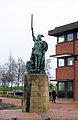 Statue of a Viking Warrior at County Hall (geograph 1683957).jpg 2,238 × 3,453; 1.79 MB
-
 Stream heading towards Afon Dyfrdwy - geograph.org.uk - 1692108.jpg 640 × 428; 125 KB
-

-
 The Angel Hotel, Cardigan - geograph.org.uk - 1691585.jpg 640 × 480; 128 KB
-
 The Commercial Inn, Bridgwater - geograph.org.uk - 1691397.jpg 640 × 417; 97 KB
-
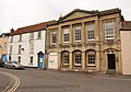 The Court House, Bridgwater - geograph.org.uk - 1691597.jpg 640 × 446; 66 KB
-
 The lane to Four Crosses - geograph.org.uk - 1692124.jpg 640 × 428; 85 KB
-
 The Maltshovel, Bridgwater - geograph.org.uk - 1691795.jpg 640 × 480; 74 KB
-
 The Meads - geograph.org.uk - 1692075.jpg 640 × 480; 108 KB
-
 The Red Lion, Cardigan - geograph.org.uk - 1691592.jpg 640 × 480; 111 KB
-

-
 Towards the Durleigh Brook - geograph.org.uk - 1691977.jpg 640 × 471; 90 KB
-
 Track leading to Bentons - geograph.org.uk - 1680133.jpg 640 × 427; 129 KB
-
 Track to Park Farm, Buxhall - geograph.org.uk - 1680072.jpg 640 × 427; 94 KB
-
 Trees near Castle Farm - geograph.org.uk - 1680096.jpg 640 × 427; 82 KB
-
 Trees near Fasbourn Hall - geograph.org.uk - 1680073.jpg 640 × 427; 66 KB
-
 Wills Road, Bridgwater - geograph.org.uk - 1692193.jpg 640 × 438; 53 KB
-
 World's End - geograph.org.uk - 1680101.jpg 640 × 427; 107 KB
.jpg)


.jpg)


.jpg)


.jpg)


.jpg)


