Category:United Kingdom photographs taken on 2009-12-19
Jump to navigation
Jump to search
| ← | Saturday 19 December 2009 | → | ||
| ← | December 2009 | → | ||

United Kingdom photographs taken on 19 December 2009.
Image files should be categorized here automatically using {{taken on}} template. Direct categorisation is also possible, if automatic is impossible.
Subcategories
This category has only the following subcategory.
Media in category "United Kingdom photographs taken on 2009-12-19"
The following 200 files are in this category, out of 888 total.
(previous page) (next page)-
-

-
-
 20mph sign in Rake Lane - geograph.org.uk - 1625568.jpg 640 × 480; 129 KB
-
 30mph sign in Rake Lane - geograph.org.uk - 1625502.jpg 640 × 480; 113 KB
-
 37706 at Kings Cross 034.jpg 3,648 × 2,736; 4.37 MB
-
 37706 at Kings Cross 035.jpg 3,648 × 2,736; 4.61 MB
-
 37706 at Kings Cross 038.jpg 3,648 × 2,736; 4.04 MB
-
 37706 at Kings Cross 039.jpg 3,648 × 2,736; 4.14 MB
-
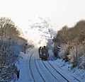
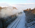
 60019 Bittern at Kings Cross 001.jpg 3,648 × 2,736; 3.83 MB
-
 60019 Bittern at Kings Cross 003.jpg 3,648 × 2,736; 4.31 MB
-
 A Class Roads at Stonehenge - geograph.org.uk - 1626528.jpg 3,872 × 2,592; 4.02 MB
-
 A clearing in Tilgate Forest - geograph.org.uk - 1625296.jpg 640 × 428; 164 KB
-
 A cold and wintry day - geograph.org.uk - 1625739.jpg 640 × 480; 100 KB
-
 A radio transmitter on Bemersyde Hill - geograph.org.uk - 1625964.jpg 640 × 418; 163 KB
-
 A snowy car park at Milford Station - geograph.org.uk - 1625465.jpg 640 × 480; 108 KB
-

-
 A tall hedge - geograph.org.uk - 1625715.jpg 480 × 640; 161 KB
-
 A tree by Parnell Lane - geograph.org.uk - 1625640.jpg 640 × 490; 111 KB
-
 A tree on Bemersyde Hill - geograph.org.uk - 1625957.jpg 640 × 427; 132 KB
-
 A wintery River Exe, at Bickleigh - geograph.org.uk - 1625520.jpg 640 × 480; 63 KB
-
 A year later - geograph.org.uk - 1632670.jpg 640 × 480; 100 KB
-
 A14 at the new junction with bridge - geograph.org.uk - 1626193.jpg 640 × 419; 95 KB
-
 A14 near Woolpit - geograph.org.uk - 1625508.jpg 640 × 440; 75 KB
-

-
 A4 Pacific 60019 Bittern passes Foxton Crossing, December 19, 2009. - panoramio.jpg 2,727 × 1,996; 7.52 MB
-
 Across a frosty field - geograph.org.uk - 1630697.jpg 640 × 480; 73 KB
-
 Across the Field at West Amesbury - geograph.org.uk - 1626761.jpg 640 × 428; 69 KB
-
 Alcove by the corner - geograph.org.uk - 1654247.jpg 640 × 480; 52 KB
-
 Alcove in the chapel - geograph.org.uk - 1655276.jpg 480 × 640; 37 KB
-
 Alder Grove, Malpas - geograph.org.uk - 1626285.jpg 640 × 418; 69 KB
-
 Alder trees abound by Kellas Fishery - geograph.org.uk - 1625675.jpg 640 × 427; 83 KB
-
 Allenmoor Lane - geograph.org.uk - 1638290.jpg 640 × 480; 241 KB
-
 Along the Skell towards the abbey - geograph.org.uk - 1626839.jpg 640 × 385; 71 KB
-
 Altar in the chancel - geograph.org.uk - 1653691.jpg 640 × 480; 69 KB
-
 An old truck, near East Court - geograph.org.uk - 1628612.jpg 640 × 480; 86 KB
-

-
 An unusual sight - geograph.org.uk - 1625899.jpg 613 × 640; 119 KB
-
 Ancient track, near Little Silver - geograph.org.uk - 1625991.jpg 640 × 480; 158 KB
-
 Anderson Place, Malpas, Newport - geograph.org.uk - 1626278.jpg 640 × 417; 61 KB
-

-

-
 Approaching Harrison's in Station Lane - geograph.org.uk - 1625484.jpg 640 × 480; 101 KB
-
 Approaching the "summit" of Mare Hill - geograph.org.uk - 1626723.jpg 640 × 480; 101 KB
-

-
 Arch to the chapel - geograph.org.uk - 1655182.jpg 480 × 640; 52 KB
-
 Arches in the chapel - geograph.org.uk - 1655247.jpg 640 × 480; 68 KB
-
 Architectural Heritage - geograph.org.uk - 1635469.jpg 640 × 480; 102 KB
-
 Architectural Heritage - geograph.org.uk - 1635470.jpg 480 × 640; 109 KB
-
 Arm Lees Farm, Middleton - geograph.org.uk - 1625638.jpg 640 × 480; 96 KB
-
 Bacon Place, Malpas, Newport - geograph.org.uk - 1625367.jpg 640 × 386; 57 KB
-
 Barn at Oakley Farm - geograph.org.uk - 1626391.jpg 640 × 430; 248 KB
-

-
 Barn, near Little Silver - geograph.org.uk - 1625966.jpg 640 × 480; 96 KB
-
 Barns, near Kingdom's Corner - geograph.org.uk - 1626205.jpg 640 × 480; 103 KB
-
 Barrow Near Stonehenge - geograph.org.uk - 1626605.jpg 3,872 × 2,592; 5.85 MB
-
 Barrows Near Stonehenge - geograph.org.uk - 1626611.jpg 3,872 × 2,592; 7.68 MB
-
 Bath Road reservoir site - geograph.org.uk - 1633359.jpg 638 × 640; 335 KB
-

-
 Becoming lost - geograph.org.uk - 1656188.jpg 640 × 480; 156 KB
-
 Beehive Farm - geograph.org.uk - 1638328.jpg 640 × 480; 173 KB
-
 Belfast docks from Cave Hill - geograph.org.uk - 1629181.jpg 640 × 433; 251 KB
-
 Belfast from Cave Hill - geograph.org.uk - 1629187.jpg 640 × 400; 189 KB
-
 Bemersyde Hill - geograph.org.uk - 1625939.jpg 640 × 427; 148 KB
-
 Bemersyde Hill in mid December - geograph.org.uk - 1625996.jpg 640 × 413; 130 KB
-
 Bend in Cramhurst Lane - geograph.org.uk - 1626786.jpg 640 × 480; 93 KB
-
 Bend in Sunnydown - geograph.org.uk - 1625862.jpg 640 × 480; 108 KB
-
 Bendy Bus, Haymarket St - geograph.org.uk - 1665657.jpg 640 × 430; 138 KB
-
 Berwick Folly - geograph.org.uk - 1736434.jpg 1,024 × 768; 154 KB
-
 Birkenhead North End - Demolition.jpg 1,195 × 942; 355 KB
-
 Black Crag - geograph.org.uk - 1627810.jpg 640 × 480; 100 KB
-
 Black Ice, Omagh - geograph.org.uk - 1625308.jpg 640 × 480; 58 KB
-

-
 Blue plaque on the wall - geograph.org.uk - 1629624.jpg 640 × 480; 59 KB
-
 Bonaparte Inn, Nidd - geograph.org.uk - 1626275.jpg 640 × 427; 74 KB
-
 Borwick village green - geograph.org.uk - 1625942.jpg 640 × 489; 214 KB
-
 Borwick village green - geograph.org.uk - 1625947.jpg 640 × 480; 236 KB
-
 Boundary marker on Ragged Stone Hill - geograph.org.uk - 1628702.jpg 640 × 426; 139 KB
-
 BP Petrol Station - geograph.org.uk - 1639003.jpg 640 × 427; 54 KB
-
 Bridge no 39, Oxford Canal - geograph.org.uk - 1627574.jpg 640 × 428; 90 KB
-
 Bridge on new section of the A14 - geograph.org.uk - 1626137.jpg 640 × 462; 96 KB
-
 Bridge over the A14 - geograph.org.uk - 1625495.jpg 640 × 422; 72 KB
-
 Bridge over the Dover Beck - geograph.org.uk - 1626313.jpg 640 × 427; 81 KB
-
 Bridge over the railway line - geograph.org.uk - 1625645.jpg 640 × 473; 70 KB
-
 Bridge over the railway line - geograph.org.uk - 1625745.jpg 640 × 454; 149 KB
-
 Bridge over the railway line - geograph.org.uk - 1625767.jpg 640 × 458; 184 KB
-
 Bridge Over the River Avon, Amesbury - geograph.org.uk - 1626937.jpg 640 × 428; 103 KB
-
 Bridge over the River Skell - geograph.org.uk - 1626841.jpg 480 × 640; 139 KB
-
 Bridleway in the snow - geograph.org.uk - 1625273.jpg 640 × 428; 175 KB
-
 Bridleway, to Kingdom's Corner - geograph.org.uk - 1626199.jpg 640 × 480; 121 KB
-
 Brighton, Royal Pavilion in snow.jpg 2,600 × 1,950; 1.45 MB
-
 British Airways Boeing 777-200 Lofting-2.jpg 1,280 × 849; 634 KB
-
 Broad Street chapel - geograph.org.uk - 1633429.jpg 427 × 640; 183 KB
-
 Broad Street in the morning - geograph.org.uk - 1632033.jpg 640 × 480; 94 KB
-
 Broad Street independent chapel - geograph.org.uk - 1632666.jpg 480 × 640; 82 KB
-
 Broad Street looking east - geograph.org.uk - 1633418.jpg 640 × 427; 246 KB
-
 Broad Street looking west - geograph.org.uk - 1633421.jpg 640 × 426; 208 KB
-
 Broad Street looking west - geograph.org.uk - 1633425.jpg 640 × 427; 192 KB
-
 Broadwell postbox and cottages - geograph.org.uk - 1625170.jpg 640 × 424; 91 KB
-
 Bungalows, Malpas Road, Newport - geograph.org.uk - 1625344.jpg 640 × 473; 69 KB
-
 Bungalows, Whittle Drive, Malpas - geograph.org.uk - 1625400.jpg 640 × 450; 70 KB
-
 Burial Mounds at Stonehenge - geograph.org.uk - 1626554.jpg 3,872 × 2,176; 3.23 MB
-
 Burn Bridge, near Bickleigh - geograph.org.uk - 1625556.jpg 640 × 480; 141 KB
-
 Bury Interchange - geograph.org.uk - 1665632.jpg 570 × 640; 76 KB
-
 By School Road - geograph.org.uk - 1625615.jpg 640 × 449; 95 KB
-
 By the lane between Woolpit and the A14 - geograph.org.uk - 1625482.jpg 640 × 480; 148 KB
-

-

-
 Cadeleigh Court - geograph.org.uk - 1628311.jpg 640 × 480; 70 KB
-
 Caldwell's northern houses - geograph.org.uk - 1627252.jpg 640 × 400; 106 KB
-
 Car dealership - geograph.org.uk - 1625449.jpg 640 × 443; 73 KB
-
 Car park, Store Street, Consett - geograph.org.uk - 1630631.jpg 640 × 480; 84 KB
-

-
 Carbis Bay Methodist Church - geograph.org.uk - 1631382.jpg 640 × 480; 65 KB
-
 Carbrook tram stop - evening - geograph.org.uk - 1773184.jpg 4,416 × 3,312; 2.9 MB
-
 Careys Farm, Taddington - geograph.org.uk - 1635491.jpg 640 × 480; 80 KB
-
 Castle Eden Walkway - geograph.org.uk - 1625383.jpg 640 × 480; 68 KB
-
 Castle Street - geograph.org.uk - 1633383.jpg 640 × 427; 179 KB
-
 Catch of the Day - geograph.org.uk - 1626840.jpg 640 × 480; 257 KB
-

-
 Catwalk Wood - geograph.org.uk - 1625497.jpg 640 × 359; 118 KB
-
 Cave Hill and Glengormley - geograph.org.uk - 1629199.jpg 530 × 640; 512 KB
-
 Cave Hill Country Park - geograph.org.uk - 1629183.jpg 640 × 407; 323 KB
-
 Cave, Cave Hill - geograph.org.uk - 1629176.jpg 480 × 640; 497 KB
-
 Chair by the stalls - geograph.org.uk - 1655164.jpg 640 × 480; 79 KB
-
 Chair in the chancel - geograph.org.uk - 1655145.jpg 513 × 640; 112 KB
-
 Chair in the chancel - geograph.org.uk - 1655162.jpg 474 × 640; 118 KB
-
 Change of use, Elsecar - geograph.org.uk - 1628428.jpg 480 × 640; 65 KB
-

-
 Chapel wall - geograph.org.uk - 1655225.jpg 640 × 480; 76 KB
-
 Choir stalls in the church - geograph.org.uk - 1653709.jpg 640 × 480; 72 KB
-
 Christmas shoppers in Leeds in December 2009.jpg 3,648 × 2,736; 1.58 MB
-
 Christmas trees for sale at Oakley Farm - geograph.org.uk - 1626399.jpg 640 × 480; 305 KB
-
 Claremont, Malpas - geograph.org.uk - 1626284.jpg 640 × 480; 102 KB
-

-
 Closing the Circle - geograph.org.uk - 1625849.jpg 640 × 480; 160 KB
-
 Coachman's Cottage - geograph.org.uk - 1637781.jpg 640 × 480; 115 KB
-
 Coat of Arms over the door - geograph.org.uk - 1629620.jpg 480 × 640; 60 KB
-
 Colchester General Hospital Main entrance - geograph.org.uk - 1626303.jpg 4,000 × 3,000; 2.31 MB
-
 Christ Church, Consett - geograph.org.uk - 1630658.jpg 640 × 471; 112 KB
-
 Converted chapel, Little Silver - geograph.org.uk - 1626531.jpg 640 × 480; 81 KB
-
 Cottage on Hollybush Common - geograph.org.uk - 1629896.jpg 640 × 426; 67 KB
-
 Cottages at Taddington - geograph.org.uk - 1635483.jpg 640 × 480; 83 KB
-
 Cottages at Wheelerstreet - geograph.org.uk - 1625772.jpg 640 × 480; 85 KB
-
 Cottages at Whiteleaved Oak - geograph.org.uk - 1628675.jpg 640 × 426; 107 KB
-
 Cottages in Cutsdean - geograph.org.uk - 1630671.jpg 640 × 480; 78 KB
-
 Cottages in Petworth Road - geograph.org.uk - 1626159.jpg 640 × 480; 90 KB
-
 Country view from the new junction - geograph.org.uk - 1626169.jpg 640 × 480; 97 KB
-
 Countryside near Cave Hill - geograph.org.uk - 1629251.jpg 502 × 640; 435 KB
-
 Countryside near Cave Hill - geograph.org.uk - 1629253.jpg 640 × 434; 408 KB
-
 County Durham Gateway Bridge - geograph.org.uk - 1625358.jpg 640 × 480; 64 KB
-
 Covering with ivy - geograph.org.uk - 1656186.jpg 480 × 640; 134 KB
-
 Cow on Chase End Hill - geograph.org.uk - 1628470.jpg 640 × 426; 99 KB
-
 Cowfold Lane - geograph.org.uk - 1638250.jpg 640 × 480; 184 KB
-
 Craggwood Allotments - geograph.org.uk - 1719649.jpg 640 × 480; 154 KB
-
 Craighouse Farm - geograph.org.uk - 1626005.jpg 640 × 427; 142 KB
-
 Cray Avenue, Orpington - geograph.org.uk - 1627854.jpg 640 × 480; 55 KB
-
 Creasys Drive, Crawley - geograph.org.uk - 1625325.jpg 640 × 427; 139 KB
-
 Crosses in the corner - geograph.org.uk - 1653720.jpg 480 × 640; 39 KB
-
 Curious ponies, above Little Silver - geograph.org.uk - 1626489.jpg 640 × 480; 115 KB
-
 St James, Cutsdean - geograph.org.uk - 1630686.jpg 640 × 480; 104 KB
-
 Cutsdean Farm - geograph.org.uk - 1630690.jpg 640 × 480; 89 KB
-
 Cutsdeanhill Barn - geograph.org.uk - 1631580.jpg 640 × 480; 98 KB
-
 Cyclist, Cave Hill - geograph.org.uk - 1629197.jpg 640 × 489; 353 KB
-
 Danbury, Eves Corner. Winter 2010 - panoramio.jpg 3,888 × 2,592; 5.15 MB
-
 Date on the apex - geograph.org.uk - 1632664.jpg 480 × 640; 88 KB
-
 Dead Woman's Corner - geograph.org.uk - 1625442.jpg 640 × 480; 121 KB
-
 December snow near Caldecote - geograph.org.uk - 1625961.jpg 640 × 480; 75 KB
-

-
 Decoration by the pulpit - geograph.org.uk - 1654269.jpg 640 × 480; 54 KB
-
 Decorative alcove - geograph.org.uk - 1656179.jpg 480 × 640; 57 KB
-
 Deer in the park - geograph.org.uk - 1626467.jpg 441 × 640; 124 KB
-
 Detail on the pillar - geograph.org.uk - 1654252.jpg 480 × 640; 55 KB
-
 Detail on the window - geograph.org.uk - 1655219.jpg 640 × 480; 64 KB
-
 Detail under the window - geograph.org.uk - 1653674.jpg 480 × 640; 79 KB
-
 Different styles - geograph.org.uk - 1656185.jpg 640 × 480; 146 KB
-
 Dirty Bridge - geograph.org.uk - 1632393.jpg 640 × 480; 129 KB
-
 Display by the organ - geograph.org.uk - 1656780.jpg 480 × 640; 79 KB
-
 Display in the window - geograph.org.uk - 1656785.jpg 640 × 480; 74 KB
-
 Disused quarry - geograph.org.uk - 1632309.jpg 640 × 480; 110 KB
-
 Disused railway bridge at Bickleigh - geograph.org.uk - 1625511.jpg 640 × 480; 136 KB
-
 Disused Railway Platform at Ryding - geograph.org.uk - 1625342.jpg 640 × 480; 137 KB
-

-

-

-

-

-

-

-
 Door at the base - geograph.org.uk - 1653552.jpg 480 × 640; 103 KB
-
 Door in the wall - geograph.org.uk - 1654257.jpg 480 × 640; 55 KB
-
 Doorway to the loft - geograph.org.uk - 1655259.jpg 480 × 640; 47 KB
-
 Dover Beck meanders - geograph.org.uk - 1626319.jpg 640 × 427; 80 KB
-

-

-
 Driveway to Careys Farm - geograph.org.uk - 1635476.jpg 640 × 480; 83 KB
-
 Driveway to Manor Farm - geograph.org.uk - 1635473.jpg 640 × 480; 99 KB
-
 Dunelm Care Home - geograph.org.uk - 1633365.jpg 640 × 427; 188 KB
-
 East Court, Cadeleigh - geograph.org.uk - 1628373.jpg 640 × 480; 83 KB
-
 East Window of Stapleton's Chantry - geograph.org.uk - 1653740.jpg 480 × 640; 80 KB


