Category:United Kingdom photographs taken on 2009-11-20
Jump to navigation
Jump to search
| ← | Friday 20 November 2009 | → | ||
| ← | November 2009 | → | ||

United Kingdom photographs taken on 20 November 2009.
Image files should be categorized here automatically using {{taken on}} template. Direct categorisation is also possible, if automatic is impossible.
Subcategories
This category has the following 3 subcategories, out of 3 total.
Media in category "United Kingdom photographs taken on 2009-11-20"
The following 200 files are in this category, out of 918 total.
(previous page) (next page)-
 204 Union Street, Aberdeen - geograph.org.uk - 1589996.jpg 428 × 640; 64 KB
-

-
 A car-park with a view - geograph.org.uk - 1589970.jpg 640 × 488; 109 KB
-

-
 A Free Car Park - geograph.org.uk - 1589418.jpg 4,592 × 3,056; 3.15 MB
-
 A green space by Groats Road - geograph.org.uk - 1590323.jpg 640 × 425; 78 KB
-
 A high River Severn - geograph.org.uk - 1590112.jpg 640 × 311; 65 KB
-
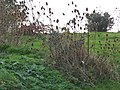 A large clump of teasels - geograph.org.uk - 1592340.jpg 640 × 480; 99 KB
-
 A mansion at Queen's Cross - geograph.org.uk - 1589537.jpg 640 × 466; 91 KB
-
 A mature tree in Hazlehead Park - geograph.org.uk - 1590318.jpg 480 × 640; 136 KB
-
 A path in Hazlehead Park - geograph.org.uk - 1590307.jpg 640 × 480; 92 KB
-
 A play area near Groats Road - geograph.org.uk - 1590144.jpg 640 × 480; 117 KB
-
 A rock outcrop on the River North Esk - geograph.org.uk - 1589884.jpg 640 × 424; 164 KB
-
 A shelter in Hazlehead Park - geograph.org.uk - 1590298.jpg 640 × 480; 55 KB
-
 A small llyn by Llyn Sarnau - geograph.org.uk - 1589503.jpg 640 × 426; 94 KB
-
 A swollen River Tweed at Lowood - geograph.org.uk - 1590620.jpg 640 × 426; 137 KB
-

-
 A track junction at Pen Ucha'r-gwaith - geograph.org.uk - 1589529.jpg 640 × 426; 115 KB
-
 A view across The Lagan , Lisburn - geograph.org.uk - 1590595.jpg 640 × 480; 82 KB
-
 A warning to dog-walkers - geograph.org.uk - 1592343.jpg 480 × 640; 100 KB
-

-
 A woodland walk - geograph.org.uk - 1590138.jpg 640 × 480; 144 KB
-
 A424 and the Diamond Way - geograph.org.uk - 1597233.jpg 640 × 480; 110 KB
-
 Abbey Infant School Darlington - geograph.org.uk - 1589214.jpg 640 × 480; 93 KB
-
 Aberdeen Crematorium - geograph.org.uk - 1589467.jpg 640 × 480; 63 KB
-
 Aberthaw Road, Alway, Newport - geograph.org.uk - 1589967.jpg 640 × 437; 77 KB
-
 Access to Hazlehead Park pavilions - geograph.org.uk - 1590291.jpg 640 × 468; 129 KB
-
 Across the fields - geograph.org.uk - 1600048.jpg 640 × 480; 89 KB
-
 Across the fields to Icomb - geograph.org.uk - 1597822.jpg 640 × 480; 73 KB
-
 Across the fields to Washbeerhayes Farm - geograph.org.uk - 1589119.jpg 640 × 480; 173 KB
-

-
 Across the Ithon valley to Castle Bank - geograph.org.uk - 1590185.jpg 480 × 640; 120 KB
-
 Adelaide Street - geograph.org.uk - 1590229.jpg 640 × 480; 69 KB
-
 Afon Llugwy in flood - geograph.org.uk - 1589233.jpg 462 × 640; 128 KB
-
 Afon Llugwy in flood - geograph.org.uk - 1589797.jpg 640 × 480; 264 KB
-
 Ainsworth Road - geograph.org.uk - 1592456.jpg 640 × 480; 61 KB
-
 Aircraft hangar, at Exeter Airport - geograph.org.uk - 1590497.jpg 640 × 480; 84 KB
-
 Albyn Lane - geograph.org.uk - 1590011.jpg 640 × 480; 75 KB
-
 Along Liswerry Park Drive, Newport - geograph.org.uk - 1589632.jpg 640 × 398; 58 KB
-
 Alum Scar wood - panoramio (1).jpg 1,008 × 756; 285 KB
-
 Alum Scar wood - panoramio (2).jpg 1,008 × 756; 387 KB
-
 Alum Scar wood - panoramio (3).jpg 1,008 × 756; 404 KB
-
 Alum Scar wood - panoramio (4).jpg 1,008 × 756; 413 KB
-
 Alum Scar wood - panoramio (5).jpg 1,008 × 756; 377 KB
-
 Alum Scar wood - panoramio (6).jpg 1,008 × 756; 350 KB
-
 Alum Scar wood - panoramio (7).jpg 1,008 × 756; 339 KB
-
 Alum Scar wood - panoramio (8).jpg 1,008 × 756; 331 KB
-
 Alum Scar wood - panoramio (9).jpg 1,008 × 756; 380 KB
-
 Alum Scar wood - panoramio.jpg 1,008 × 756; 379 KB
-
 Approaching Icomb - geograph.org.uk - 1597845.jpg 640 × 480; 81 KB
-
 Approaching Somerset - geograph.org.uk - 1619027.jpg 640 × 480; 104 KB
-
 Arable fields no more - geograph.org.uk - 1589680.jpg 640 × 480; 81 KB
-
 Armstrong Way - geograph.org.uk - 1594809.jpg 640 × 480; 84 KB
-
 Ascot Road, Bobbers Mill - geograph.org.uk - 1591116.jpg 640 × 480; 88 KB
-
 Ashridge Crescent, London SE18 - geograph.org.uk - 1589045.jpg 640 × 480; 89 KB
-
 Atlas Road and mill - geograph.org.uk - 1589661.jpg 640 × 480; 52 KB
-
 Autumn oak - geograph.org.uk - 1589127.jpg 640 × 480; 193 KB
-
 Autumn trees next to a farm lane - geograph.org.uk - 1589210.jpg 640 × 480; 193 KB
-

-
 Autumnal trees, near Lower Burrowton - geograph.org.uk - 1589616.jpg 640 × 480; 151 KB
-
 B and Q - geograph.org.uk - 1589221.jpg 640 × 480; 66 KB
-
 B3227 near Taddiport 1 - geograph.org.uk - 1589999.jpg 640 × 480; 239 KB
-
 B3227 near Taddiport 2 - geograph.org.uk - 1590006.jpg 640 × 480; 277 KB
-
 B3227 near Taddiport 3 - geograph.org.uk - 1590009.jpg 639 × 640; 452 KB
-
 Back of the Eisenhower Pier, Bangor - geograph.org.uk - 1592987.jpg 640 × 385; 232 KB
-

-
 Ballinderry Road - geograph.org.uk - 1591584.jpg 480 × 640; 125 KB
-
 Balloch Castle, Loch Lomond - geograph.org.uk - 1599635.jpg 640 × 480; 65 KB
-
 Ballybay River at Milltown - geograph.org.uk - 1590366.jpg 640 × 480; 132 KB
-
 Ballybay River at Milltown - geograph.org.uk - 1590371.jpg 480 × 640; 125 KB
-
 Bank by the mountain road - geograph.org.uk - 1589880.jpg 480 × 640; 130 KB
-
 Bank of Scotland car park exit - geograph.org.uk - 1590018.jpg 640 × 459; 64 KB
-
 Barn, near Crannaford Farm - geograph.org.uk - 1589438.jpg 640 × 480; 100 KB
-
 Barn, near Lower Southbrook - geograph.org.uk - 1589869.jpg 640 × 480; 142 KB
-
 Barton Baptist Church - geograph.org.uk - 1595165.jpg 640 × 346; 37 KB
-
 Beach huts, Southwold - geograph.org.uk - 1745199.jpg 800 × 600; 177 KB
-
 Beacon Hill, Clifton - geograph.org.uk - 1630529.jpg 640 × 480; 93 KB
-
 Beaconsfield Street - geograph.org.uk - 1590420.jpg 640 × 511; 94 KB
-
 Beaconsfield Street - geograph.org.uk - 1592241.jpg 640 × 480; 91 KB
-
 Beaconsfield Street - geograph.org.uk - 1626158.jpg 640 × 439; 104 KB
-
 Beckindale, near Lower Southbrook - geograph.org.uk - 1589897.jpg 640 × 480; 93 KB
-
 Beech wood near Taddiport - geograph.org.uk - 1590019.jpg 640 × 480; 296 KB
-
 Beech wood near Taddiport - geograph.org.uk - 1590039.jpg 640 × 480; 285 KB
-
 Belton Street - geograph.org.uk - 1592237.jpg 640 × 480; 69 KB
-
 Benson Knott - geograph.org.uk - 1589181.jpg 640 × 480; 71 KB
-
 Benson Lock - geograph.org.uk - 1594194.jpg 640 × 480; 75 KB
-
 Bentinck Road - geograph.org.uk - 1592029.jpg 640 × 480; 88 KB
-
 Bere Regis - Lane End - geograph.org.uk - 1591801.jpg 640 × 320; 26 KB
-
 Bexley Road, Northumberland Heath - geograph.org.uk - 1589084.jpg 640 × 480; 66 KB
-
 Birmingham Wheel in Centenary Square - geograph.org.uk - 1589344.jpg 480 × 640; 301 KB
-
 Bishopsgate - geograph.org.uk - 1589902.jpg 480 × 640; 112 KB
-
 Black Tor - geograph.org.uk - 1589006.jpg 640 × 427; 69 KB
-
 Black Tor Logan Stone - geograph.org.uk - 1589773.jpg 640 × 427; 77 KB
-
 Black Tor Stone Row - geograph.org.uk - 1589032.jpg 640 × 427; 80 KB
-
 Black Tor Stone Row - geograph.org.uk - 1589042.jpg 640 × 427; 103 KB
-
 Bleached fern frond, Wark Forest - geograph.org.uk - 1590191.jpg 640 × 480; 109 KB
-
 Blue plaque with a difference - geograph.org.uk - 1590303.jpg 480 × 640; 62 KB
-
 Blue plaque with a difference - geograph.org.uk - 1590311.jpg 480 × 640; 69 KB
-

-
 Bobbers Mill Panorama - geograph.org.uk - 1592219.jpg 640 × 477; 81 KB
-
 Bobbers Mill Road, Radford Road end - geograph.org.uk - 1594284.jpg 640 × 504; 96 KB
-
 Bobbers Mill, Albert Avenue - geograph.org.uk - 1592225.jpg 640 × 480; 77 KB
-

-
 Bobbers Mill, Cyril Avenue - geograph.org.uk - 1590665.jpg 640 × 481; 79 KB
-
 Bondgate Bridge - geograph.org.uk - 1590817.jpg 640 × 410; 73 KB
-
 Bournemouth , Gervis Place - geograph.org.uk - 1595223.jpg 640 × 480; 88 KB
-
 Bournemouth , Winton - Wimborne Road - geograph.org.uk - 1595447.jpg 640 × 474; 64 KB
-
-

-
 Bridgewater Canal - geograph.org.uk - 1592563.jpg 640 × 480; 89 KB
-
 Bridgewater Canal - geograph.org.uk - 1593141.jpg 640 × 480; 75 KB
-
 Bridleway between the woods - geograph.org.uk - 1596997.jpg 640 × 480; 154 KB
-
 Bridleway in the woods - geograph.org.uk - 1596991.jpg 640 × 480; 123 KB
-
 Bridleway meets main road - geograph.org.uk - 1597221.jpg 640 × 480; 127 KB
-
 Bridleway to Churchill - geograph.org.uk - 1616218.jpg 640 × 480; 133 KB
-
 Bridleway to Fernham - geograph.org.uk - 1616237.jpg 640 × 480; 143 KB
-
 Brookmount Railway Bridge - geograph.org.uk - 1591616.jpg 640 × 480; 100 KB
-
 Brookmount Railway Bridge - geograph.org.uk - 1591626.jpg 640 × 480; 129 KB
-
 Bryn y Fan hillside - geograph.org.uk - 1589933.jpg 480 × 640; 93 KB
-

-
 Buildings at Westwood - geograph.org.uk - 1589185.jpg 640 × 480; 200 KB
-
 Burnley Wood - geograph.org.uk - 1590368.jpg 640 × 480; 56 KB
-

-

-
 Bus shelter outside Hazlehead Park - geograph.org.uk - 1590274.jpg 640 × 476; 82 KB
-
 Bus stop, Lower Mickletown - geograph.org.uk - 1592350.jpg 640 × 480; 46 KB
-
 Bushmoor Crescent, London SE18 - geograph.org.uk - 1589051.jpg 640 × 480; 56 KB
-
 By the Bridge at the East Beach - geograph.org.uk - 1595269.jpg 640 × 377; 83 KB
-
 By the entrance - geograph.org.uk - 1594147.jpg 480 × 640; 84 KB
-
 Cairns above Uberash Breast - geograph.org.uk - 1590038.jpg 640 × 480; 109 KB
-
 Camden Close - geograph.org.uk - 1592517.jpg 640 × 480; 62 KB
-
 Cameron House Hotel, Loch Lomond - 4 - geograph.org.uk - 1599598.jpg 640 × 480; 69 KB
-
 Cameron House Hotel, Loch Lomond - 5 - geograph.org.uk - 1599601.jpg 640 × 480; 66 KB
-
 Cameron House Hotel, Loch Lomond - 6 - geograph.org.uk - 1599608.jpg 640 × 480; 128 KB
-

-

-
 Camperdown House, Newport - geograph.org.uk - 1588995.jpg 640 × 480; 66 KB
-
 Camperdown Road, Newport - geograph.org.uk - 1588975.jpg 640 × 436; 57 KB
-

-
 Capel Jerusalem, Pentre Castell - geograph.org.uk - 1590324.jpg 640 × 480; 56 KB
-
 Car park by Southwold Pier - geograph.org.uk - 1745772.jpg 800 × 600; 59 KB
-
 Cardwell Street - geograph.org.uk - 1590428.jpg 640 × 480; 99 KB
-
 Castle Clough Wood - geograph.org.uk - 1596500.jpg 640 × 480; 160 KB
-
 Chapel of Remembrance - geograph.org.uk - 1590349.jpg 640 × 420; 67 KB
-
 Chapel of St Anne's Hospital - geograph.org.uk - 1590818.jpg 640 × 400; 80 KB
-
 Chard Street - geograph.org.uk - 1618251.jpg 640 × 480; 80 KB
-
 Chill Pits Lane - geograph.org.uk - 1618269.jpg 640 × 480; 101 KB
-
 China Palace, Rochester - geograph.org.uk - 1627705.jpg 640 × 427; 66 KB
-
 Church buildings, Llandrindod Wells - geograph.org.uk - 1590122.jpg 640 × 453; 95 KB
-
 Church gates, Knowsley Road - geograph.org.uk - 1592524.jpg 640 × 480; 94 KB
-
 Churchfield News - geograph.org.uk - 1591058.jpg 640 × 480; 101 KB
-

-

-
 Clappmill Farm cross - geograph.org.uk - 1589179.jpg 640 × 480; 145 KB
-

-
 Clough Street - geograph.org.uk - 1590351.jpg 640 × 480; 62 KB
-

-
 Collingwood Close, Newport - geograph.org.uk - 1588958.jpg 640 × 530; 89 KB
-
 Collingwood Road, Newport - geograph.org.uk - 1588967.jpg 640 × 442; 65 KB
-

-
 Concrete otter on gatepost - geograph.org.uk - 1592267.jpg 640 × 480; 90 KB
-
 Copt Hewick Common - geograph.org.uk - 1590816.jpg 427 × 640; 82 KB
-
 Cottage, near Saundercroft Farm - geograph.org.uk - 1589631.jpg 640 × 480; 107 KB
-
 Cottages at Pentre Castell, Llanberis - geograph.org.uk - 1590720.jpg 640 × 480; 111 KB
-

-
 Cottages, south of Rockbeare - geograph.org.uk - 1590341.jpg 640 × 480; 61 KB
-
 Country lane by the Ithon valley - geograph.org.uk - 1590169.jpg 640 × 480; 138 KB
-
 Country lane, in autumn - geograph.org.uk - 1589856.jpg 640 × 480; 128 KB
-
 Courtyard Theatre, Hereford - geograph.org.uk - 1593812.jpg 480 × 640; 105 KB
-
 Covered reservoir - geograph.org.uk - 1598886.jpg 640 × 480; 102 KB
-
 Crab Lane Junction - geograph.org.uk - 1600703.jpg 640 × 480; 62 KB
-
 Cramber Pool - geograph.org.uk - 1588933.jpg 640 × 427; 86 KB
-
 Cramber Tor - geograph.org.uk - 1588942.jpg 640 × 427; 60 KB
-

-
 Crannaford Cottage - geograph.org.uk - 1589515.jpg 640 × 480; 115 KB
-
 Crossing Cottage - geograph.org.uk - 1589533.jpg 640 × 480; 85 KB
-
 Crossroads, Hutton Gate - geograph.org.uk - 1589197.jpg 640 × 480; 62 KB
-
 Curious horse - geograph.org.uk - 1592248.jpg 640 × 480; 87 KB
-
 Custom House Quay - Weymouth - geograph.org.uk - 1593850.jpg 640 × 480; 110 KB
-
 Cwm Brwyno - geograph.org.uk - 1589075.jpg 640 × 412; 96 KB
-

-
 Dali's Hole - geograph.org.uk - 1592799.jpg 640 × 480; 108 KB
-

-
 Deepdale Road - geograph.org.uk - 1592549.jpg 640 × 480; 75 KB
-

-
 Detail of the stonework on the Orangerie - geograph.org.uk - 1589992.jpg 640 × 424; 105 KB
-
 Devon Caravans, Rockbeare - geograph.org.uk - 1589974.jpg 640 × 438; 64 KB
-
 Devonport Leat after heavy rain - geograph.org.uk - 1588957.jpg 640 × 427; 96 KB
-
 Devonport Leat after heavy rain - geograph.org.uk - 1588971.jpg 640 × 427; 103 KB
-
 Diamond Way - geograph.org.uk - 1596986.jpg 640 × 480; 80 KB
-
 Diamond Way - geograph.org.uk - 1597868.jpg 640 × 480; 80 KB
-
 Diamond Way - geograph.org.uk - 1597871.jpg 640 × 480; 128 KB
-
 Diamond Way - geograph.org.uk - 1597915.jpg 640 × 480; 125 KB
-

-
 Disused Railway - geograph.org.uk - 1589534.jpg 640 × 480; 96 KB
-
 Dockergarths Plantation - geograph.org.uk - 1589177.jpg 640 × 480; 134 KB
-

-
 Driveway of Gawcombe - geograph.org.uk - 1598862.jpg 640 × 480; 116 KB
-
 Driveway to Gawcombe - geograph.org.uk - 1598865.jpg 640 × 480; 121 KB
-
 Drystane Dyke - geograph.org.uk - 1589238.jpg 480 × 640; 83 KB


.jpg)
.jpg)
.jpg)
.jpg)
.jpg)
.jpg)
.jpg)
.jpg)
.jpg)


