Category:United Kingdom photographs taken on 2009-08-08
Jump to navigation
Jump to search
| ← | Saturday 8 August 2009 | → | ||
| ← | August 2009 | → | ||

United Kingdom photographs taken on 8 August 2009.
Image files should be categorized here automatically using {{taken on}} template. Direct categorisation is also possible, if automatic is impossible.
Subcategories
This category has the following 5 subcategories, out of 5 total.
Media in category "United Kingdom photographs taken on 2009-08-08"
The following 200 files are in this category, out of 2,258 total.
(previous page) (next page)-

-

-

-

-

-

-

-
 'Beach' at Jenny Brown's point - geograph.org.uk - 1434006.jpg 640 × 425; 148 KB
-
 'Tangmere' near Gomshall, Surrey (5328093553).jpg 1,009 × 780; 1,006 KB
-
 .Comma. ( Hutchinsoni variation^) - Flickr - gailhampshire.jpg 1,596 × 1,080; 364 KB
-
 Flax Bourton railway station MMB 29 Tornado 60163.jpg 2,400 × 1,600; 2.62 MB
-
 106 miles and 55 chains on Bridge 1661 - geograph.org.uk - 1435743.jpg 640 × 480; 108 KB
-
 13 Main Street, Hemington - geograph.org.uk - 1436885.jpg 640 × 479; 65 KB
-
 156406 Danesmoor (3800884398).jpg 2,500 × 1,667; 2.92 MB
-
 16, 14 and 12 Manor Road in 2009 - geograph.org.uk - 1433247.jpg 640 × 513; 78 KB
-
 1682 Danemoor bridge - geograph.org.uk - 1434201.jpg 480 × 640; 85 KB
-
 17th Century Cottage - geograph.org.uk - 1434540.jpg 640 × 547; 142 KB
-
 1937 Coronation plantation - geograph.org.uk - 1435590.jpg 640 × 480; 120 KB
-
 1st Rhosnessney Scout Hut - geograph.org.uk - 1633456.jpg 640 × 427; 67 KB
-
 Bristol Balloon Fiesta 2009 MMB 07.jpg 2,400 × 1,600; 1.72 MB
-
 Bristol Balloon Fiesta 2009 MMB 09 G-LBUK.jpg 2,400 × 1,600; 1.18 MB
-
 Bristol Balloon Fiesta 2009 MMB 19 G-CELM.jpg 2,400 × 1,535; 1.76 MB
-
 Bristol Balloon Fiesta 2009 MMB 24.jpg 1,532 × 2,300; 1.94 MB
-
 Bristol Balloon Fiesta 2009 MMB 26.jpg 2,235 × 1,463; 1.59 MB
-
 Bristol Balloon Fiesta 2009 MMB 28 G-CDOG.jpg 2,400 × 1,600; 2.6 MB
-
 Bristol Balloon Fiesta 2009 MMB 29.jpg 2,400 × 1,600; 2.15 MB
-
 Bristol Balloon Fiesta 2009 MMB 30 G-UPOI G-CDDM G-GOGB.jpg 2,400 × 1,600; 1.82 MB
-
 34059 'Sir Archibald Sinclair' - geograph.org.uk - 1438962.jpg 640 × 480; 67 KB
-
 435 bus outside the Assembly Rooms - geograph.org.uk - 1466296.jpg 640 × 480; 66 KB
-
 56040 Oystermouth - geograph.org.uk - 1435339.jpg 640 × 480; 56 KB
-
 56040 Oystermouth - geograph.org.uk - 1435358.jpg 640 × 480; 61 KB
-

-
 7 and 9 Main Street, Hemington - geograph.org.uk - 1436888.jpg 640 × 479; 82 KB
-
 701 bus in Mill Street - geograph.org.uk - 1466294.jpg 640 × 480; 72 KB
-
 701 bus outside the Assembly Rooms - geograph.org.uk - 1466047.jpg 640 × 480; 64 KB
-
 703 bus in Old Street - geograph.org.uk - 1465847.jpg 640 × 480; 66 KB
-
 A geo at Porth Morgan - geograph.org.uk - 1435776.jpg 640 × 480; 101 KB
-

-
 A hidden geo - geograph.org.uk - 1445644.jpg 640 × 480; 121 KB
-

-
 A muddy high Weald Landscape Trail - geograph.org.uk - 1437443.jpg 640 × 480; 141 KB
-

-

-

-

-
 A shop for "Happy Families" - geograph.org.uk - 1449318.jpg 640 × 480; 72 KB
-

-

-

-
 A summer stroll in Broad Street - geograph.org.uk - 1465950.jpg 480 × 640; 68 KB
-
 A summer stroll in Churchill Road - geograph.org.uk - 1449094.jpg 640 × 480; 86 KB
-
 A summer stroll in Easthope Road - geograph.org.uk - 1449221.jpg 640 × 480; 79 KB
-

-

-

-
 A.B. Optics in Sandford Avenue - geograph.org.uk - 1449307.jpg 480 × 640; 82 KB
-
 A143 Beccles Road, Fritton - geograph.org.uk - 1439573.jpg 640 × 480; 87 KB
-
 A143 Beccles Road, Fritton - geograph.org.uk - 1439575.jpg 3,072 × 2,304; 1.39 MB
-
 A143 Beccles Road, Fritton - geograph.org.uk - 1439582.jpg 3,072 × 2,304; 1.38 MB
-
 A143 Beccles Road, Haddiscoe - geograph.org.uk - 1439503.jpg 3,072 × 2,304; 1.44 MB
-
 A143 Beccles Road, Haddiscoe - geograph.org.uk - 1439506.jpg 3,072 × 2,304; 1.44 MB
-
 A143 Beccles Road, Haddiscoe - geograph.org.uk - 1439649.jpg 3,072 × 2,304; 1.48 MB
-
 A145 London Road, Beccles - geograph.org.uk - 1438293.jpg 3,072 × 2,304; 1.32 MB
-
 A2070 Willesborough Road bridge - geograph.org.uk - 1435932.jpg 640 × 480; 60 KB
-
 A40 - A449 road junction near Raglan - geograph.org.uk - 1456762.jpg 640 × 427; 272 KB
-
 A453 approaching Jct 24 - geograph.org.uk - 1437391.jpg 640 × 479; 48 KB
-
 Abundant in Station Drive - geograph.org.uk - 1465130.jpg 480 × 640; 79 KB
-
 Access road off Station Drive - geograph.org.uk - 1466509.jpg 640 × 480; 65 KB
-
 Accountants in Mill Street - geograph.org.uk - 1466043.jpg 480 × 640; 59 KB
-
 Acton Town Underground Station - geograph.org.uk - 1433797.jpg 640 × 480; 72 KB
-

-
 AFRPS Appleby shed - 2009-08-08.jpg 2,592 × 3,872; 2.08 MB
-
 AFRPS Frodingham station - 2009-08-08.jpg 3,872 × 2,592; 3.48 MB
-
 Aglais io - geograph.org.uk - 1437547.jpg 640 × 480; 97 KB
-
 Air Algérie A330-200 7T-VJX LHR 2009-8-8.png 1,024 × 683; 2 MB
-
 Air New Zealand Boeing 747-400 KvW.jpg 1,023 × 683; 254 KB
-
 Airbus A330-343X, Air Canada AN1580529.jpg 1,024 × 683; 176 KB
-
 Akgakirk Fen to the Sea Bank - geograph.org.uk - 1435911.jpg 640 × 426; 74 KB
-
 Alana ecology in the High Street - geograph.org.uk - 1466809.jpg 640 × 480; 83 KB
-
 Albyn Terrace - geograph.org.uk - 1460018.jpg 640 × 480; 121 KB
-
 Algakirk Fen - geograph.org.uk - 1435922.jpg 640 × 426; 79 KB
-
 All Saint's Church, Brockhampton - geograph.org.uk - 1434628.jpg 640 × 426; 81 KB
-
-
 All Saints churchyard - geograph.org.uk - 1473185.jpg 640 × 480; 105 KB
-
 Alley branching off from Old Street - geograph.org.uk - 1465818.jpg 480 × 640; 53 KB
-

-
 Allt Dhaidh Mor Ford - geograph.org.uk - 1435324.jpg 640 × 480; 95 KB
-

-

-
 Altogether Unique in Corve Street - geograph.org.uk - 1465721.jpg 480 × 640; 85 KB
-
 Ammanford Town Hall - geograph.org.uk - 1447404.jpg 640 × 480; 72 KB
-

-
 An August Saturday in Mill Street - geograph.org.uk - 1466284.jpg 640 × 460; 65 KB
-
 An inflatable in Porth y gwin - geograph.org.uk - 1445172.jpg 640 × 480; 69 KB
-
 An old horse drawn plough - geograph.org.uk - 1449933.jpg 640 × 482; 119 KB
-
-

-
 Anglers on the River Tweed at Leaderfoot - geograph.org.uk - 1435523.jpg 640 × 427; 150 KB
-
 Another way of "logging out" - geograph.org.uk - 1437692.jpg 640 × 470; 134 KB
-
 Approach to garden centre near Dunchurch - geograph.org.uk - 1434348.jpg 640 × 421; 101 KB
-
 Approaching a spur in Essex Road - geograph.org.uk - 1449179.jpg 640 × 480; 69 KB
-
 Approaching Philpots Farm - geograph.org.uk - 1437284.jpg 640 × 480; 145 KB
-

-

-
-

-

-
 Arable land below Goodrich Castle - geograph.org.uk - 1436173.jpg 640 × 426; 98 KB
-

-

-
 Arrowebrook Bus Depot - geograph.org.uk - 1433645.jpg 640 × 480; 88 KB
-
 Art gallery in Corve Street - geograph.org.uk - 1465695.jpg 640 × 480; 103 KB
-
 Ashby Baptist Church - geograph.org.uk - 1470244.jpg 640 × 480; 107 KB
-
 Ashby Congregational Church - geograph.org.uk - 1469944.jpg 640 × 480; 75 KB
-
 Ashby town centre and the White Hart - geograph.org.uk - 1470257.jpg 640 × 480; 101 KB
-
 Holy Trinity Church - geograph.org.uk - 1469910.jpg 468 × 640; 140 KB
-
 Holy Trinity church interior - geograph.org.uk - 1469919.jpg 640 × 480; 110 KB
-
 Ashwellthorpe Railway station - geograph.org.uk - 1435510.jpg 640 × 480; 76 KB
-
 At the edge of Santon Wood - geograph.org.uk - 1435261.jpg 640 × 425; 98 KB
-
 August Cows - geograph.org.uk - 1771122.jpg 640 × 480; 61 KB
-
 Aylmerton St John the Baptist's church - geograph.org.uk - 2207443.jpg 700 × 525; 200 KB
-
 B1208 through Far Wood - geograph.org.uk - 1433486.jpg 640 × 480; 109 KB
-
 Balancing Pond at Wetherby Services - geograph.org.uk - 1449662.jpg 640 × 480; 104 KB
-
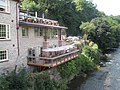 Balcony overlooking the Teme at Ludford - geograph.org.uk - 1465918.jpg 640 × 480; 105 KB
-
 Balgonie Castle - geograph.org.uk - 1438108.jpg 640 × 480; 61 KB
-
 Balgonie Castle courtyard - geograph.org.uk - 1438106.jpg 640 × 426; 75 KB
-
 Banksy Doodle - panoramio.jpg 603 × 776; 458 KB
-
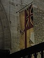
 Banner within St Giles, Ludford - geograph.org.uk - 1443996.jpg 480 × 640; 57 KB
-
 Barclays Bank in King Street - geograph.org.uk - 1466767.jpg 480 × 640; 93 KB
-

-

-

-
 Barley growing near Fishpool Hill - geograph.org.uk - 1434406.jpg 640 × 426; 84 KB
-
 Barn at Whittlebury Farm - geograph.org.uk - 1434577.jpg 640 × 426; 107 KB
-
 Barn conversion at Brockhampton - geograph.org.uk - 1434637.jpg 640 × 426; 65 KB
-

-
-
 Barton-le-Willows - geograph.org.uk - 1435431.jpg 640 × 480; 60 KB
-

-
 Beach coach station - geograph.org.uk - 1435059.jpg 640 × 425; 40 KB
-
 Beaumont Court - geograph.org.uk - 1449306.jpg 640 × 452; 82 KB
-
 Beaumont Road shops - geograph.org.uk - 1449249.jpg 480 × 640; 45 KB
-

-
 Bebb Fine Art in Church Street - geograph.org.uk - 1466321.jpg 640 × 480; 84 KB
-
 Beccles Town Sign - geograph.org.uk - 1438286.jpg 3,072 × 2,304; 1.41 MB
-
 Beccles Town Sign - geograph.org.uk - 1438287.jpg 3,072 × 2,304; 1.32 MB
-
 Bell Tower, St Mary's Church - geograph.org.uk - 1432916.jpg 683 × 1,024; 125 KB
-
 Bench near Cwmbran Drive path - geograph.org.uk - 1444594.jpg 640 × 480; 148 KB
-

-
 Bend in Linney - geograph.org.uk - 1465625.jpg 480 × 640; 83 KB
-
 Bend in Old Street - geograph.org.uk - 1465881.jpg 640 × 480; 66 KB
-

-
 Bend in the road near The Headlands - geograph.org.uk - 1436714.jpg 640 × 480; 37 KB
-

-
 Benkid77 156420, Buxton 1 080809.JPG 3,648 × 2,736; 3.67 MB
-
 Beridge Arms - geograph.org.uk - 1527594.jpg 640 × 426; 62 KB
-
 Black Swan Walk - geograph.org.uk - 1465719.jpg 640 × 480; 89 KB
-

-

-
 Boats in Collieston Bay - geograph.org.uk - 1461120.jpg 640 × 480; 109 KB
-
 Boats on the water. - geograph.org.uk - 1706385.jpg 4,368 × 2,912; 5.22 MB
-
 Bodbury Close - geograph.org.uk - 1449110.jpg 640 × 480; 74 KB
-
 Boeing 767-432-ER, Delta Air Lines AN1582400.jpg 1,024 × 683; 184 KB
-
 Boeing 777-219-ER, Air New Zealand AN1569463.jpg 1,024 × 683; 189 KB
-
 Boeing 777-246-ER, Japan Airlines - JAL AN1570917.jpg 1,024 × 683; 175 KB
-
 Boeing 777-333-ER, Air Canada AN1569421.jpg 1,024 × 683; 203 KB
-
 Bookshop in Castle Street - geograph.org.uk - 1466042.jpg 640 × 480; 89 KB
-
 Bradgate Country Park at Hunt's Hill - geograph.org.uk - 1471821.jpg 640 × 480; 116 KB
-
 Bradgate House - 1 - geograph.org.uk - 1475134.jpg 640 × 480; 134 KB
-
 Bradgate House - 2 - geograph.org.uk - 1475137.jpg 640 × 480; 110 KB
-
 Braemar Castle and curtain wall - geograph.org.uk - 1435899.jpg 480 × 640; 75 KB
-
 Braemar Castle from the east - geograph.org.uk - 1435908.jpg 640 × 480; 72 KB
-
 Brampton Milepost on the A145 - geograph.org.uk - 1438037.jpg 3,072 × 2,304; 1.68 MB
-

-

-

-

-

-
 Brewhurst Lock, Wey and Arun Canal - geograph.org.uk - 1436603.jpg 640 × 469; 120 KB
-
 Brewhurst Lock, Wey and Arun Canal - geograph.org.uk - 1438624.jpg 640 × 465; 132 KB
-
 Bridge - panoramio - Tanya Dedyukhina.jpg 1,408 × 1,056; 234 KB
-
 Bridge 1661 on the Forncett Branch - geograph.org.uk - 1435749.jpg 640 × 480; 100 KB
-
 Bridge 1679 on the Mid Norfolk Railway - geograph.org.uk - 1433278.jpg 640 × 480; 125 KB
-
 Bridge 1690 - geograph.org.uk - 1435118.jpg 640 × 480; 78 KB
-
 Bridge from Ellingham to Somerley Park - geograph.org.uk - 1433729.jpg 640 × 427; 188 KB
-

-
 Bridge over Mawddach at Penmaenpool - geograph.org.uk - 1453769.jpg 640 × 482; 53 KB
-
 Bridge over the drainage ditch at Haddiscoe - geograph.org.uk - 1439485.jpg 3,072 × 2,304; 1.33 MB
-
 Bridgnorth - panoramio - Tanya Dedyukhina (1).jpg 1,408 × 1,056; 272 KB
-
 Bridgnorth - panoramio - Tanya Dedyukhina (2).jpg 1,408 × 1,056; 266 KB
-
 Bridgnorth - panoramio - Tanya Dedyukhina (4).jpg 1,408 × 1,056; 231 KB
-
 Bridgnorth - panoramio - Tanya Dedyukhina.jpg 1,408 × 1,056; 313 KB
-
 Bridgnorth town's tower - panoramio.jpg 1,408 × 1,056; 283 KB
-
 Bridgnorth view from the upper town - panoramio.jpg 1,408 × 1,056; 478 KB
-
 Church - panoramio - Tanya Dedyukhina (1).jpg 1,408 × 1,056; 291 KB
-
 Church - panoramio - Tanya Dedyukhina.jpg 1,408 × 1,056; 333 KB
-
 Bridleway and Private Drive - geograph.org.uk - 1433579.jpg 640 × 480; 133 KB
-
 Bridleway near Strawberry Roundabout - geograph.org.uk - 1433538.jpg 480 × 640; 152 KB
-

-
 Bringing in the Harvest - geograph.org.uk - 1436980.jpg 640 × 425; 110 KB


.jpg)
_-_Flickr_-_gailhampshire.jpg)


.jpg)


_-_geograph.org.uk_-_1466024.jpg)
_-_geograph.org.uk_-_1466018.jpg)


_-_geograph.org.uk_-_1466022.jpg)
_-_geograph.org.uk_-_1466829.jpg)
_-_geograph.org.uk_-_1466886.jpg)


.jpg)
.jpg)
.jpg)


.jpg)


