Category:United Kingdom photographs taken on 2009-07-12
Jump to navigation
Jump to search

Subcategories
This category has the following 4 subcategories, out of 4 total.
Media in category "United Kingdom photographs taken on 2009-07-12"
The following 200 files are in this category, out of 1,202 total.
(previous page) (next page)-
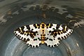 (1884) The Magpie (Abraxas grossulariata) (3717095703).jpg 1,200 × 803; 966 KB
-
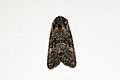 (2225) Minor Shoulder-knot (Brachylomia viminalis) (3717096929).jpg 1,500 × 1,004; 837 KB
-
 (2225) Minor Shoulder-knot (Brachylomia viminalis) (3717912516).jpg 1,200 × 803; 708 KB
-
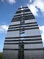
 10 Trinity Square.jpg 640 × 455; 95 KB
-
 114 miles to nowhere - geograph.org.uk - 1397748.jpg 447 × 640; 146 KB
-
 14 crossings over - under the Tyne - geograph.org.uk - 1414275.jpg 480 × 640; 58 KB
-
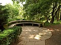
 A bench in the Mulgrave Woods - geograph.org.uk - 1626049.jpg 640 × 428; 123 KB
-
 A berk in Birk Dale^ - geograph.org.uk - 1397494.jpg 640 × 432; 100 KB
-
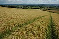
 A field of ripening wheat - geograph.org.uk - 1397268.jpg 640 × 480; 97 KB
-
 A field overlooking Sandsend Wyke - geograph.org.uk - 1626079.jpg 640 × 428; 57 KB
-
 A flooded farm track - geograph.org.uk - 1397383.jpg 640 × 480; 114 KB
-
 A glimpse of the forest - geograph.org.uk - 1397727.jpg 640 × 480; 96 KB
-
 A New Footpath^ - geograph.org.uk - 1397245.jpg 640 × 427; 115 KB
-
 A pleasant place for a cup of tea - geograph.org.uk - 1397140.jpg 640 × 480; 102 KB
-
 A tree in the Mulgrave Woods - geograph.org.uk - 1626024.jpg 428 × 640; 121 KB
-
 A tree in the Mulgrave Woods - geograph.org.uk - 1626037.jpg 640 × 428; 143 KB
-
 A Waterfall dashes in Little Sled Dale. - geograph.org.uk - 1397536.jpg 475 × 640; 119 KB
-
 A1 Tornado, Newton Abbot - geograph.org.uk - 1715873.jpg 1,024 × 683; 174 KB
-
 A361 at West Lyng - geograph.org.uk - 1398441.jpg 640 × 480; 78 KB
-
 A470 toward Brecon - geograph.org.uk - 1538973.jpg 640 × 480; 65 KB
-
 A48 approaching the Cinderford junction - geograph.org.uk - 1397725.jpg 640 × 480; 118 KB
-
 A48, heading for Gloucester - geograph.org.uk - 1397708.jpg 640 × 480; 139 KB
-
 A698 heading towards Denholm - geograph.org.uk - 1397455.jpg 640 × 480; 55 KB
-
 Abba - geograph.org.uk - 1398458.jpg 640 × 480; 61 KB
-
 Abereiddy Bay - geograph.org.uk - 1406831.jpg 600 × 450; 163 KB
-

-
 Above Traeth Llyfn, cornfield - geograph.org.uk - 1406839.jpg 600 × 450; 176 KB
-
 Access road to Holverston Hall - geograph.org.uk - 1397281.jpg 640 × 480; 116 KB
-
 Acer leaves, Dartington - geograph.org.uk - 1401608.jpg 640 × 506; 111 KB
-
 Acer, Dartington - geograph.org.uk - 1401590.jpg 640 × 480; 152 KB
-
 Across the horseshoe bend - geograph.org.uk - 1397141.jpg 640 × 480; 132 KB
-
 Across the iron bridge, northwards - geograph.org.uk - 1401238.jpg 480 × 640; 56 KB
-
 Adsborough village - geograph.org.uk - 1397012.jpg 640 × 480; 134 KB
-

-
 Aglais urticae on Inula, Dartington - geograph.org.uk - 1401516.jpg 640 × 434; 63 KB
-

-

-
 Another view of the Cwm Crew moraine - geograph.org.uk - 1399058.jpg 640 × 480; 100 KB
-
 Anyone for Pimm's^ - geograph.org.uk - 1398484.jpg 640 × 480; 100 KB
-

-

-
 Arch bridge near Westbury-on-Severn - geograph.org.uk - 1397742.jpg 640 × 480; 122 KB
-
 Arch bridge on the Blaisdon road - geograph.org.uk - 1397746.jpg 640 × 466; 100 KB
-
 Arches and windows, Belfast - geograph.org.uk - 1397740.jpg 640 × 454; 68 KB
-
 Armchair Theatre - geograph.org.uk - 1397620.jpg 640 × 480; 89 KB
-
 Artwork, Belfast (4) - geograph.org.uk - 1396783.jpg 640 × 428; 69 KB
-
 Asda Superstore, Keighley - geograph.org.uk - 1401585.jpg 640 × 480; 65 KB
-

-
 Aughton, A338 - geograph.org.uk - 1405210.jpg 640 × 480; 98 KB
-

-
-
 B6359 heading for Horsleyhill Farm - geograph.org.uk - 1396945.jpg 640 × 480; 72 KB
-
 Bank Lane - geograph.org.uk - 1396904.jpg 640 × 480; 142 KB
-
 Barcombe Recreation Ground - geograph.org.uk - 1397792.jpg 640 × 480; 67 KB
-
 Barley field on Sandhurst Hill - geograph.org.uk - 1397270.jpg 640 × 426; 110 KB
-
 Barley field, Sandhurst Hill - geograph.org.uk - 1397142.jpg 640 × 426; 103 KB
-
 Barn of Budd's Green Farm - geograph.org.uk - 1399592.jpg 640 × 480; 84 KB
-
 Barrow Road Level Crossing, New Holland - geograph.org.uk - 1398414.jpg 640 × 480; 101 KB
-
 Bastion Whispering Circle, Dartington - geograph.org.uk - 1401727.jpg 640 × 480; 123 KB
-
 St George and All Saints, Beaford - geograph.org.uk - 1411996.jpg 640 × 428; 88 KB
-
 BearwoodCollege2.jpg 1,224 × 1,632; 847 KB
-
 Beccles, Bus Station - geograph.org.uk - 1735615.jpg 3,072 × 2,304; 2.7 MB
-
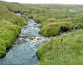 Beck Meetings - geograph.org.uk - 1397479.jpg 640 × 504; 122 KB
-
 Bee on Echinops, Dartington - geograph.org.uk - 1401511.jpg 529 × 640; 56 KB
-
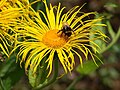 Bee on Inula, Dartington - geograph.org.uk - 1401487.jpg 640 × 480; 89 KB
-
 Behind the War Memorial - geograph.org.uk - 1398743.jpg 640 × 480; 87 KB
-
 Big Hills in the Clag - geograph.org.uk - 1397520.jpg 640 × 209; 29 KB
-
 Birdingbury Country Festival (1) - geograph.org.uk - 1397339.jpg 640 × 417; 130 KB
-
 Birdingbury Country Festival (10) - geograph.org.uk - 1397424.jpg 640 × 426; 131 KB
-
 Birdingbury Country Festival (11) - geograph.org.uk - 1399772.jpg 640 × 458; 115 KB
-
 Birdingbury Country Festival (12) - geograph.org.uk - 1399779.jpg 640 × 425; 124 KB
-
 Birdingbury Country Festival (13) - geograph.org.uk - 1399785.jpg 640 × 426; 105 KB
-
 Birdingbury Country Festival (14) - geograph.org.uk - 1399787.jpg 640 × 426; 112 KB
-
 Birdingbury Country Festival (15) - geograph.org.uk - 1399797.jpg 640 × 419; 107 KB
-
 Birdingbury Country Festival (16) - geograph.org.uk - 1399802.jpg 640 × 447; 155 KB
-
 Birdingbury Country Festival (17) - geograph.org.uk - 1399810.jpg 640 × 426; 124 KB
-
 Birdingbury Country Festival (18) - geograph.org.uk - 1399817.jpg 640 × 426; 134 KB
-
 Birdingbury Country Festival (19) - geograph.org.uk - 1399822.jpg 474 × 640; 110 KB
-
 Birdingbury Country Festival (2) - geograph.org.uk - 1397342.jpg 640 × 420; 134 KB
-
 Birdingbury Country Festival (20) - geograph.org.uk - 1399827.jpg 640 × 477; 146 KB
-
 Birdingbury Country Festival (21) - geograph.org.uk - 1399833.jpg 640 × 426; 111 KB
-
 Birdingbury Country Festival (22) - geograph.org.uk - 1399838.jpg 640 × 469; 118 KB
-
 Birdingbury Country Festival (23) - geograph.org.uk - 1399843.jpg 640 × 426; 109 KB
-
 Birdingbury Country Festival (3) - geograph.org.uk - 1397355.jpg 640 × 407; 99 KB
-
 Birdingbury Country Festival (4) - geograph.org.uk - 1397362.jpg 640 × 409; 126 KB
-
 Birdingbury Country Festival (5) - geograph.org.uk - 1397373.jpg 640 × 436; 126 KB
-
 Birdingbury Country Festival (6) - geograph.org.uk - 1397379.jpg 640 × 436; 123 KB
-
 Birdingbury Country Festival (7) - geograph.org.uk - 1397389.jpg 640 × 432; 136 KB
-
 Birdingbury Country Festival (8) - geograph.org.uk - 1397403.jpg 640 × 418; 120 KB
-
 Birdingbury Country Festival (9) - geograph.org.uk - 1397411.jpg 640 × 425; 146 KB
-

-
 Bishops Cannings, Chandlers Lane - geograph.org.uk - 1406742.jpg 640 × 480; 82 KB
-

-

-
 Bishops Cannings, The Crown Inn - geograph.org.uk - 1406871.jpg 640 × 480; 74 KB
-
 Bison enclosure - geograph.org.uk - 1398582.jpg 640 × 440; 35 KB
-
 Blackcurrant 'Ben Lomond' - geograph.org.uk - 1397771.jpg 639 × 640; 368 KB
-
 Church Hall, Bladon - geograph.org.uk - 1407978.jpg 480 × 640; 62 KB
-
 Bladon School from churchyard - geograph.org.uk - 1407985.jpg 640 × 480; 86 KB
-
 Blastobasis lacticolella (3717098929).jpg 1,500 × 1,004; 818 KB
-
 Blenheim Palace - geograph.org.uk - 1485192.jpg 640 × 474; 74 KB
-
 Blenheim Palace - geograph.org.uk - 1485398.jpg 640 × 480; 54 KB
-
 Blenheim Palace - geograph.org.uk - 1485408.jpg 480 × 640; 98 KB
-
-
-
 Bolton Abbey station - geograph.org.uk - 1400965.jpg 640 × 480; 65 KB
-
 Bolton Abbey West signal box - geograph.org.uk - 1400973.jpg 640 × 480; 72 KB
-
 Bonsai hawthorn on limestone pavement - geograph.org.uk - 1408168.jpg 640 × 480; 117 KB
-
 Booths Well 2009 - geograph.org.uk - 1399197.jpg 640 × 606; 188 KB
-
-

-
-
 Brecon Beacons - geograph.org.uk - 1538983.jpg 640 × 480; 81 KB
-
 Brewery at Fosse Park - geograph.org.uk - 1401601.jpg 640 × 480; 76 KB
-
 Briar Cottage, Back Lane - geograph.org.uk - 1408019.jpg 640 × 427; 110 KB
-
 Bridge by Cyffredin Cottages - geograph.org.uk - 1397184.jpg 640 × 480; 93 KB
-
 Bridge near Trench Farm - geograph.org.uk - 1399700.jpg 640 × 480; 124 KB
-
 Bridge over brook - geograph.org.uk - 1397576.jpg 640 × 480; 128 KB
-
 Bridge over dismantled railway - geograph.org.uk - 1396895.jpg 640 × 425; 101 KB
-
 Bridge over Little Sled Dale Beck - geograph.org.uk - 1397532.jpg 640 × 480; 128 KB
-
 Bridge over Long Gill - geograph.org.uk - 1397523.jpg 640 × 480; 146 KB
-
 Bridge over stream near Roughetts Wood - geograph.org.uk - 1399679.jpg 640 × 480; 126 KB
-
 Bridge under disused railway - geograph.org.uk - 1396846.jpg 640 × 425; 97 KB
-
 Bridleway in Dene Park - geograph.org.uk - 1399469.jpg 640 × 480; 127 KB
-
 Bridleway Junction in Dene Park - geograph.org.uk - 1399477.jpg 640 × 480; 120 KB
-
 Bridleway junction in Fairlawne Park - geograph.org.uk - 1399525.jpg 640 × 480; 75 KB
-
 Bridleway on Cherhill Down - geograph.org.uk - 1564983.jpg 640 × 480; 135 KB
-
 Bridleway to Hellington - geograph.org.uk - 1397387.jpg 515 × 640; 162 KB
-
 Bridleway to Ightam Mote - geograph.org.uk - 1399532.jpg 640 × 480; 111 KB
-
 Bridleway to the A146 - geograph.org.uk - 1397375.jpg 630 × 553; 100 KB
-
 Bridleway, Morgan's Hill - geograph.org.uk - 1564960.jpg 640 × 480; 142 KB
-
 Brinkworth village hall - geograph.org.uk - 1575275.jpg 640 × 480; 128 KB
-
 Broad riverboat on the Avon - geograph.org.uk - 1399610.jpg 640 × 407; 89 KB
-
 Broadoak House - geograph.org.uk - 1397699.jpg 640 × 437; 75 KB
-

-

-

-
-

-
 Brown's Row, Belfast (2) - geograph.org.uk - 1397391.jpg 640 × 403; 86 KB
-
 Buckingham palace - panoramio (1).jpg 4,288 × 2,848; 4.38 MB
-
 Buildings at Hassendean Farm - geograph.org.uk - 1396838.jpg 640 × 480; 44 KB
-
 Bull Inn, Brasted - geograph.org.uk - 1398788.jpg 640 × 480; 59 KB
-
 Burbage, Former route of the MandSWJR - geograph.org.uk - 1405042.jpg 640 × 480; 116 KB
-
 Bures Post Office - geograph.org.uk - 1396899.jpg 480 × 640; 77 KB
-
 Burial ground - geograph.org.uk - 1397139.jpg 640 × 480; 94 KB
-
 Bury To Sudbury - geograph.org.uk - 1396850.jpg 640 × 480; 94 KB
-
 Byway, Roundway - geograph.org.uk - 1564935.jpg 640 × 480; 147 KB
-
 Cafe at Wetton Mill - geograph.org.uk - 1408817.jpg 640 × 426; 445 KB
-
 Caisteal Camus - geograph.org.uk - 1680197.jpg 3,648 × 2,736; 3.08 MB
-
 Calstone Combes - geograph.org.uk - 1564987.jpg 640 × 480; 146 KB
-
 Calstone Mill - geograph.org.uk - 1564967.jpg 640 × 480; 171 KB
-
 Canal Road Bridge - geograph.org.uk - 1401361.jpg 640 × 480; 48 KB
-

-
 Car Dealer, Crawley Road, Horsham - geograph.org.uk - 1399856.jpg 640 × 480; 69 KB
-
 Carnaby Level Crossing - geograph.org.uk - 1412117.jpg 640 × 423; 46 KB
-
 Cat Mouse Cat play Guilfest 2009 - geograph.org.uk - 1398509.jpg 640 × 480; 86 KB
-
 Cat, Dartington - geograph.org.uk - 1401280.jpg 640 × 606; 140 KB
-
 Catering at Ways With Words - geograph.org.uk - 1402146.jpg 640 × 473; 111 KB
-
 Cathays cemetery chapel - geograph.org.uk - 1405097.jpg 640 × 480; 119 KB
-
 Cereal crop at Horsleyhill Farm - geograph.org.uk - 1397009.jpg 640 × 480; 62 KB
-
 Chancel, St Dogmael's - geograph.org.uk - 1456423.jpg 480 × 640; 56 KB
-
 Chapel Wharf bridge Manchester - geograph.org.uk - 1400059.jpg 640 × 480; 77 KB
-
 Chipstead Lake - geograph.org.uk - 1399066.jpg 640 × 480; 57 KB
-
 Church door, St Dogmael's - geograph.org.uk - 1456016.jpg 480 × 640; 137 KB
-
 Church roof, St Dogmael's - geograph.org.uk - 1456430.jpg 480 × 640; 85 KB
-
 Church Street - geograph.org.uk - 1440603.jpg 640 × 168; 26 KB
-
 Church Street, Chatham - geograph.org.uk - 1396785.jpg 640 × 480; 102 KB
-
 Churchyard at St. Mary - geograph.org.uk - 1401242.jpg 480 × 640; 51 KB
-
 Churchyard, tower and spire - geograph.org.uk - 1397843.jpg 480 × 640; 122 KB
-
 Churn stand, Llandre - geograph.org.uk - 1407415.jpg 640 × 480; 112 KB
-
 City Hall and the City - geograph.org.uk - 1408697.jpg 640 × 455; 92 KB
-
 Clapham cum Newby milestone - geograph.org.uk - 1396973.jpg 640 × 425; 128 KB
-
 Closed shop, Bladon - geograph.org.uk - 1407998.jpg 640 × 480; 93 KB
-
 Coar's Lane, Belfast (2) - geograph.org.uk - 1397462.jpg 640 × 448; 100 KB
-
 Coastguard radar station, Dover - geograph.org.uk - 1417531.jpg 640 × 480; 68 KB
-
 Cofflete Creek at Low Tide - geograph.org.uk - 1397758.jpg 640 × 427; 79 KB
-
 Cofflete Creek at Low Tide - geograph.org.uk - 1397759.jpg 640 × 427; 99 KB
-
 Cofio-remembering Waldo Williams - geograph.org.uk - 1404260.jpg 640 × 480; 69 KB
-
 Cold Cotes road junction - geograph.org.uk - 1396834.jpg 640 × 425; 110 KB
-
 Collingbourne Ducis, Cadley Road - geograph.org.uk - 1405387.jpg 640 × 480; 108 KB
-

-

-

-
 Collingbourne Ducis, Mill Lane - geograph.org.uk - 1405464.jpg 640 × 480; 127 KB
-
 Collingbourne Kingston Halt.jpg 640 × 480; 101 KB
-

-
-
 Colonnade, Camden - geograph.org.uk - 1397712.jpg 640 × 480; 115 KB
-

-
 Concrete farm hardstand - geograph.org.uk - 1397404.jpg 640 × 480; 120 KB
-
 Concrete track, Dartington - geograph.org.uk - 1402115.jpg 640 × 480; 120 KB
-
 Concrete track, Dartington - geograph.org.uk - 1402127.jpg 640 × 473; 127 KB
-
 Coniston Water - geograph.org.uk - 1477157.jpg 640 × 457; 337 KB
-
 Coniston Water - geograph.org.uk - 1477160.jpg 640 × 457; 300 KB
-
 Coniston Water - geograph.org.uk - 1477162.jpg 640 × 457; 290 KB
-
 Conservatories by the line - geograph.org.uk - 1397679.jpg 640 × 480; 130 KB
-
 Construction of New Road Bridge - geograph.org.uk - 1396503.jpg 480 × 640; 54 KB
-
 Construction of New Road Bridge - geograph.org.uk - 1396513.jpg 640 × 480; 60 KB
-
 Construction of New Road Bridge - geograph.org.uk - 1396518.jpg 640 × 480; 66 KB
_The_Magpie_(Abraxas_grossulariata)_(3717095703).jpg)
_Minor_Shoulder-knot_(Brachylomia_viminalis)_(3717096929).jpg)
_Minor_Shoulder-knot_(Brachylomia_viminalis)_(3717912516).jpg)


_-_geograph.org.uk_-_1396783.jpg)


_-_geograph.org.uk_-_1397339.jpg)
_-_geograph.org.uk_-_1397424.jpg)
_-_geograph.org.uk_-_1399772.jpg)
_-_geograph.org.uk_-_1399779.jpg)
_-_geograph.org.uk_-_1399785.jpg)
_-_geograph.org.uk_-_1399787.jpg)
_-_geograph.org.uk_-_1399797.jpg)
_-_geograph.org.uk_-_1399802.jpg)
_-_geograph.org.uk_-_1399810.jpg)
_-_geograph.org.uk_-_1399817.jpg)
_-_geograph.org.uk_-_1399822.jpg)
_-_geograph.org.uk_-_1397342.jpg)
_-_geograph.org.uk_-_1399827.jpg)
_-_geograph.org.uk_-_1399833.jpg)
_-_geograph.org.uk_-_1399838.jpg)
_-_geograph.org.uk_-_1399843.jpg)
_-_geograph.org.uk_-_1397355.jpg)
_-_geograph.org.uk_-_1397362.jpg)
_-_geograph.org.uk_-_1397373.jpg)
_-_geograph.org.uk_-_1397379.jpg)
_-_geograph.org.uk_-_1397389.jpg)
_-_geograph.org.uk_-_1397403.jpg)
_-_geograph.org.uk_-_1397411.jpg)


.jpg)


_-_geograph.org.uk_-_1397391.jpg)
.jpg)


_-_geograph.org.uk_-_1397462.jpg)


